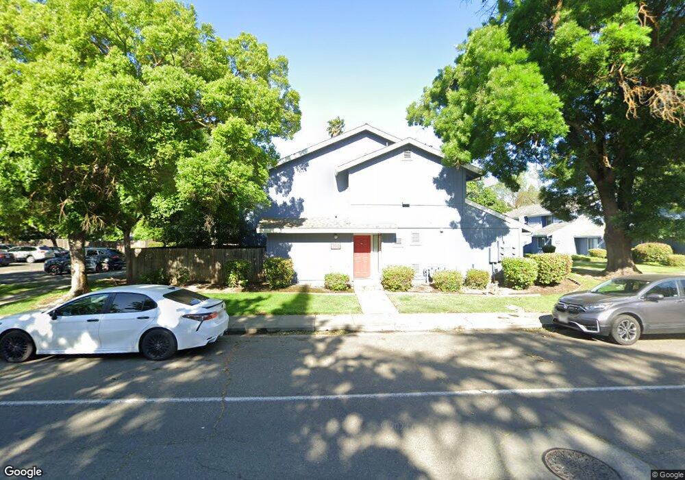
771 Adams St Davis, CA 95616
West Davis NeighborhoodEstimated Value: $850,000 - $1,054,000
8
Beds
5
Baths
3,483
Sq Ft
$273/Sq Ft
Est. Value
About This Home
This home is located at 771 Adams St, Davis, CA 95616 and is currently estimated at $952,000, approximately $273 per square foot. 771 Adams St is a home located in Yolo County with nearby schools including Robert E. Willett Elementary School, Ralph Waldo Emerson Junior High School, and Davis Senior High School.
Ownership History
Date
Name
Owned For
Owner Type
Purchase Details
Closed on
Mar 12, 2025
Sold by
Hoffmann Aaron M
Bought by
Aaron Hoffmann Trust and Hoffmann
Current Estimated Value
Purchase Details
Closed on
Jan 13, 2023
Sold by
Stephen And Loran Hoffmann Family Trust
Bought by
Stephen And Loran Hoffmann Family Trust
Purchase Details
Closed on
Dec 30, 2003
Sold by
Hoffmann Stephen W and Hoffmann Loran L
Bought by
Hoffmann Stephen W and Hoffmann Loran
Create a Home Valuation Report for This Property
The Home Valuation Report is an in-depth analysis detailing your home's value as well as a comparison with similar homes in the area
Home Values in the Area
Average Home Value in this Area
Purchase History
| Date | Buyer | Sale Price | Title Company |
|---|---|---|---|
| Aaron Hoffmann Trust | -- | None Listed On Document | |
| Hoffmann Aaron M | -- | None Listed On Document | |
| Stephen And Loran Hoffmann Family Trust | -- | -- | |
| Hoffmann Stephen W | -- | -- |
Source: Public Records
Tax History
| Year | Tax Paid | Tax Assessment Tax Assessment Total Assessment is a certain percentage of the fair market value that is determined by local assessors to be the total taxable value of land and additions on the property. | Land | Improvement |
|---|---|---|---|---|
| 2025 | $14,644 | $1,196,460 | $338,130 | $858,330 |
| 2023 | $14,644 | $1,150,000 | $325,000 | $825,000 |
| 2022 | $5,740 | $364,241 | $101,169 | $263,072 |
| 2021 | $5,595 | $357,100 | $99,186 | $257,914 |
| 2020 | $5,498 | $353,439 | $98,169 | $255,270 |
| 2019 | $5,204 | $346,510 | $96,245 | $250,265 |
| 2018 | $4,873 | $339,716 | $94,358 | $245,358 |
| 2017 | $4,768 | $333,056 | $92,508 | $240,548 |
| 2016 | $4,738 | $326,527 | $90,695 | $235,832 |
| 2015 | $4,581 | $321,623 | $89,333 | $232,290 |
| 2014 | $4,581 | $315,324 | $87,584 | $227,740 |
Source: Public Records
Map
Nearby Homes
- 1011 Arthur St
- 36100 Russell Blvd
- 1211 Arthur St
- 1013 Plum Ln
- 1418 Yukon St
- 2144 Calaveras Ave
- 1427 Brown Dr
- 2406 Overhill Ln
- 1651 Joshua Tree St
- 2526 Overhill Ln
- 1560 Drake Dr
- 2705 Brandywine Place
- 1577 Drake Dr
- 2216 Bryce Ln
- 618 Elmwood Dr
- 2806 Ganges Ave
- 528 Rutgers Dr
- 3360 Houser Ct
- 3368 Houser Ct
- 825 Oak Ave
- 763 Adams St
- 781 Adams St
- 789 Adams St
- 714 Arthur St
- 720 Arthur St Unit 722
- 716 Arthur St
- 708 Arthur St
- 800 Arthur St
- 702 Arthur St Unit 704
- 683 Adams St Unit 1
- 691 Adams St
- 806 Arthur St
- 807 Adams St
- 808 Arthur St Unit 810
- 650 Arthur St Unit 652
- 812 Arthur St
- 715 Arthur St Unit 717
- 715 Arthur St
- 721 Arthur St
- 850 Adams St
Your Personal Tour Guide
Ask me questions while you tour the home.