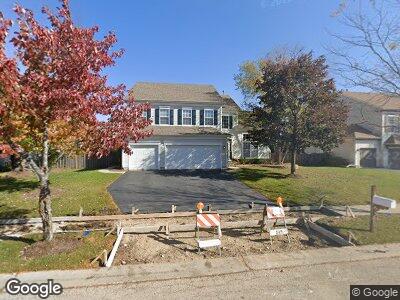
771 Majestic Dr Algonquin, IL 60102
High Hill Farms NeighborhoodEstimated Value: $416,734 - $494,000
--
Bed
1
Bath
2,771
Sq Ft
$169/Sq Ft
Est. Value
About This Home
This home is located at 771 Majestic Dr, Algonquin, IL 60102 and is currently estimated at $469,184, approximately $169 per square foot. 771 Majestic Dr is a home located in McHenry County with nearby schools including Westfield Community School, Kenneth E Neubert Elementary School, and Harry D Jacobs High School.
Ownership History
Date
Name
Owned For
Owner Type
Purchase Details
Closed on
Jun 1, 1999
Sold by
Realen Homes Developers Inc
Bought by
Abboreno Anthony J and Abboreno Amy J
Current Estimated Value
Home Financials for this Owner
Home Financials are based on the most recent Mortgage that was taken out on this home.
Original Mortgage
$200,000
Interest Rate
7.29%
Create a Home Valuation Report for This Property
The Home Valuation Report is an in-depth analysis detailing your home's value as well as a comparison with similar homes in the area
Home Values in the Area
Average Home Value in this Area
Purchase History
| Date | Buyer | Sale Price | Title Company |
|---|---|---|---|
| Abboreno Anthony J | $250,000 | Chicago Title Insurance Co |
Source: Public Records
Mortgage History
| Date | Status | Borrower | Loan Amount |
|---|---|---|---|
| Open | Abboreno Anthony J | $216,500 | |
| Closed | Abboreno Anthony J | $210,000 | |
| Closed | Abboreno Anthony J | $205,375 | |
| Closed | Abboreno Anthony J | $227,000 | |
| Closed | Abboreno Anthony J | $263,600 | |
| Closed | Abboreno Amy J | $54,000 | |
| Closed | Abboreno Anthony J | $211,250 | |
| Closed | Abboreno Anthony J | $10,000 | |
| Closed | Abboreno Anthony J | $200,000 |
Source: Public Records
Tax History Compared to Growth
Tax History
| Year | Tax Paid | Tax Assessment Tax Assessment Total Assessment is a certain percentage of the fair market value that is determined by local assessors to be the total taxable value of land and additions on the property. | Land | Improvement |
|---|---|---|---|---|
| 2023 | $10,072 | $128,312 | $20,828 | $107,484 |
| 2022 | $10,499 | $128,430 | $21,044 | $107,386 |
| 2021 | $10,084 | $119,648 | $19,605 | $100,043 |
| 2020 | $9,824 | $115,412 | $18,911 | $96,501 |
| 2019 | $9,592 | $110,463 | $18,100 | $92,363 |
| 2018 | $9,155 | $102,045 | $16,721 | $85,324 |
| 2017 | $8,975 | $96,133 | $15,752 | $80,381 |
| 2016 | $8,851 | $90,164 | $14,774 | $75,390 |
| 2013 | -- | $84,826 | $13,783 | $71,043 |
Source: Public Records
Map
Nearby Homes
- 3 Regal Ct
- 1095 Saint Andrews Ct Unit 292
- 1415 Stonegate Rd
- 1850 White Oak Dr
- 1 Sherman Rd
- 000 County Line Rd
- 1 N Hubbard St
- 1721 Fernwood Ln
- 1740 Kensington Dr
- 4 Hawthorne Rd
- 1410 Spring Hill Dr
- Lots 10 & 11 Ramble Rd
- 1210 Spring Hill Dr
- 2601 Harnish Dr
- 1501 Millbrook Dr Unit 1
- 2611 Harnish Dr
- 2621 Harnish Dr
- 313 Bayberry Dr
- 2631 Harnish Dr
- 8 W Pheasant Trail Unit 21D