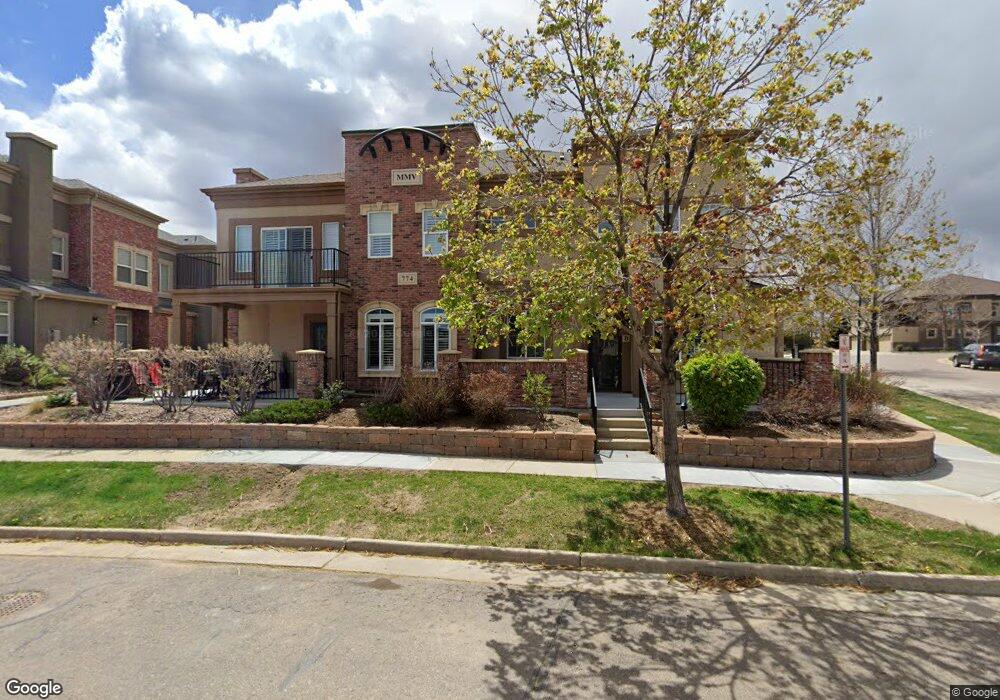
774 Brookhurst Ave Unit B Littleton, CO 80129
Westridge NeighborhoodEstimated Value: $580,323 - $622,000
2
Beds
3
Baths
1,699
Sq Ft
$355/Sq Ft
Est. Value
About This Home
This home is located at 774 Brookhurst Ave Unit B, Littleton, CO 80129 and is currently estimated at $603,081, approximately $354 per square foot. 774 Brookhurst Ave Unit B is a home located in Douglas County with nearby schools including Eldorado Elementary School, Ranch View Middle School, and Thunderridge High School.
Ownership History
Date
Name
Owned For
Owner Type
Purchase Details
Closed on
Jun 28, 2013
Sold by
Holmes Steven C
Bought by
Jensen Arthur
Current Estimated Value
Purchase Details
Closed on
Feb 13, 2012
Sold by
Munoz Michael
Bought by
Holmes Steven C
Home Financials for this Owner
Home Financials are based on the most recent Mortgage that was taken out on this home.
Original Mortgage
$214,400
Interest Rate
3.95%
Mortgage Type
New Conventional
Purchase Details
Closed on
Jul 8, 2008
Sold by
Robert R Munoz Jr Trust Fbo Michael Muno
Bought by
Munoz Michael
Purchase Details
Closed on
Jul 1, 2008
Sold by
Munoz Robert R
Bought by
Munoz Michael
Purchase Details
Closed on
Nov 27, 2006
Sold by
Shea Homes Lp
Bought by
Robert R Munoz Jr Trust
Create a Home Valuation Report for This Property
The Home Valuation Report is an in-depth analysis detailing your home's value as well as a comparison with similar homes in the area
Home Values in the Area
Average Home Value in this Area
Purchase History
| Date | Buyer | Sale Price | Title Company |
|---|---|---|---|
| Jensen Arthur | $294,000 | Land Title Guarantee Company | |
| Holmes Steven C | $268,000 | Land Title Guarantee Company | |
| Munoz Michael | -- | -- | |
| Munoz Michael | -- | None Available | |
| Robert R Munoz Jr Trust | $269,455 | Fahtco |
Source: Public Records
Mortgage History
| Date | Status | Borrower | Loan Amount |
|---|---|---|---|
| Previous Owner | Holmes Steven C | $214,400 |
Source: Public Records
Tax History Compared to Growth
Tax History
| Year | Tax Paid | Tax Assessment Tax Assessment Total Assessment is a certain percentage of the fair market value that is determined by local assessors to be the total taxable value of land and additions on the property. | Land | Improvement |
|---|---|---|---|---|
| 2024 | $2,861 | $40,750 | -- | $40,750 |
| 2023 | $3,487 | $40,750 | $0 | $40,750 |
| 2022 | $2,752 | $30,120 | $0 | $30,120 |
| 2021 | $2,862 | $30,120 | $0 | $30,120 |
| 2020 | $2,732 | $29,460 | $1,430 | $28,030 |
| 2019 | $2,742 | $29,460 | $1,430 | $28,030 |
| 2018 | $2,578 | $27,280 | $1,440 | $25,840 |
| 2017 | $2,348 | $27,280 | $1,440 | $25,840 |
Source: Public Records
Map
Nearby Homes
- 781 Rockhurst Dr Unit A
- 9496 Elmhurst Ln Unit A
- 900 Elmhurst Dr Unit B
- 601 W Burgundy St Unit B
- 681 W Burgundy A St Unit A
- 9424 Ridgeline Blvd Unit I
- 1144 Rockhurst Dr Unit 202
- 1144 Rockhurst Dr Unit 306
- 1221 Braewood Ave
- 274 W Willowick Cir
- 907 Riddlewood Ln
- 1225 Mulberry Ln
- 1325 Carlyle Park Cir
- 1062 Timbervale Trail
- 1104 W Timbervale Trail
- 1359 Carlyle Park Cir
- 1086 Thornbury Place
- 1281 Riddlewood Rd
- 9775 Westbury Way
- 9329 Wolfe St
- 774 Brookhurst Ave Unit A
- 774 Brookhurst Ave Unit 6A
- 797 Brookhurst Ave Unit A
- 797 Brookhurst Ave Unit B
- 797 Brookhurst Ave Unit C
- 781 Rockhurst Dr Unit B
- 781 Rockhurst Dr Unit C
- 800 Rockhurst Dr Unit A
- 800 Rockhurst Dr Unit C
- 800 Rockhurst Dr Unit B
- 706 Bristle Pine Cir Unit A
- 706 Bristle Pine Cir Unit C
- 800 Bristle Pine Cir Unit B
- 752 Bristle Pine Cir Unit A
- 800 Bristle Pine Cir Unit A
- 752 Bristle Pine Cir Unit C
- 752 Bristle Pine Cir Unit B
- 800 Bristle Pine Cir Unit 19A
- 791 Rockhurst Dr Unit C
- 791 Rockhurst Dr Unit A