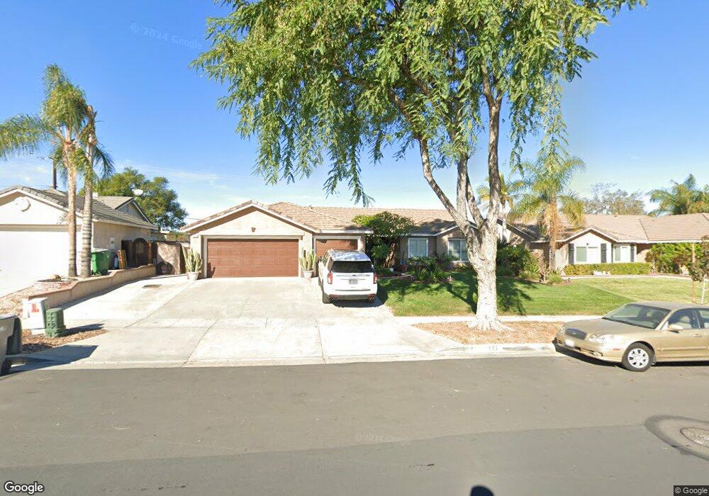
777 Beverly Rd Corona, CA 92879
Central Corona NeighborhoodEstimated Value: $755,000 - $864,000
4
Beds
2
Baths
1,916
Sq Ft
$411/Sq Ft
Est. Value
About This Home
This home is located at 777 Beverly Rd, Corona, CA 92879 and is currently estimated at $786,976, approximately $410 per square foot. 777 Beverly Rd is a home located in Riverside County with nearby schools including Garretson Elementary School, Auburndale Intermediate, and Centennial High School.
Ownership History
Date
Name
Owned For
Owner Type
Purchase Details
Closed on
Jun 26, 2001
Sold by
Young Flint O and Young Jasmine J
Bought by
Hieda Darryl N and Hieda Cyndi L
Current Estimated Value
Home Financials for this Owner
Home Financials are based on the most recent Mortgage that was taken out on this home.
Original Mortgage
$229,500
Outstanding Balance
$88,122
Interest Rate
7.09%
Estimated Equity
$698,854
Purchase Details
Closed on
Nov 26, 1994
Sold by
Kaufman & Broad Of Southern Ca Inc
Bought by
Young Flint O and Young Jasmine J
Home Financials for this Owner
Home Financials are based on the most recent Mortgage that was taken out on this home.
Original Mortgage
$152,000
Interest Rate
8.9%
Create a Home Valuation Report for This Property
The Home Valuation Report is an in-depth analysis detailing your home's value as well as a comparison with similar homes in the area
Home Values in the Area
Average Home Value in this Area
Purchase History
| Date | Buyer | Sale Price | Title Company |
|---|---|---|---|
| Hieda Darryl N | $255,000 | Chicago Title Co | |
| Young Flint O | $169,000 | First American Title Ins Co |
Source: Public Records
Mortgage History
| Date | Status | Borrower | Loan Amount |
|---|---|---|---|
| Open | Hieda Darryl N | $229,500 | |
| Previous Owner | Young Flint O | $152,000 |
Source: Public Records
Tax History
| Year | Tax Paid | Tax Assessment Tax Assessment Total Assessment is a certain percentage of the fair market value that is determined by local assessors to be the total taxable value of land and additions on the property. | Land | Improvement |
|---|---|---|---|---|
| 2025 | $4,161 | $376,680 | $103,395 | $273,285 |
| 2023 | $4,161 | $362,055 | $99,381 | $262,674 |
| 2022 | $4,030 | $354,957 | $97,433 | $257,524 |
| 2021 | $3,950 | $347,998 | $95,523 | $252,475 |
| 2020 | $3,907 | $344,431 | $94,544 | $249,887 |
| 2019 | $3,817 | $337,679 | $92,691 | $244,988 |
| 2018 | $3,732 | $331,059 | $90,875 | $240,184 |
| 2017 | $3,641 | $324,569 | $89,094 | $235,475 |
| 2016 | $3,606 | $318,206 | $87,348 | $230,858 |
| 2015 | $3,528 | $313,429 | $86,037 | $227,392 |
| 2014 | $3,400 | $307,291 | $84,352 | $222,939 |
Source: Public Records
Map
Nearby Homes
- 645 Lancer Ln
- 1429 Garretson Ave
- 938 Ford St
- 929 Fullerton Ave
- 1710 Garretson Ave
- 520 E 8th St
- 1020 Margarita Dr Unit C202
- 714 E Grand Blvd
- 1153 E Grand Blvd
- 1015 Margarita Dr Unit D202
- 828 Tangerine St
- 1138 Acacia St
- 994 La Costa Dr Unit N101
- 506 E 7th St
- 1164 Stone Pine Ln Unit A
- 760 Rimpau Ave Unit 202
- 1925 S Starfire Ave
- 1740 Forum Way Unit C
- 1761 Forum Way Unit D
- 945 Michael Place Unit C
- 769 Beverly Rd
- 785 Beverly Rd
- 1213 William St
- 801 Beverly Rd
- 761 Beverly Rd
- 1209 William St
- 1214 William St
- 1214 Lime St
- 774 Beverly Rd
- 766 Beverly Rd
- 782 Beverly Rd
- 1210 William St
- 1210 Lime St
- 809 Beverly Rd
- 1205 William St
- 753 Beverly Rd
- 790 Beverly Rd
- 758 Beverly Rd
- 1292 Mulberry Ln
- 1206 William St
Your Personal Tour Guide
Ask me questions while you tour the home.