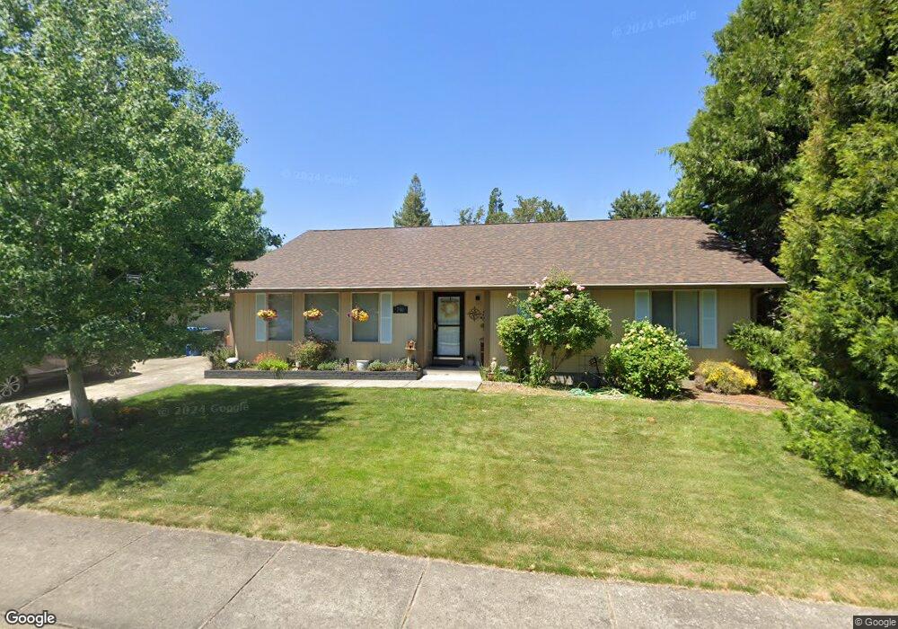
790 Talbot St Eagle Point, OR 97524
Eagle Point AreaEstimated Value: $365,000 - $427,000
About This Home
This home is located at 790 Talbot St, Eagle Point, OR 97524 and is currently estimated at $398,768, approximately $234 per square foot. 790 Talbot St is a home located in Jackson County with nearby schools including Eagle Point Middle School, White Mountain Middle School, and Eagle Point High School.
Ownership History
We collect this data history from publicly available records. To have your information removed, we recommend requesting removal directly through your county’s website.
Purchase Details
Home Financials for this Owner
Home Financials are based on the most recent Mortgage that was taken out on this home.Purchase Details
Home Values in the Area
Average Home Value in this Area
Purchase History
We collect this data history from publicly available records. To have your information removed, we recommend requesting removal directly through your county’s website.
| Date | Buyer | Sale Price | Title Company |
|---|---|---|---|
| $186,400 | Amerititle | ||
| $35,000 | Jackson County Title |
Mortgage History
We collect this data history from publicly available records. To have your information removed, we recommend requesting removal directly through your county’s website.
| Date | Status | Borrower | Loan Amount |
|---|---|---|---|
| Open | $190,204 |
Tax History
We collect this data history from publicly available records. To have your information removed, we recommend requesting removal directly through your county’s website.
| Year | Tax Paid | Tax Assessment Tax Assessment Total Assessment is a certain percentage of the fair market value that is determined by local assessors to be the total taxable value of land and additions on the property. | Land | Improvement |
|---|---|---|---|---|
| 2026 | $2,897 | $212,890 | ||
| 2025 | $2,828 | $206,690 | $57,380 | $149,310 |
| 2024 | $2,828 | $200,670 | $55,710 | $144,960 |
| 2023 | $2,732 | $194,830 | $54,090 | $140,740 |
| 2022 | $2,658 | $194,830 | $54,090 | $140,740 |
| 2021 | $2,579 | $189,160 | $52,520 | $136,640 |
| 2020 | $2,740 | $183,660 | $51,000 | $132,660 |
| 2019 | $2,698 | $173,130 | $48,080 | $125,050 |
| 2018 | $2,647 | $168,090 | $46,680 | $121,410 |
| 2017 | $2,582 | $168,090 | $46,680 | $121,410 |
| 2016 | $2,532 | $158,450 | $44,010 | $114,440 |
| 2015 | $2,449 | $158,450 | $44,010 | $114,440 |
| 2014 | $2,363 | $149,360 | $41,480 | $107,880 |
Map
- 613 St Thomas Ln
- 0 Sf Little Butte Unit 220204792
- 620 S Royal Ave
- 133 Edith Cir
- 32 Pebble Creek Dr
- 888 Arrowhead Trail
- 1085 Oak Grove Ct
- 936 Arrowhead Trail
- 961 Arrowhead Trail
- 1065 S Shasta Ave
- 126 Lorraine Ave
- 995 Pumpkin Ridge
- 421 Stevens Rd Unit 20
- 421 Stevens Rd Unit 14
- 421 Stevens Rd Unit 34
- 421 Stevens Rd Unit 52
- 1288 S Shasta Ave
- 11 S Platt Ave
- 1314 S Shasta Ave Unit A
- 19 Pine Ct
Ask me questions while you tour the home.