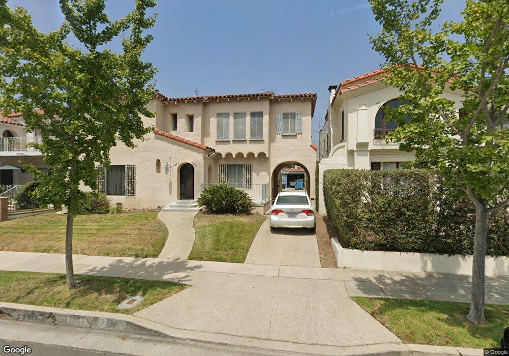
7931 W 4th St Los Angeles, CA 90048
Beverly Grove NeighborhoodEstimated Value: $2,001,000 - $2,700,000
6
Beds
2
Baths
4,160
Sq Ft
$539/Sq Ft
Est. Value
About This Home
This home is located at 7931 W 4th St, Los Angeles, CA 90048 and is currently estimated at $2,240,302, approximately $538 per square foot. 7931 W 4th St is a home located in Los Angeles County with nearby schools including Hancock Park Elementary, John Burroughs Middle School, and Fairfax High School.
Ownership History
Date
Name
Owned For
Owner Type
Purchase Details
Closed on
Oct 3, 2024
Sold by
Andrews Robin D
Bought by
Robin Andrews Living Trust and Andrews
Current Estimated Value
Home Financials for this Owner
Home Financials are based on the most recent Mortgage that was taken out on this home.
Original Mortgage
$530,000
Outstanding Balance
$524,428
Interest Rate
6.35%
Mortgage Type
New Conventional
Estimated Equity
$1,715,874
Purchase Details
Closed on
Apr 20, 2018
Sold by
Andrews Robin D
Bought by
Andrews Robin D and Malick Peter Benson
Create a Home Valuation Report for This Property
The Home Valuation Report is an in-depth analysis detailing your home's value as well as a comparison with similar homes in the area
Home Values in the Area
Average Home Value in this Area
Purchase History
| Date | Buyer | Sale Price | Title Company |
|---|---|---|---|
| Robin Andrews Living Trust | -- | Ticor Title | |
| Andrews Robin D | -- | Ticor Title | |
| Andrews Robin D | -- | None Available | |
| Andrews Robin D | -- | None Available |
Source: Public Records
Mortgage History
| Date | Status | Borrower | Loan Amount |
|---|---|---|---|
| Open | Andrews Robin D | $530,000 |
Source: Public Records
Tax History Compared to Growth
Tax History
| Year | Tax Paid | Tax Assessment Tax Assessment Total Assessment is a certain percentage of the fair market value that is determined by local assessors to be the total taxable value of land and additions on the property. | Land | Improvement |
|---|---|---|---|---|
| 2025 | $2,144 | $140,655 | $71,554 | $69,101 |
| 2024 | $2,144 | $137,898 | $70,151 | $67,747 |
| 2023 | $2,115 | $135,195 | $68,776 | $66,419 |
| 2022 | $2,037 | $132,545 | $67,428 | $65,117 |
| 2021 | $1,984 | $129,947 | $66,106 | $63,841 |
| 2019 | $1,933 | $126,096 | $64,147 | $61,949 |
| 2018 | $1,780 | $123,625 | $62,890 | $60,735 |
| 2016 | $1,656 | $118,827 | $60,449 | $58,378 |
| 2015 | $1,635 | $117,043 | $59,541 | $57,502 |
| 2014 | $1,654 | $114,751 | $58,375 | $56,376 |
Source: Public Records
Map
Nearby Homes
- 6319 Colgate Ave
- 7932 Blackburn Ave
- 6245 Drexel Ave
- 6509 Colgate Ave
- 8206 W 4th St
- 6206 Lindenhurst Ave
- 104 S Hayworth Ave Unit 204
- 6410 Drexel Ave
- 6300 Lindenhurst Ave
- 6360 Maryland Dr
- 6336 Lindenhurst Ave
- 6115 W 6th St
- 103 N Hayworth Ave
- 101 N Laurel Ave
- 6402 Maryland Dr
- 6546 Colgate Ave
- 123 S Kilkea Dr
- 6151 Orange St Unit 307
- 132 N Laurel Ave
- 6451 Maryland Dr
- 7939 W 4th St
- 7937 W 4th St Unit Upper unit
- 7937 W 4th St
- 7927 W 4th St
- 7929 W 4th St
- 7943 W 4th St
- 7923 W 4th St
- 7928 Blackburn Ave
- 7922 Blackburn Ave
- 7934 4th St
- 7930 Blackburn Ave
- 7947 W 4th St
- 7938 Blackburn Ave
- 7917 W 4th St
- 7912 Blackburn Ave Unit 5
- 7916 Blackburn Ave Unit 1
- 7912 Blackburn Ave Unit 6
- 7912 Blackburn Ave Unit 4
- 7912 Blackburn Ave Unit 9
- 7912 Blackburn Ave Unit 3