Estimated Value: $2,874,000 - $5,413,000
4
Beds
4
Baths
3,641
Sq Ft
$1,173/Sq Ft
Est. Value
About This Home
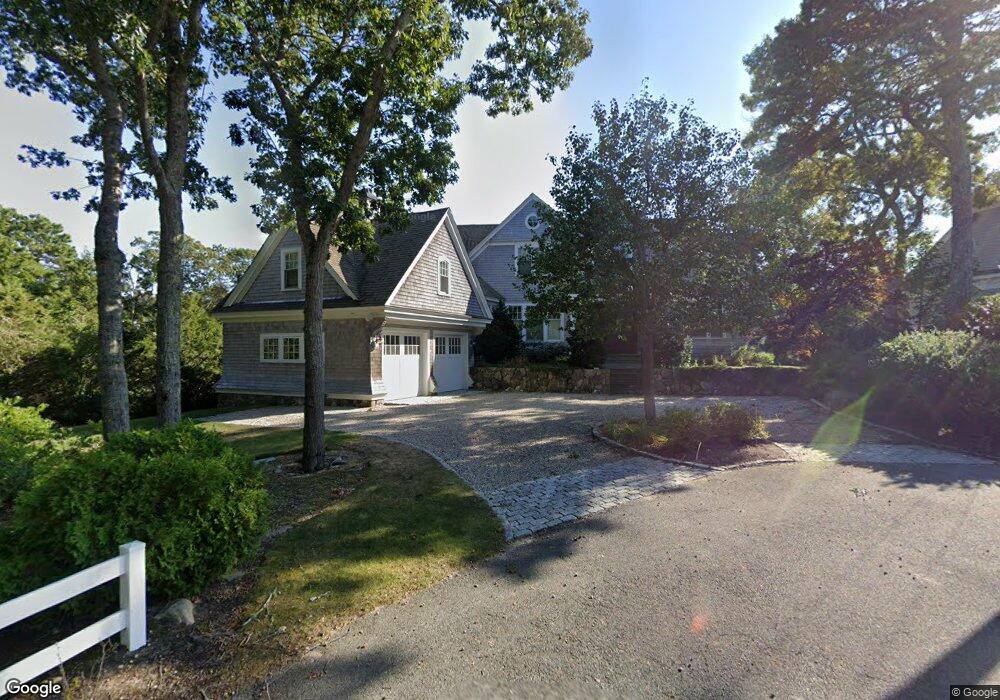
This home is located at 8 Chart Way, Mashpee, MA 02649 and is currently estimated at $4,271,149, approximately $1,173 per square foot. 8 Chart Way is a home located in Barnstable County with nearby schools including Kenneth C. Coombs School, Quashnet School, and Mashpee Middle School.
Ownership History
Date
Name
Owned For
Owner Type
Purchase Details
Closed on
Dec 27, 2012
Sold by
Caiazzo Shane T
Bought by
Chart Way Nt
Current Estimated Value
Purchase Details
Closed on
Oct 17, 2008
Sold by
Elkinson Sherri A
Bought by
Caiazzo Shane T
Create a Home Valuation Report for This Property
The Home Valuation Report is an in-depth analysis detailing your home's value as well as a comparison with similar homes in the area
Home Values in the Area
Average Home Value in this Area
Purchase History
| Date | Buyer | Sale Price | Title Company |
|---|---|---|---|
| Chart Way Nt | -- | -- | |
| Caiazzo Shane T | $1,775,000 | -- |
Source: Public Records
Tax History
| Year | Tax Paid | Tax Assessment Tax Assessment Total Assessment is a certain percentage of the fair market value that is determined by local assessors to be the total taxable value of land and additions on the property. | Land | Improvement |
|---|---|---|---|---|
| 2025 | $24,951 | $3,769,000 | $1,520,300 | $2,248,700 |
| 2024 | $21,244 | $3,303,900 | $1,382,400 | $1,921,500 |
| 2023 | $20,351 | $2,903,200 | $1,316,200 | $1,587,000 |
| 2022 | $21,146 | $2,588,300 | $1,140,600 | $1,447,700 |
| 2021 | $3,302 | $2,403,400 | $1,128,900 | $1,274,500 |
| 2020 | $3,204 | $2,311,400 | $1,085,700 | $1,225,700 |
| 2019 | $20,866 | $2,305,600 | $1,085,700 | $1,219,900 |
| 2018 | $2,763 | $2,287,400 | $1,085,700 | $1,201,700 |
| 2017 | $20,801 | $2,263,400 | $1,085,700 | $1,177,700 |
| 2016 | $20,282 | $2,195,000 | $1,085,700 | $1,109,300 |
| 2015 | $19,583 | $2,149,600 | $1,085,700 | $1,063,900 |
| 2014 | $20,008 | $2,130,800 | $1,070,900 | $1,059,900 |
Source: Public Records
Map
Nearby Homes
- 160 Waterway
- 109 Waterway
- 16 Bosuns Ln
- 16 Bosun's Ln
- 30 Bright Coves Way
- 140 Summersea Rd
- 36 Little Neck Ln
- 71 Shore Dr
- 444 Vineyard Rd
- 14 Azalea Ln
- 42 Kim Path
- 128 Uncle Percys Rd
- 37 The Hunt Cir
- 52 Old Dock Ln
- 17 Degrass Rd
- 21 Saltwater Cir
- 12 Tracey Rd
- 36 Rosewood Cir
- 239 Clamshell Cove Rd
- 251 Shore Dr Unit D2
- 9 Chart Way
- 6 Chart Way
- 51 Popponesset Island Rd
- 3 Bight Cir
- 45 Popponesset Island Rd
- 7 Chart Way
- 39 Popponesset Island Rd
- 7 Bight Cir
- 142 Waterway
- 150 Waterway
- 6 Bight Cir
- 138 Waterway
- 156 Waterway
- 146 Waterway
- 9 Bight Cir
- 35 Popponesset Island Rd
- 44 Popponesset Island Rd
- 132 Waterway
- 50 Popponesset Island Rd
- 21 Compass Cir
Your Personal Tour Guide
Ask me questions while you tour the home.