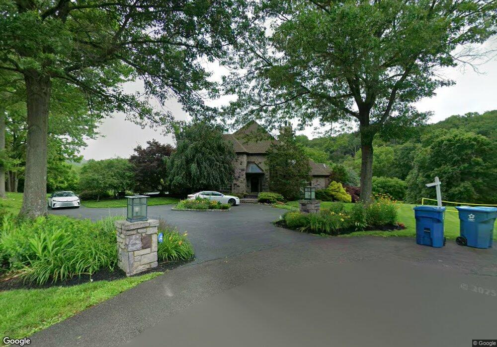
820 Macclesfield Rd Furlong, PA 18925
Estimated Value: $1,068,000 - $1,275,000
5
Beds
6
Baths
4,240
Sq Ft
$285/Sq Ft
Est. Value
About This Home
This home is located at 820 Macclesfield Rd, Furlong, PA 18925 and is currently estimated at $1,209,724, approximately $285 per square foot. 820 Macclesfield Rd is a home located in Bucks County with nearby schools including Bridge Valley Elementary School, Holicong Middle School, and Central Bucks High School - East.
Ownership History
Date
Name
Owned For
Owner Type
Purchase Details
Closed on
Jun 30, 1999
Sold by
Mancuso Frank M and Mancuso Patricia A
Bought by
Adelizzi Paul J
Current Estimated Value
Home Financials for this Owner
Home Financials are based on the most recent Mortgage that was taken out on this home.
Original Mortgage
$650,000
Outstanding Balance
$179,627
Interest Rate
7.39%
Estimated Equity
$1,030,097
Purchase Details
Closed on
Aug 14, 1987
Bought by
Mancuso Frank M and Mancuso Patricia A
Create a Home Valuation Report for This Property
The Home Valuation Report is an in-depth analysis detailing your home's value as well as a comparison with similar homes in the area
Home Values in the Area
Average Home Value in this Area
Purchase History
| Date | Buyer | Sale Price | Title Company |
|---|---|---|---|
| Adelizzi Paul J | $850,000 | T A Title Insurance Company | |
| Mancuso Frank M | $50,000 | -- |
Source: Public Records
Mortgage History
| Date | Status | Borrower | Loan Amount |
|---|---|---|---|
| Open | Adelizzi Paul J | $650,000 |
Source: Public Records
Tax History Compared to Growth
Tax History
| Year | Tax Paid | Tax Assessment Tax Assessment Total Assessment is a certain percentage of the fair market value that is determined by local assessors to be the total taxable value of land and additions on the property. | Land | Improvement |
|---|---|---|---|---|
| 2025 | $13,710 | $84,210 | $16,680 | $67,530 |
| 2024 | $13,710 | $84,210 | $16,680 | $67,530 |
| 2023 | $13,245 | $84,210 | $16,680 | $67,530 |
| 2022 | $13,087 | $84,210 | $16,680 | $67,530 |
| 2021 | $12,930 | $84,210 | $16,680 | $67,530 |
| 2020 | $12,930 | $84,210 | $16,680 | $67,530 |
| 2019 | $20,564 | $134,800 | $16,680 | $118,120 |
| 2018 | $20,564 | $134,800 | $16,680 | $118,120 |
| 2017 | $20,395 | $134,800 | $16,680 | $118,120 |
| 2016 | $20,597 | $134,800 | $16,680 | $118,120 |
| 2015 | -- | $134,800 | $16,680 | $118,120 |
| 2014 | -- | $134,800 | $16,680 | $118,120 |
Source: Public Records
Map
Nearby Homes
- 1515 Sugar Bottom Rd
- 2417 April Dr
- 1390 Old Jacksonville Rd
- 1408 Old Jacksonville Rd
- 2429 N Daisey Dr
- 31 Aspen Dr
- 941 Penns Park
- 1530 Spruce Ct
- 26 Breckenridge Dr
- 1000 Old Jacksonville Rd
- 1416 Angela Ct Unit 1004
- 108 Eagle Ct Unit 105
- 6 Breckenridge Dr
- Homesite 11003 Marquis Ln
- Homesite 10903 Marquis Ln
- 3014 Marquis Ln
- Homesite 11001 Marquis Ln
- 3020 Marquis Ln
- 5011 Quartermaster Ln
- 1536 Park Dr
- 830 Macclesfield Rd
- 815 Macclesfield Rd
- 825 Macclesfield Rd
- 840 Macclesfield Rd
- 829 Macclesfield Rd
- 850 Macclesfield Rd
- 869 Macclesfield Rd
- 945 Camelot Rd
- 860 Macclesfield Rd
- 865 Macclesfield Rd
- 870 Macclesfield Rd
- 883 Macclesfield Rd
- 880 Macclesfield Rd
- 3090 Rushland Rd
- 2749 Walton Rd
- 2749 Walton Rd Unit Carriage House
- 951 Camelot Rd
- 890 Macclesfield Rd
- 3145 Dark Hollow Rd
- 961 Camelot Rd