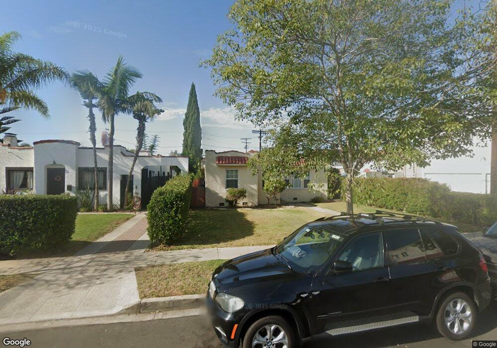
8950 Hargis St Los Angeles, CA 90034
Mid-City NeighborhoodEstimated Value: $1,505,000 - $1,610,000
2
Beds
2
Baths
1,482
Sq Ft
$1,049/Sq Ft
Est. Value
About This Home
This home is located at 8950 Hargis St, Los Angeles, CA 90034 and is currently estimated at $1,554,309, approximately $1,048 per square foot. 8950 Hargis St is a home located in Los Angeles County with nearby schools including Mark Twain Middle School, Alexander Hamilton Senior High School, and Turning Point School.
Ownership History
Date
Name
Owned For
Owner Type
Purchase Details
Closed on
Jun 17, 2019
Sold by
Anglin Marcus and Anglin Marcus
Bought by
Anaya Guadalupe
Current Estimated Value
Purchase Details
Closed on
Apr 18, 2013
Sold by
Anglin Marcus and Anglin Marcus J
Bought by
Anglin Marcus and Anaya Guadalupe
Home Financials for this Owner
Home Financials are based on the most recent Mortgage that was taken out on this home.
Original Mortgage
$400,000
Interest Rate
3.6%
Mortgage Type
New Conventional
Create a Home Valuation Report for This Property
The Home Valuation Report is an in-depth analysis detailing your home's value as well as a comparison with similar homes in the area
Home Values in the Area
Average Home Value in this Area
Purchase History
| Date | Buyer | Sale Price | Title Company |
|---|---|---|---|
| Anaya Guadalupe | -- | None Available | |
| Anglin Marcus | -- | First American Title Company |
Source: Public Records
Mortgage History
| Date | Status | Borrower | Loan Amount |
|---|---|---|---|
| Previous Owner | Anglin Marcus | $400,000 |
Source: Public Records
Tax History Compared to Growth
Tax History
| Year | Tax Paid | Tax Assessment Tax Assessment Total Assessment is a certain percentage of the fair market value that is determined by local assessors to be the total taxable value of land and additions on the property. | Land | Improvement |
|---|---|---|---|---|
| 2025 | $2,892 | $229,919 | $131,413 | $98,506 |
| 2024 | $2,892 | $225,412 | $128,837 | $96,575 |
| 2023 | $2,842 | $220,993 | $126,311 | $94,682 |
| 2022 | $2,718 | $216,661 | $123,835 | $92,826 |
| 2021 | $2,674 | $212,413 | $121,407 | $91,006 |
| 2020 | $2,697 | $210,236 | $120,163 | $90,073 |
| 2019 | $2,596 | $206,114 | $117,807 | $88,307 |
| 2018 | $2,541 | $202,074 | $115,498 | $86,576 |
| 2016 | $2,418 | $194,229 | $111,014 | $83,215 |
| 2015 | $2,383 | $191,313 | $109,347 | $81,966 |
| 2014 | $2,400 | $187,567 | $107,206 | $80,361 |
Source: Public Records
Map
Nearby Homes
- 2847 S Robertson Blvd
- 8954 Kramerwood Place
- 2807 S Bedford St
- 2702 Reynier Ave
- 2628 Reynier Ave
- 3115 Curts Ave
- 2502 S Robertson Blvd
- 3007 S Canfield Ave
- 3107 S Dakota Dr
- 8953 W 24th St
- 2411 S Canfield Ave
- 8639 Hervey St
- 3306 Aria Ln
- 3309 Aria Ln
- 9521 Cattaraugus Ave
- 2637 S Garth Ave
- 2803 Cardiff Ave
- 8809 David Ave
- 3257 Cattaraugus Ave
- 3252 Cattaraugus Ave
- 8946 Hargis St
- 8940 Hargis St
- 8960 Hargis St
- 8951 Cattaraugus Ave Unit 1
- 8936 Hargis St
- 8957 Hargis St
- 8945 Cattaraugus Ave
- 8943 Cattaraugus Ave
- 8939 Cattaraugus Ave
- 8932 Hargis St
- 8937 Cattaraugus Ave
- 8951 Hargis St
- 8947 Hargis St
- 8935 Cattaraugus Ave
- 8943 Hargis St
- 8928 Hargis St
- 8933 Cattaraugus Ave
- 2822 S Robertson Blvd
- 8937 Hargis St
- 2895 S Robertson Blvd