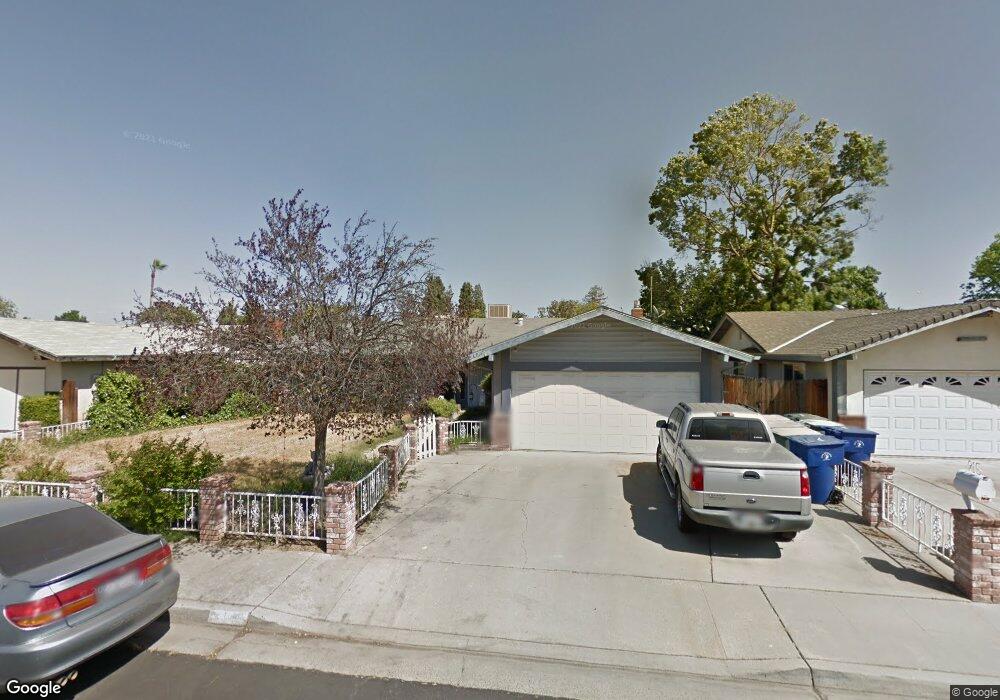
915 Fordham Ave Clovis, CA 93611
Estimated Value: $417,000 - $445,939
3
Beds
2
Baths
1,676
Sq Ft
$259/Sq Ft
Est. Value
About This Home
This home is located at 915 Fordham Ave, Clovis, CA 93611 and is currently estimated at $433,980, approximately $258 per square foot. 915 Fordham Ave is a home located in Fresno County with nearby schools including Clovis Elementary School, Clark Intermediate School, and Clovis High School.
Ownership History
Date
Name
Owned For
Owner Type
Purchase Details
Closed on
Feb 14, 2024
Sold by
Weis Brandon and Mckay Tricia
Bought by
Toy Patrick and Whiting Sharon N
Current Estimated Value
Home Financials for this Owner
Home Financials are based on the most recent Mortgage that was taken out on this home.
Original Mortgage
$14,875
Outstanding Balance
$5,743
Interest Rate
6.66%
Mortgage Type
FHA
Estimated Equity
$428,237
Purchase Details
Closed on
Nov 24, 2003
Sold by
Fine Ronald D
Bought by
Fine Ronald D and Fine Gayle M
Create a Home Valuation Report for This Property
The Home Valuation Report is an in-depth analysis detailing your home's value as well as a comparison with similar homes in the area
Home Values in the Area
Average Home Value in this Area
Purchase History
| Date | Buyer | Sale Price | Title Company |
|---|---|---|---|
| Toy Patrick | $425,000 | Chicago Title | |
| Fine Ronald D | -- | First American Title Ins Co |
Source: Public Records
Mortgage History
| Date | Status | Borrower | Loan Amount |
|---|---|---|---|
| Open | Toy Patrick | $14,875 | |
| Open | Toy Patrick | $417,200 |
Source: Public Records
Tax History
| Year | Tax Paid | Tax Assessment Tax Assessment Total Assessment is a certain percentage of the fair market value that is determined by local assessors to be the total taxable value of land and additions on the property. | Land | Improvement |
|---|---|---|---|---|
| 2025 | $5,123 | $433,500 | $130,050 | $303,450 |
| 2023 | $6,111 | $197,925 | $53,304 | $144,621 |
| 2022 | $6,079 | $194,045 | $52,259 | $141,786 |
| 2021 | $6,015 | $190,241 | $51,235 | $139,006 |
| 2020 | $6,006 | $188,291 | $50,710 | $137,581 |
| 2019 | $5,951 | $184,600 | $49,716 | $134,884 |
| 2018 | $5,913 | $180,982 | $48,742 | $132,240 |
| 2017 | $5,867 | $177,435 | $47,787 | $129,648 |
| 2016 | $5,799 | $173,956 | $46,850 | $127,106 |
| 2015 | $1,940 | $171,344 | $46,147 | $125,197 |
| 2014 | $1,903 | $167,989 | $45,244 | $122,745 |
Source: Public Records
Map
Nearby Homes
- 1606 Barstow Ave
- 760 Sunnyside Ave
- 860 Mcarthur Ave
- 1228 Jefferson Ave
- 1273 Bundy Ave
- 1272 Bullard Ave
- 1622 Dennis Ave
- 1334 Shirley Ave
- 1428 Miami Ave
- 1721 Beverly Ave
- 1876 Cougar Ln
- 1498 Escalon Ave
- 1946 Calimyrna Ave
- 1515 Keats Ave
- 1895 Dennis Ave
- 1584 Laverne Ave
- 2034 Wrenwood Ave
- 1855 Vartikian Ave
- 3497 Shaw Ave
- 96 Burgan Ave
- 903 Fordham Ave
- 923 Fordham Ave
- 914 Stanford Ave
- 924 Stanford Ave
- 904 Stanford Ave
- 937 Fordham Ave
- 914 Fordham Ave
- 902 Fordham Ave
- 936 Stanford Ave
- 924 Fordham Ave
- 857 Fordham Ave
- 866 Fordham Ave
- 947 Fordham Ave
- 934 Fordham Ave
- 858 Stanford Ave
- 948 Stanford Ave
- 856 Fordham Ave
- 915 Purdue Ave
- 847 Fordham Ave
- 911 Stanford Ave
Your Personal Tour Guide
Ask me questions while you tour the home.