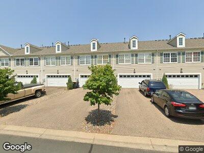
949 Newport Ave Shakopee, MN 55379
Estimated Value: $271,000 - $287,000
3
Beds
3
Baths
1,584
Sq Ft
$174/Sq Ft
Est. Value
About This Home
This home is located at 949 Newport Ave, Shakopee, MN 55379 and is currently estimated at $276,150, approximately $174 per square foot. 949 Newport Ave is a home located in Scott County with nearby schools including Jackson Elementary School, East Middle School, and Shakopee Senior High School.
Ownership History
Date
Name
Owned For
Owner Type
Purchase Details
Closed on
Apr 20, 2005
Sold by
Hahn Harold B and Hahn Kristina L
Bought by
Miller Melody and Miller Jeff
Current Estimated Value
Home Financials for this Owner
Home Financials are based on the most recent Mortgage that was taken out on this home.
Original Mortgage
$154,320
Outstanding Balance
$84,628
Interest Rate
6.35%
Mortgage Type
Adjustable Rate Mortgage/ARM
Estimated Equity
$190,453
Purchase Details
Closed on
Mar 26, 2003
Sold by
Town & Country Homes
Bought by
Hahn Harold B and Linkes Christina L
Create a Home Valuation Report for This Property
The Home Valuation Report is an in-depth analysis detailing your home's value as well as a comparison with similar homes in the area
Home Values in the Area
Average Home Value in this Area
Purchase History
| Date | Buyer | Sale Price | Title Company |
|---|---|---|---|
| Miller Melody | $192,900 | -- | |
| Hahn Harold B | $177,360 | -- |
Source: Public Records
Mortgage History
| Date | Status | Borrower | Loan Amount |
|---|---|---|---|
| Open | Miller Melody | $154,320 | |
| Closed | Miller Melody | $38,580 |
Source: Public Records
Tax History Compared to Growth
Tax History
| Year | Tax Paid | Tax Assessment Tax Assessment Total Assessment is a certain percentage of the fair market value that is determined by local assessors to be the total taxable value of land and additions on the property. | Land | Improvement |
|---|---|---|---|---|
| 2025 | $2,604 | $269,600 | $76,100 | $193,500 |
| 2024 | $2,604 | $257,200 | $72,400 | $184,800 |
| 2023 | $2,666 | $253,600 | $71,000 | $182,600 |
| 2022 | $2,658 | $255,300 | $72,700 | $182,600 |
| 2021 | $2,372 | $221,700 | $57,000 | $164,700 |
| 2020 | $2,590 | $218,200 | $52,500 | $165,700 |
| 2019 | $2,616 | $210,400 | $44,400 | $166,000 |
| 2018 | $2,136 | $0 | $0 | $0 |
| 2016 | $1,974 | $0 | $0 | $0 |
| 2014 | -- | $0 | $0 | $0 |
Source: Public Records
Map
Nearby Homes
- 1005 Providence Dr
- 1059 Providence Dr
- 749 Cobblestone Way
- 844 Princeton Ave Unit 4503
- 842 Princeton Ave Unit 4502
- 1651 Liberty St
- 735 Westchester Ave
- 1604 Liberty Cir
- 1971 Evergreen Ln
- 239 Appleblossom Ln
- 1326 Primrose Ln
- 106 Appleblossom Ln
- 1551 Creekside Ln
- 1874 Pintail Ave
- 1815 Mooers Ave
- 1980 Downing Ave
- 1207 Dakota St S
- 2011 Downing Ave
- 468 Appleblossom Ln
- 1986 Mathias Rd
- 949 Newport Ave
- 957 Newport Ave
- 933 Newport Ave
- 965 Newport Ave
- 973 Newport Ave
- 925 Newport Ave
- 981 Newport Ave
- 1785 Colonial St
- 1783 Colonial St
- 1781 Colonial St
- 1779 Colonial St
- 944 Newport Ave
- 997 Newport Ave
- 1777 Colonial St
- 962 Newport Ave
- 926 Newport Ave
- 1005 Newport Ave
- 1775 Colonial St
- 980 Newport Ave
- 1792 Colonial St