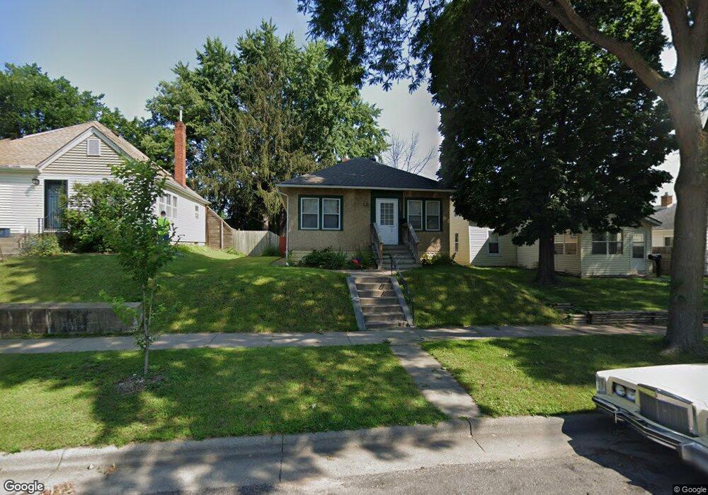
967 967 Rose Ave E St. Paul, MN 55106
Payne-Phalen NeighborhoodEstimated Value: $231,000 - $251,000
2
Beds
1
Bath
1,008
Sq Ft
$236/Sq Ft
Est. Value
About This Home
This home is located at 967 967 Rose Ave E, St. Paul, MN 55106 and is currently estimated at $238,118, approximately $236 per square foot. 967 967 Rose Ave E is a home located in Ramsey County with nearby schools including Frost Lake Elementary School, Battle Creek Middle School, and Johnson Senior High School.
Ownership History
Date
Name
Owned For
Owner Type
Purchase Details
Closed on
Jul 12, 2021
Sold by
Bristol Sara
Bought by
Meyer Robin Mckenzie
Current Estimated Value
Home Financials for this Owner
Home Financials are based on the most recent Mortgage that was taken out on this home.
Original Mortgage
$213,400
Outstanding Balance
$193,627
Interest Rate
2.9%
Mortgage Type
New Conventional
Estimated Equity
$44,491
Purchase Details
Closed on
Oct 25, 2018
Sold by
Affordable Properties Llc
Bought by
Bristol Sara
Home Financials for this Owner
Home Financials are based on the most recent Mortgage that was taken out on this home.
Original Mortgage
$130,950
Interest Rate
4.6%
Mortgage Type
New Conventional
Purchase Details
Closed on
Feb 10, 2010
Sold by
Citifinancial Services Llc
Bought by
Affordable Properties Llc
Create a Home Valuation Report for This Property
The Home Valuation Report is an in-depth analysis detailing your home's value as well as a comparison with similar homes in the area
Home Values in the Area
Average Home Value in this Area
Purchase History
| Date | Buyer | Sale Price | Title Company |
|---|---|---|---|
| Meyer Robin Mckenzie | $220,000 | None Available | |
| Bristol Sara | $135,000 | Results Title | |
| Affordable Properties Llc | $53,500 | -- |
Source: Public Records
Mortgage History
| Date | Status | Borrower | Loan Amount |
|---|---|---|---|
| Open | Meyer Robin Mckenzie | $213,400 | |
| Previous Owner | Bristol Sara | $130,950 |
Source: Public Records
Tax History
| Year | Tax Paid | Tax Assessment Tax Assessment Total Assessment is a certain percentage of the fair market value that is determined by local assessors to be the total taxable value of land and additions on the property. | Land | Improvement |
|---|---|---|---|---|
| 2025 | $2,856 | $234,000 | $25,000 | $209,000 |
| 2023 | $2,856 | $188,900 | $20,000 | $168,900 |
| 2022 | $2,224 | $200,000 | $20,000 | $180,000 |
| 2021 | $2,056 | $154,300 | $20,000 | $134,300 |
| 2020 | $2,408 | $139,200 | $9,900 | $129,300 |
| 2019 | $1,970 | $130,700 | $9,900 | $120,800 |
| 2018 | $1,834 | $111,700 | $9,900 | $101,800 |
| 2017 | $1,806 | $99,200 | $9,900 | $89,300 |
| 2016 | $1,732 | $0 | $0 | $0 |
| 2015 | $1,676 | $83,900 | $9,900 | $74,000 |
| 2014 | $1,740 | $0 | $0 | $0 |
Source: Public Records
Map
Nearby Homes
- 966 Hawthorne Ave E
- 960 Geranium Ave E
- 934 Orange Ave E
- 896 Jessamine Ave E
- 1064 Rose Ave E
- 975 Hyacinth Ave E
- 1045 Magnolia Ave E
- 1082 Hawthorne Ave E
- 878 Magnolia Ave E
- 1069 Earl St
- 1106 Hawthorne Ave E
- 1111 Maryland Ave E
- 892 Cook Ave E
- 813 Jessamine Ave E
- 804 Hawthorne Ave E
- 1135 Geranium Ave E
- 866 Clear Ave
- 893 Jenks Ave
- 850 Clear Ave
- 1128 Magnolia Ave E
- 967 Rose Ave E
- 971 Rose Ave E
- 963 Rose Ave E
- 975 Rose Ave E
- 957 Rose Ave E
- 981 Rose Ave E
- 955 Rose Ave E
- 955 955 Rose-Avenue-e
- 985 985 Rose Ave E
- 968 Maryland Ave E
- 974 Maryland Ave E
- 966 Maryland Ave E
- 953 Rose Ave E
- 968 Rose Ave E
- 972 Rose Ave E
- 972 972 Rose Ave E
- 978 Maryland Ave E
- 964 Rose Ave E
- 962 Maryland Ave E
- 960 Rose Ave E
Your Personal Tour Guide
Ask me questions while you tour the home.