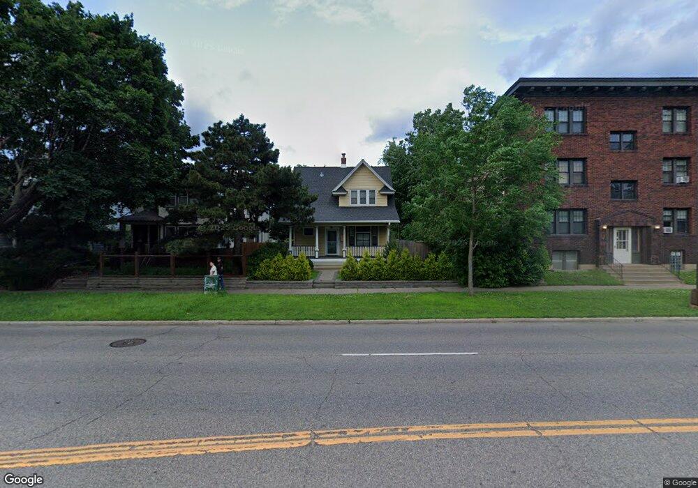
98 Snelling Ave N Saint Paul, MN 55104
Union Park NeighborhoodEstimated Value: $336,636 - $369,000
2
Beds
1
Bath
1,298
Sq Ft
$269/Sq Ft
Est. Value
About This Home
This home is located at 98 Snelling Ave N, Saint Paul, MN 55104 and is currently estimated at $349,409, approximately $269 per square foot. 98 Snelling Ave N is a home located in Ramsey County with nearby schools including Maxfield Magnet Elementary School, Hidden River Middle School, and Central Senior High School.
Ownership History
Date
Name
Owned For
Owner Type
Purchase Details
Closed on
Dec 17, 2018
Sold by
Drew O Reinic Deana B and Reinic Drew O
Bought by
Sands Jason
Current Estimated Value
Purchase Details
Closed on
May 31, 2002
Sold by
Sitter James L
Bought by
Harris Peter
Purchase Details
Closed on
May 27, 1997
Sold by
Sitter Leo and Sitter Delores
Bought by
Sitter James L
Purchase Details
Closed on
May 16, 1997
Sold by
Wurtele C Angus and Wurtele Margaret
Bought by
Sitter Leo
Purchase Details
Closed on
Jul 31, 1996
Sold by
Estate Of Amelia B Cunningham
Bought by
Wurtele Margaret
Create a Home Valuation Report for This Property
The Home Valuation Report is an in-depth analysis detailing your home's value as well as a comparison with similar homes in the area
Home Values in the Area
Average Home Value in this Area
Purchase History
| Date | Buyer | Sale Price | Title Company |
|---|---|---|---|
| Sands Jason | $251,500 | Minnesota Title | |
| Harris Peter | $142,000 | -- | |
| Simeer James L | $50,000 | -- | |
| Sitter James L | $50,000 | -- | |
| Sitter Leo | $65,000 | -- | |
| Wurtele Margaret | $63,500 | -- |
Source: Public Records
Mortgage History
| Date | Status | Borrower | Loan Amount |
|---|---|---|---|
| Closed | Sitter James L | -- |
Source: Public Records
Tax History Compared to Growth
Tax History
| Year | Tax Paid | Tax Assessment Tax Assessment Total Assessment is a certain percentage of the fair market value that is determined by local assessors to be the total taxable value of land and additions on the property. | Land | Improvement |
|---|---|---|---|---|
| 2025 | $4,876 | $325,400 | $46,600 | $278,800 |
| 2023 | $4,876 | $320,300 | $46,600 | $273,700 |
| 2022 | $4,434 | $325,400 | $46,600 | $278,800 |
| 2021 | $3,968 | $282,500 | $46,600 | $235,900 |
| 2020 | $3,782 | $253,300 | $46,600 | $206,700 |
| 2019 | $3,776 | $237,100 | $46,600 | $190,500 |
| 2018 | $3,464 | $224,800 | $46,600 | $178,200 |
| 2017 | $3,282 | $217,500 | $46,600 | $170,900 |
| 2016 | $3,180 | $0 | $0 | $0 |
| 2015 | $3,106 | $190,800 | $39,600 | $151,200 |
| 2014 | $2,562 | $0 | $0 | $0 |
Source: Public Records
Map
Nearby Homes
- 1540 Ashland Ave Unit 12
- 1510 Laurel Ave
- 184 Saratoga St N
- 1670 Ashland Ave
- 1447 Hague Ave
- 750 Summit Ave
- 266 Fry St
- 1671 Marshall Ave
- 1611 Carroll Ave
- 1798 Marshall Ave
- 1821 Selby Ave
- 1354 Grand Ave
- 1325 Dayton Ave
- 142 Cambridge St
- 1796 Iglehart Ave
- 382 Fry St
- 389 Roy St N
- 1836 Marshall Ave
- 1787 Carroll Ave
- 12XX Marshall Ave
- 106 Snelling Ave N
- 112 Snelling Ave N
- 114 Snelling Ave N
- 1562 Laurel Ave
- 1553 Ashland Ave
- 1560 Laurel Ave
- 1556 Laurel Ave
- 1549 Ashland Ave
- 1550 Laurel Ave
- 1545 Ashland Ave
- 1546 Laurel Ave
- 1573 Laurel Ave
- 1577 Laurel Ave
- 1571 Laurel Ave
- 1595 Ashland Ave
- 1595 1595 Ashland Ave
- 1565 Laurel Ave
- 1598 Laurel Ave
- 1540 Laurel Ave
- 1561 Laurel Ave