$577,578Average Value$278Average Price per Sq Ft8Homes For Sale
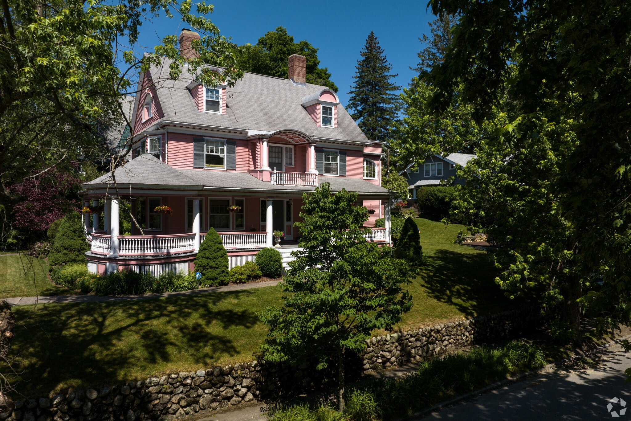
Colorful homes can be found throughout Forest Grove.
Tree-lined living on Worcester’s west side
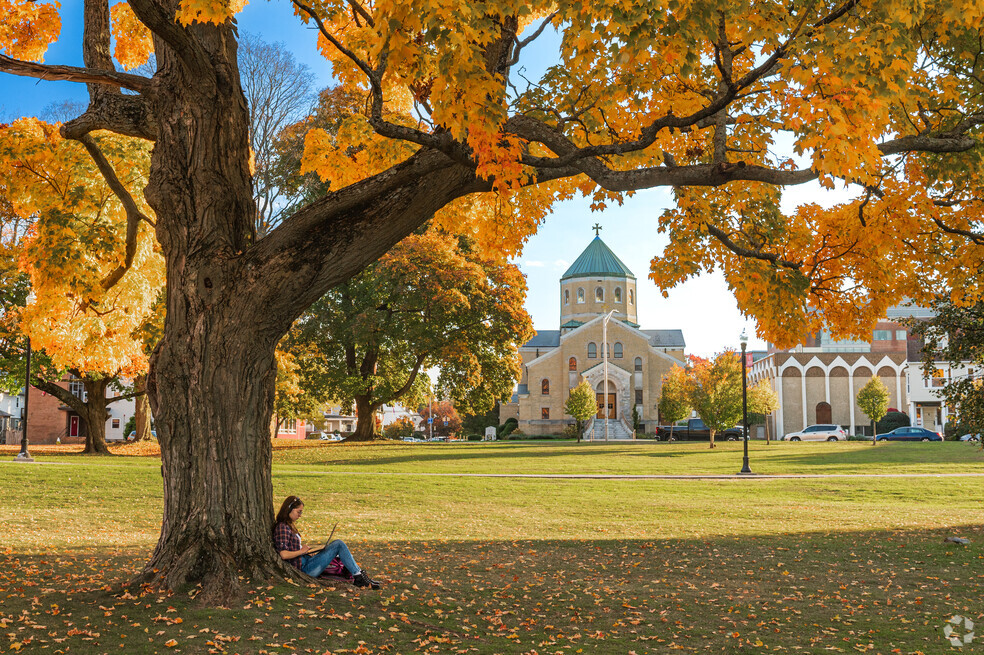
Forest Grove is a shaded suburban community on the west side of gritty, post-industrial Worcester. As its name suggests, the neighborhood is framed by a mature tree canopy and dense brush, and trails wind through acres of woodlands. It borders the sprawling Indian Lake, where pontoons float in the summer and largemouth bass swim below. Forest Grove is also home to Assumption University, a private four-year Roman Catholic school founded in 1904. “It’s a beautiful campus,” says Realtor Lee Joseph with Coldwell Banker Realty, who has sold homes in Worcester for nearly 40 years. “People take their daily walks there or use their sports facilities. It adds a lot of character to the neighborhood.” With historic homes on spacious lots a short drive from some of the city’s favorite areas, this is one of the most desirable neighborhoods in Worcester. “It comes with some of the highest resale values we see in town,” Joseph says.
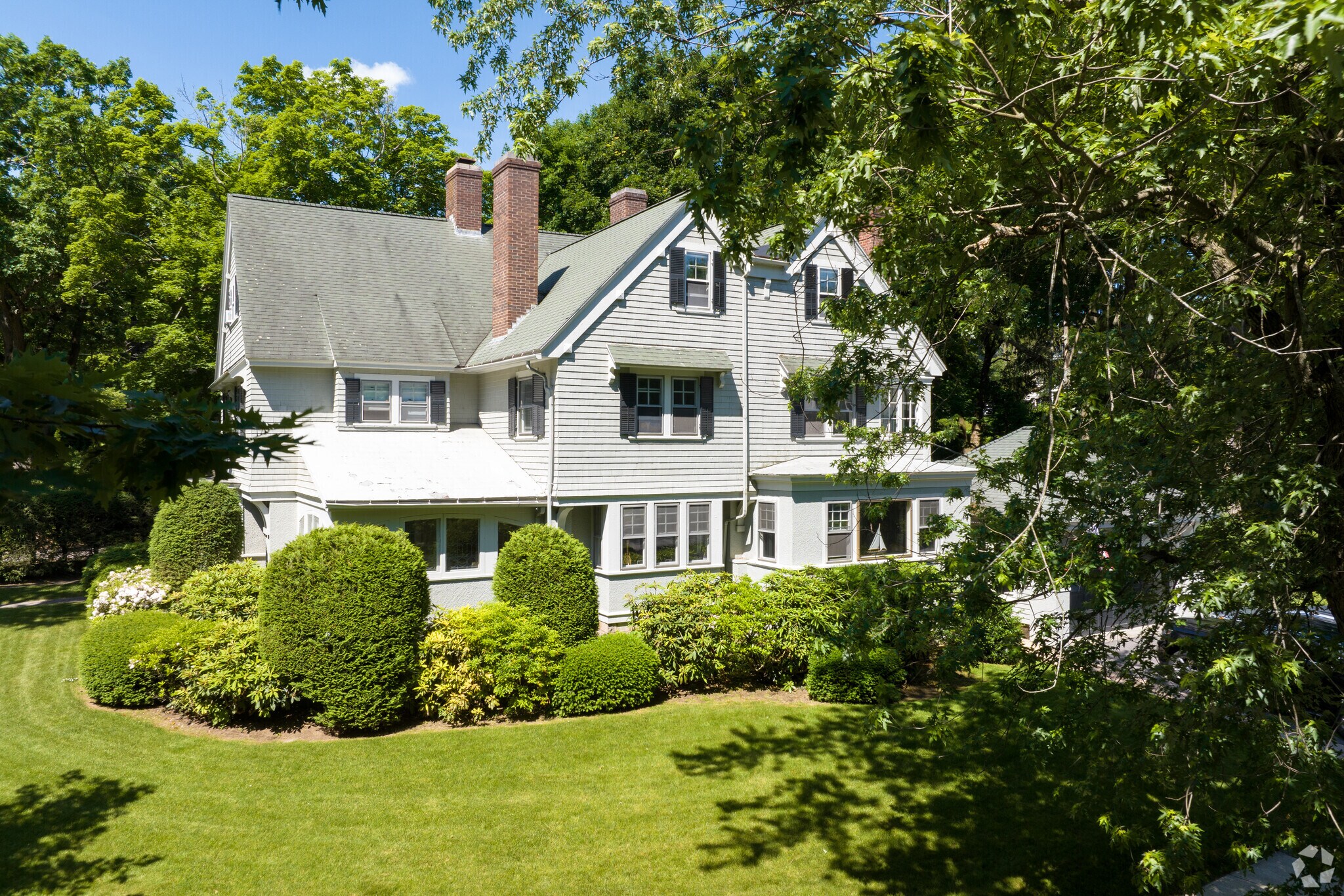
Well-manicured lawns are a frequent sight in Forest Grove.
Homes on forested lots and Montvale Historic District
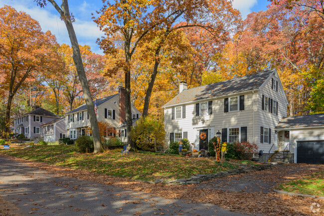
Large Colonial Revivals on meticulously maintained plots, modest Cape Cods, historic Victorian homes and midcentury split- or bilevels are some styles that line the neighborhood’s shaded roads, which occasionally end in cul-de-sacs. Sidewalks are present on some streets; picket fences enclose a few lawns. The median sale price in Forest Grove is about $490,000, and most homes were built in the 1960s. Buyers can find a ranch-style or other single-story property for between $350,000 and $490,000, while larger two-story, four-bedroom houses tend to range from $500,000 to $900,000, depending on the size, age and condition. There are also a few townhouses in the neighborhood, and these properties range in price from $350,000 to $540,000, while condos cost between $240,000 and $460,000. The Montvale Historic District is in the neighborhood, between Whitman and Sagamore roads. It was first developed in 1897 and added to the National Register of Historic Places in 1980. Along brick sidewalks and behind low stone walls, this small area has 37 historic homes in styles such as Queen Anne, Victorian and Colonial Revival. Landscaped lots with flowering bushes and mature trees line the tidy sidewalks. Properties in this district rarely come on the market, but when they do, they cost between $550,000 and $1 million. “There are rules governing what you can and can’t do to those buildings,” Joseph says. “So, anything you could see from a public walkway would require approval from a historic commission.”
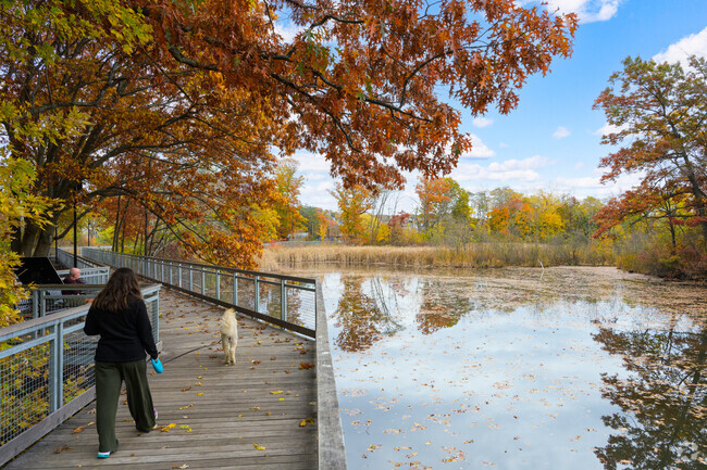
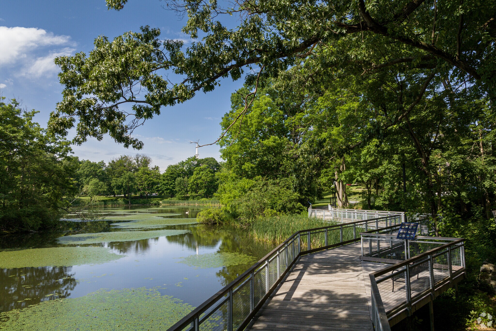
Locals can enjoy the walking trails at Institute Park in Forest Grove.
Wandering Nick’s Woods, boating Indian Lake
Nick’s Woods spans 65 acres in the northern part of the neighborhood. Here, trails weave under the shade of mountain laurels and sugar maples, past cold-water Sargent Brook and uphill to views of the ravine. Some homes in Forest Grove border Indian Lake, a 193-acre Worcester waterway serving the northern side of the city. Before automatic icemakers and freezers, the lake was used for ice harvesting. A horse-drawn plow would draw a grid on the frozen surface, forming ice blocks stored in a nearby facility. Today, locals hang out in the sun on the lake’s sandy 7-acre Shore Park, launch kayaks or canoes into the water or cast their lines for an afternoon of fishing. Institute Park is tucked in a corner of the neighborhood, and students at Worcester Polytechnic Institute just to the south sometimes cross this grassy space to get to class. A wooden walkway that leads to the college's athletic facilities bridges a large pond where swans swim and long grass sways.When snow piles high during a windy Worcester winter, there’s plenty to do indoors. X-Golf offers indoor game simulators and beers on tap; the Worcester Center for Crafts hosts creative classes and workshops; and the YMCA of Central Massachusetts operates its Greendale Family Branch on the north side of Indian Lake.
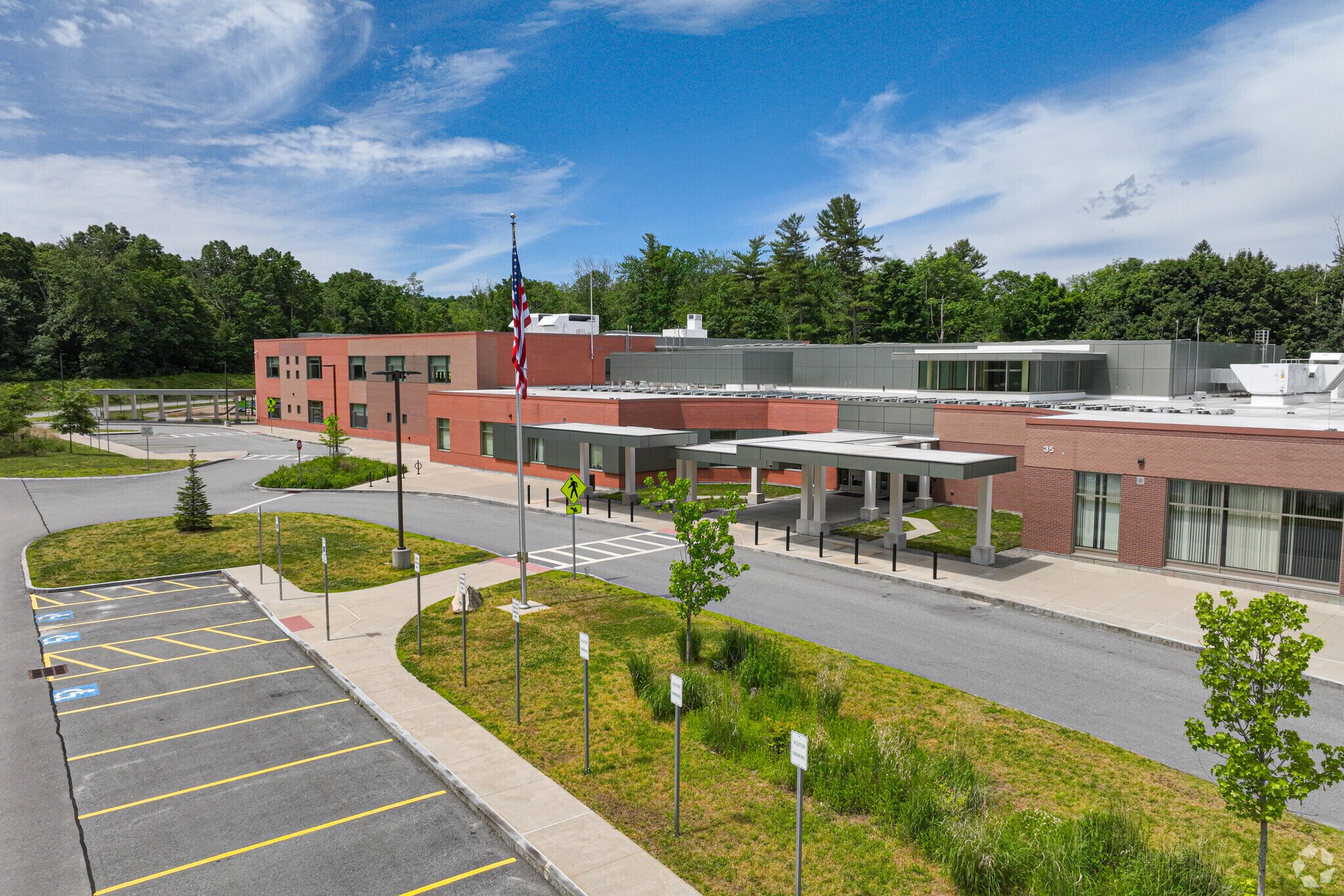
Nelson Place Elementary School is in Forest Grove.
Worcester Public Schools, Assumption University and WPI
Students are zoned for Worcester Public Schools. They can attend Nelson Place School and Forest Grove Middle School, both of which get B-minus scores from Niche. They can finish their public education at Doherty Memorial High School, which earns a B from Niche and offers the Engineering and Technology Academy, which admits students based on a lottery system. Assumption University is right in the middle of Forest Grove. This private Catholic college has roughly 2,000 students, and its countryside grounds are set back from the neighborhood’s homes. Also nearby is Worcester Polytechnic Institute, one of America’s first engineering and technology universities, which educates over 5,000 undergraduates.
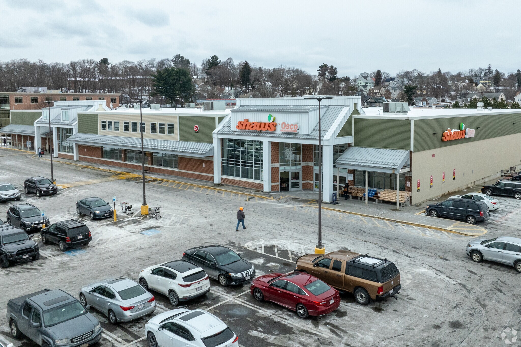
This areal view shows Shaw's in Worcester.
Amenities along Park Avenue
There are clusters of commercial convinces along Park Avenue, from fast-casual eateries like Chipotle and Starbucks to nail salons and dentist offices. Big-box stores, car dealerships, a Price Rite Marketplace grocery store and other businesses sit between Boylston Street and Gold Star Boulevard. A few local eateries are also nearby, like Oak Barrel Tavern, a lowkey dive serving pub fare, draft beers and whiskeys from its rustic interior. Bean Bakery Café, which has locations throughout the Worcester area, pours coffee in the morning and sells baked goods for dessert, from cream puffs to wedding cakes. The Canal District – home to Worcester's Triple-A baseball stadium Polar Park, as well as trendy bars, shops and restaurants – and the Shrewsbury Street dining district are both about 4 miles from the neighborhood. “Any kind of cuisine you could want exists on Shrewsbury Street,” Joseph says.
Getting around Forest Grove
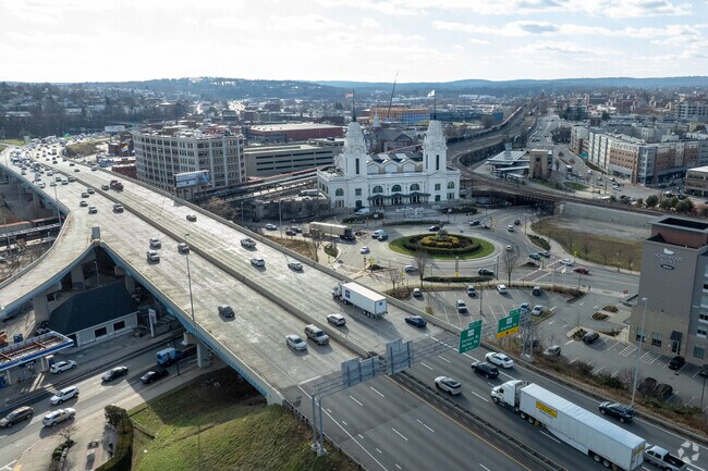
Forest Grove is just west of U.S. Interstate 190, which leads throughout north-central Massachusetts. Interstate 290, which connects to the Massachusetts Turnpike and Interstate 495, is also nearby. To commute the 50 miles to Boston without a car, locals can head to Union Station, about 5 miles southeast, where a train leads to the state capital with stops in small towns along the way. The Worcester Airport, which is small with limited flights, is about 6 miles away, while the Boston Logan International Airport is about 55 miles east. In case of emergency, UMass Memorial Medical Center-University campus is about 4 miles from Forest Grove.
This is downtown Worcester showing Rte. 290 and Union Station.
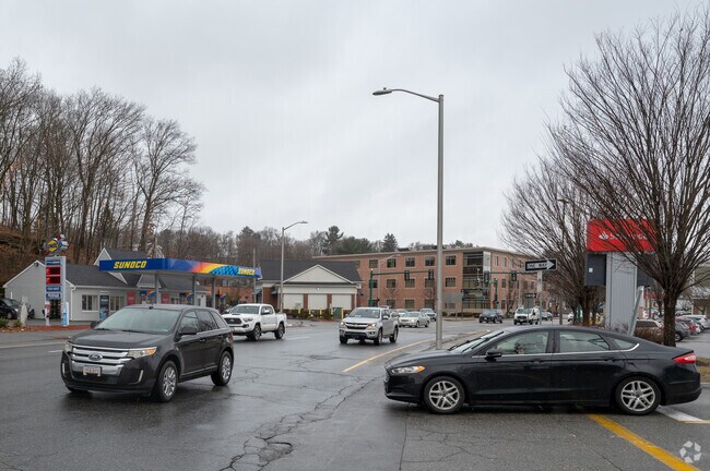
Grove street in Worcester is a busy road for locals to shop, eat and work.
GreatSchools:
The GreatSchools Rating helps parents compare schools within a state based on a variety of school quality indicators and provides a helpful picture of how effectively each school serves all of its students. Ratings are on a scale of 1 (below average) to 10 (above average) and can include test scores, college readiness, academic progress, advanced courses, equity, discipline and attendance data. We also advise parents to visit schools, consider other information on school performance and programs, and consider family needs as part of the school selection process.
View GreatSchools Rating Methodology
Are you familiar with the Forest Grove neighborhood?
to let others know what life in this neighborhood is like.
Crime and Safety
1 - Low Crime, 10 - High Crime
Forest Grove
US
Homicide
3
4
Sexual Assault
1
4
Assault with Weapon
2
4
Robbery
2
4
Burglary
2
4
Motor Vehicle Theft
2
4
Larceny
1
4
Crime Score
1
4
Source: WhatIsMyCrimeRisk.com
Forest Grove Demographics and Home Trends
On average, homes in Forest Grove, Worcester sell after 24 days on the market compared to the national average of 54 days. The median sale price for homes in Forest Grove, Worcester over the last 12 months is $519,335, up 3% from the median home sale price over the previous 12 months.
Investor or Homeowner, Take Note!This charming 3-bedroom home, situates on a double, corner lot in Worcester’s desirable West Side, offers endless potential. Conveniently located just minutes from Indian Lake, high-way access, and shopping. it features a custom-built kitchen and an updated bath, blending style and comfort.The walk-out, partially finished basement awaits your personal touch —
BUYER LOST THEIR FINANCING Westwood Hills presents a home that exudes timeless charm and offers a unique opportunity to embrace a life of comfortable elegance. This center foyer colonial with a stone front boasts a generous 2,500 square feet of living area and sits proudly on a knoll. The front to back living rm is accented a with fireplace and built-in bookcase, perfect for hosting gatherings.
Welcome to 4004 Brompton Cir, a distinguished condominium residence nestled in the heart of Massachusetts. This property offers a unique opportunity to experience refined living in a desirable setting. The layout of this condominium is thoughtfully designed, featuring three bedrooms and three full and a half bathroom. The generous 2790 square feet of living space provides ample room for
Nestled at 25 Chester in the vibrant city of Worcester, this beautifully remodeled home offers the perfect blend of modern design and efficient living with an opportunity to own a piece of history, with the classic architecture dating back to 1918. This home presents an exciting opportunity of low maintenance, luxury living without an HOA fee. With 1614 square feet of living space, this residence
Offers if any will be reviewed Tuesday at 5 PM. Showings begin on Saturday at the 1:00pm open house. Beautiful hardwood floors and classic built-ins. The updated kitchen and baths offer today’s conveniences, while the finished walkout basement provides additional living space with a recently added 3rd bedroom/den/home office and full bathroom. Recent updates include brand-new appliances, new
Welcome to 577 Grove Street! This unique mixed-use property offers stunning water views and a versatile layout, featuring a spacious 4-bedroom raised ranch upstairs and a fully equipped veterinary clinic on the lower level. Perfect for an owner-operator or investor, the residential space provides comfortable living or rental potential, while the commercial space is ideal for a veterinarian, dog
Elegance and contemporary design converge at 23 Leslie Rd, Worcester, MA, where this single-family residence, built in 2026, presents an attractive property for modern day living. The kitchen stands at the center of the home, featuring a large center island that invites gathering and culinary creation a pocket door gives way to an oversized panty. Shaker cabinets provide both stylish aesthetics
This first-floor garden-style condo in the Heritage Building is located off Salisbury Street in the desirable Salisbury West community. Beautifully landscaped grounds, a pool, clubhouse, and tennis court are among the amenities. The 2-bedroom, 2-bath unit features an open floor plan with access to a covered and screened porch from both the living and dining rooms—perfect for relaxing. A gas
Welcome to 84 Chester St, Worcester, MA — a beautifully maintained Colonial offering an open floor plan, generously sized rooms, and a spacious, level backyard perfect for year-round enjoyment.The main level is ideal for both entertaining and everyday living. The large kitchen features a center island and flows seamlessly into the front-to-back living room and dining area, creating an inviting
4 bedroom 1 bath single family home for rent. 2 bedrooms and bathroom on main floor. 2 additional bedrooms on the second floor. Lawn care as well as snow removal of sidewalk, driveway, and walkways is tenant’s sole responsibility. Tenant pays for gas bill. Important things to note about laundry access: Tenant will generally have access to half of the basement which has a 2nd
Local Logic measures the walkability, access to public transit and bikeability of any address. CAP Index provides objective, accurate, and consistent data to help measure, compare, and mitigate crime risks.
Disclaimer: Certain information contained herein is derived from information provided by parties other than Homes.com. Our sources include: Accuweather, Public Records and Neustar. All information provided is deemed reliable, but is not guaranteed to be accurate and should be independently verified.