Estimated Value: $620,000 - $678,000
3
Beds
2
Baths
2,280
Sq Ft
$282/Sq Ft
Est. Value
About This Home
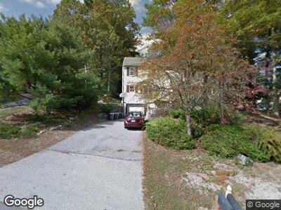
This home is located at 1 Poor Farm Rd, Derry, NH 03038 and is currently estimated at $643,238, approximately $282 per square foot. 1 Poor Farm Rd is a home located in Rockingham County with nearby schools including South Range Elementary School, West Running Brook Middle School, and Pinkerton Academy.
Ownership History
Date
Name
Owned For
Owner Type
Purchase Details
Closed on
Aug 30, 1996
Sold by
Debronkart J Richard D
Bought by
Mccabe Glen M and Mccabe Loralee A
Current Estimated Value
Create a Home Valuation Report for This Property
The Home Valuation Report is an in-depth analysis detailing your home's value as well as a comparison with similar homes in the area
Home Values in the Area
Average Home Value in this Area
Purchase History
| Date | Buyer | Sale Price | Title Company |
|---|---|---|---|
| Mccabe Glen M | $77,000 | -- |
Source: Public Records
Mortgage History
| Date | Status | Borrower | Loan Amount |
|---|---|---|---|
| Open | Mccabe Glen M | $210,000 | |
| Closed | Mccabe Glen M | $216,750 | |
| Closed | Mccabe Glen M | $215,300 | |
| Closed | Mccabe Glen M | $226,300 |
Source: Public Records
Tax History Compared to Growth
Tax History
| Year | Tax Paid | Tax Assessment Tax Assessment Total Assessment is a certain percentage of the fair market value that is determined by local assessors to be the total taxable value of land and additions on the property. | Land | Improvement |
|---|---|---|---|---|
| 2024 | $10,261 | $549,000 | $221,000 | $328,000 |
| 2023 | $10,634 | $514,200 | $187,800 | $326,400 |
| 2022 | $9,790 | $514,200 | $187,800 | $326,400 |
| 2021 | $8,829 | $356,600 | $146,400 | $210,200 |
| 2020 | $8,680 | $356,600 | $146,400 | $210,200 |
| 2019 | $8,220 | $314,700 | $102,200 | $212,500 |
| 2018 | $8,241 | $316,600 | $102,200 | $214,400 |
| 2017 | $8,517 | $295,100 | $97,700 | $197,400 |
| 2016 | $7,985 | $295,100 | $97,700 | $197,400 |
| 2015 | $8,187 | $280,100 | $97,700 | $182,400 |
| 2014 | $8,241 | $280,100 | $97,700 | $182,400 |
| 2013 | $8,420 | $267,400 | $95,900 | $171,500 |
Source: Public Records
Map
Nearby Homes
- 3 Blueberry Rd Unit R
- 18 Phillip Rd
- 30 Kendall Pond Rd Unit 62
- 4 Kendall Pond Rd
- 75.5 Fordway Extension
- 15 Derryfield Rd Unit R
- 65 Fordway Extension Unit 108
- 9 Fairview Ave
- 3 Sunnyside Ln
- 37 Highland Ave Unit 4
- 1 Richard Dr
- 29 Brook St
- 23 Oak St
- 10 Valley St
- 19 Central St
- 7 Clark St
- 14 Park Ave
- 44 Sheffield Way Unit 6B
- 42 Sheffield Way Unit 6A
- 9 Hope Hill Rd Unit 3-14
- 1 Poor Farm Rd
- 2 Blueberry Rd Unit R
- 2 Blueberry Rd Unit L
- 4 Blueberry Rd Unit R
- 4 Blueberry Rd Unit L
- 15 Strawberry Hill Rd
- 6 Blueberry Rd
- 6b Blueberry Rd
- 13 Strawberry Hill Rd
- 13 Strawberry Hill Rd Unit L
- 8 Blueberry Rd
- 8 Blueberry Rd Unit R
- 8 Blueberry Rd Unit L
- 13L Strawberry Hill Rd
- 1 Blackberry Rd Unit R
- 1 Blackberry Rd Unit L
- 24 Kendall Pond Rd
- 3 Blueberry Rd Unit L
- 3 Blueberry Rd Unit 3L
- 3 Blueberry Rd Unit 3B