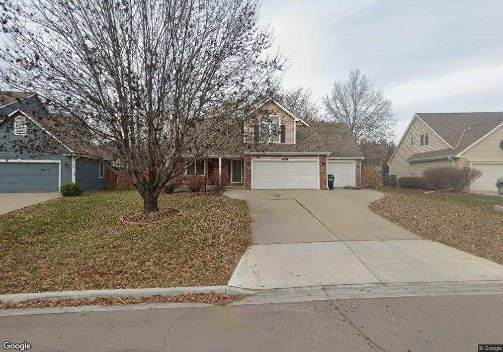
1017 Summerfield Way Lawrence, KS 66049
West Lawrence NeighborhoodEstimated Value: $443,000 - $533,000
4
Beds
4
Baths
2,990
Sq Ft
$166/Sq Ft
Est. Value
About This Home
This home is located at 1017 Summerfield Way, Lawrence, KS 66049 and is currently estimated at $495,806, approximately $165 per square foot. 1017 Summerfield Way is a home located in Douglas County with nearby schools including Langston Hughes Elementary School, Southwest Middle School, and Lawrence Free State High School.
Ownership History
Date
Name
Owned For
Owner Type
Purchase Details
Closed on
Mar 19, 2019
Sold by
Hopkins Kyle E and Hopkins Alise E
Bought by
Nelson Molly A and Nelson Donald R
Current Estimated Value
Home Financials for this Owner
Home Financials are based on the most recent Mortgage that was taken out on this home.
Original Mortgage
$269,025
Outstanding Balance
$236,519
Interest Rate
4.4%
Mortgage Type
New Conventional
Estimated Equity
$259,287
Create a Home Valuation Report for This Property
The Home Valuation Report is an in-depth analysis detailing your home's value as well as a comparison with similar homes in the area
Home Values in the Area
Average Home Value in this Area
Purchase History
| Date | Buyer | Sale Price | Title Company |
|---|---|---|---|
| Nelson Molly A | -- | Continental Title Company |
Source: Public Records
Mortgage History
| Date | Status | Borrower | Loan Amount |
|---|---|---|---|
| Open | Nelson Molly A | $269,025 |
Source: Public Records
Tax History Compared to Growth
Tax History
| Year | Tax Paid | Tax Assessment Tax Assessment Total Assessment is a certain percentage of the fair market value that is determined by local assessors to be the total taxable value of land and additions on the property. | Land | Improvement |
|---|---|---|---|---|
| 2025 | $6,443 | $51,589 | $9,200 | $42,389 |
| 2024 | $6,160 | $49,358 | $7,475 | $41,883 |
| 2023 | $6,062 | $46,966 | $7,475 | $39,491 |
| 2022 | $5,664 | $43,608 | $7,475 | $36,133 |
| 2021 | $4,967 | $37,122 | $6,334 | $30,788 |
| 2020 | $4,845 | $36,397 | $6,334 | $30,063 |
| 2019 | $4,157 | $31,314 | $6,334 | $24,980 |
| 2018 | $4,079 | $30,509 | $6,334 | $24,175 |
| 2017 | $4,047 | $29,934 | $6,334 | $23,600 |
| 2016 | $3,668 | $28,359 | $5,753 | $22,606 |
| 2015 | $3,551 | $27,462 | $5,753 | $21,709 |
| 2014 | $3,556 | $27,761 | $5,753 | $22,008 |
Source: Public Records
Map
Nearby Homes
- 5117 Harvard Rd
- 5204 Foxchase Dr
- 5204 Fox Chase Dr
- 5024 Cedar Grove Way
- 1040 Stonecreek Dr
- 1017 Stoneridge Dr
- 1202 Little Knife
- 1033 Stonecreek Dr
- 1300 Research Park Dr
- 1315 Research Park Dr
- 5245 Overland Dr Unit A15
- 5245 Overland Dr Unit C12
- 5245 Overland Dr Unit D4
- 904 Moundridge Dr
- 1347 Kanza Dr
- 5614 Chimney Rocks Cir
- 5710 Goff Ct
- 6204 Berando Ct
- 1601 Research Park Dr
- 1564 Fountain Dr
- 1021 Summerfield Way
- 1013 Summerfield Way
- 5113 Harvard Rd
- 5121 Harvard Rd
- 1101 Summerfield Way
- 5109 Harvard Rd
- 1009 Summerfield Way
- 1032 Summerfield Way
- 5205 Harvard Rd
- 5105 Harvard Rd
- 1028 Summerfield Way
- 1105 Summerfield Way
- 1100 Summerfield Way
- 1005 Summerfield Way
- 5209 Harvard Rd
- 1024 Summerfield Way
- 1020 Summerfield Way
- 1001 Summerfield Way
- 1113 Summerfield Way
- 1104 Summerfield Way