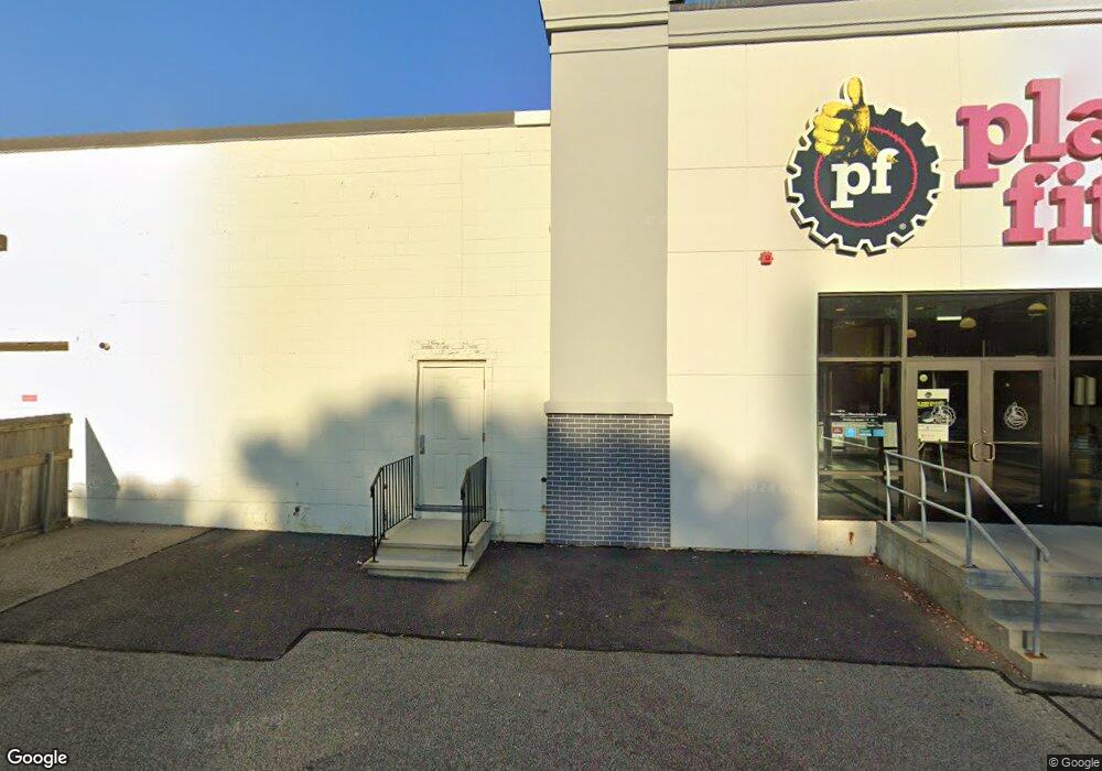
106 Falmouth Rd Mashpee, MA 2649
--
Bed
--
Bath
--
Sq Ft
13.3
Acres
About This Home
This home is located at 106 Falmouth Rd, Mashpee, MA 2649. 106 Falmouth Rd is a home located in Barnstable County with nearby schools including Kenneth C. Coombs School, Quashnet School, and Mashpee Middle School.
Ownership History
Date
Name
Owned For
Owner Type
Purchase Details
Closed on
Jun 30, 1999
Sold by
Augat Inc
Bought by
Duck Pond Lp
Home Financials for this Owner
Home Financials are based on the most recent Mortgage that was taken out on this home.
Original Mortgage
$1,000,000
Outstanding Balance
$271,929
Interest Rate
7.19%
Mortgage Type
Commercial
Create a Home Valuation Report for This Property
The Home Valuation Report is an in-depth analysis detailing your home's value as well as a comparison with similar homes in the area
Home Values in the Area
Average Home Value in this Area
Purchase History
| Date | Buyer | Sale Price | Title Company |
|---|---|---|---|
| Duck Pond Lp | $1,550,000 | -- |
Source: Public Records
Mortgage History
| Date | Status | Borrower | Loan Amount |
|---|---|---|---|
| Open | Duck Pond Lp | $1,000,000 |
Source: Public Records
Tax History Compared to Growth
Tax History
| Year | Tax Paid | Tax Assessment Tax Assessment Total Assessment is a certain percentage of the fair market value that is determined by local assessors to be the total taxable value of land and additions on the property. | Land | Improvement |
|---|---|---|---|---|
| 2025 | $87,689 | $13,853,000 | $2,545,300 | $11,307,700 |
| 2024 | $92,329 | $13,217,000 | $2,448,000 | $10,769,000 |
| 2023 | $0 | $12,747,300 | $2,331,400 | $10,415,900 |
| 2022 | $92,329 | $11,301,000 | $2,072,300 | $9,228,700 |
| 2021 | $96,670 | $10,658,200 | $1,777,600 | $8,880,600 |
| 2020 | $95,283 | $10,482,200 | $1,726,000 | $8,756,200 |
| 2019 | $85,691 | $9,468,600 | $1,676,500 | $7,792,100 |
| 2018 | $2,531 | $7,409,200 | $1,629,100 | $5,780,100 |
| 2017 | $54,576 | $5,938,600 | $1,578,500 | $4,360,100 |
| 2016 | $54,018 | $5,846,100 | $1,578,500 | $4,267,600 |
| 2015 | $51,228 | $5,623,300 | $1,546,900 | $4,076,400 |
| 2014 | $51,430 | $5,477,100 | $1,502,300 | $3,974,800 |
Source: Public Records
Map
Nearby Homes
- 70 Cape Dr Unit 14D
- 70 Cape Dr Unit 11D
- 70 Cape Dr Unit 11D
- 195 Falmouth Rd Unit 10E
- 195 Falmouth Rd Unit 12F
- 195 Falmouth Rd Unit 9D
- 195 Falmouth Rd Unit 7B
- 16 Spring Brook Ln
- 295 Pheasant Hill Cir
- 70 Simons Rd Unit E
- 70 Simons Rd
- 220 Dunrobin Rd
- 226 Dunrobin Rd
- 5 Darby Point Unit 5
- 4 Bishops Park
- 22 Stratford Ridge Unit 22
- 6 Mayfair Ct
- 6 Mayfair Ct Unit 6
- 30 Windsor Point
- 14 Willow Cir
- 215 Simons Rd
- 29 Trinity Place
- 36 Savannas Path
- 23 Bowdoin Rd Unit 5
- 23 Bowdoin Rd Unit 10
- 23 Bowdoin Rd Unit 1
- 23 Bowdoin Rd Unit 7
- 23 Bowdoin Rd Unit 4
- 23 Bowdoin Rd Unit 3
- 23 Bowdoin Rd Unit 8
- 23 Bowdoin Rd Unit 9
- 23 Bowdoin Rd
- 23 Bowdoin Rd Unit 6
- 31 Bowdoin Rd
- 17 Bowdoin Rd
- 37 Bowdoin Rd
- 17 Trinity Place Unit D
- 17 Trinity Place Unit B
- 17 Trinity Place Unit C
- 17 Trinity Place Unit A