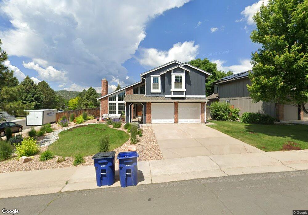
10962 Main Range Trail Littleton, CO 80127
Ken Caryl Ranch NeighborhoodEstimated Value: $759,469 - $837,000
4
Beds
3
Baths
3,352
Sq Ft
$240/Sq Ft
Est. Value
About This Home
This home is located at 10962 Main Range Trail, Littleton, CO 80127 and is currently estimated at $805,867, approximately $240 per square foot. 10962 Main Range Trail is a home located in Jefferson County with nearby schools including Shaffer Elementary School, Falcon Bluffs Middle School, and Chatfield High School.
Ownership History
Date
Name
Owned For
Owner Type
Purchase Details
Closed on
May 12, 2011
Sold by
Mitchell Cynthia J
Bought by
Desai Sandip J and Desai Payalben S
Current Estimated Value
Home Financials for this Owner
Home Financials are based on the most recent Mortgage that was taken out on this home.
Original Mortgage
$292,000
Outstanding Balance
$202,112
Interest Rate
4.87%
Mortgage Type
New Conventional
Estimated Equity
$603,755
Purchase Details
Closed on
Nov 3, 2008
Sold by
Mitchell James D and Mitchell Cynthia J
Bought by
Mitchell Cynthia J
Home Financials for this Owner
Home Financials are based on the most recent Mortgage that was taken out on this home.
Original Mortgage
$225,000
Interest Rate
5.98%
Mortgage Type
New Conventional
Purchase Details
Closed on
Dec 2, 2002
Sold by
Reloaction
Bought by
Mitchell James D and Mitchell Cynthia J
Home Financials for this Owner
Home Financials are based on the most recent Mortgage that was taken out on this home.
Original Mortgage
$236,000
Interest Rate
6.05%
Purchase Details
Closed on
Nov 29, 2002
Sold by
Grenillo Salvadore G and Grenillo Patricia A
Bought by
Reloaction
Home Financials for this Owner
Home Financials are based on the most recent Mortgage that was taken out on this home.
Original Mortgage
$236,000
Interest Rate
6.05%
Purchase Details
Closed on
Apr 28, 2000
Sold by
North Tim L and Clarke Sarah E
Bought by
Grenillo Salvadore G and Grenillo Patricia A
Home Financials for this Owner
Home Financials are based on the most recent Mortgage that was taken out on this home.
Original Mortgage
$225,000
Interest Rate
8.19%
Purchase Details
Closed on
Feb 28, 2000
Sold by
Hearthstone Homes Inc
Bought by
North Tim L and Clarke Sarah E
Home Financials for this Owner
Home Financials are based on the most recent Mortgage that was taken out on this home.
Original Mortgage
$225,000
Interest Rate
8.19%
Purchase Details
Closed on
Jan 19, 2000
Sold by
Walton Thomas A Walton Shelley L
Bought by
Hearthstone Homes Inc
Home Financials for this Owner
Home Financials are based on the most recent Mortgage that was taken out on this home.
Original Mortgage
$238,050
Interest Rate
8.31%
Create a Home Valuation Report for This Property
The Home Valuation Report is an in-depth analysis detailing your home's value as well as a comparison with similar homes in the area
Home Values in the Area
Average Home Value in this Area
Purchase History
| Date | Buyer | Sale Price | Title Company |
|---|---|---|---|
| Desai Sandip J | $325,000 | Heritage Title | |
| Mitchell Cynthia J | -- | Lsi | |
| Mitchell James D | $295,000 | -- | |
| Reloaction | -- | -- | |
| Grenillo Salvadore G | $270,000 | Land Title Guarantee Company | |
| North Tim L | $264,500 | Land Title | |
| Hearthstone Homes Inc | $256,405 | Land Title |
Source: Public Records
Mortgage History
| Date | Status | Borrower | Loan Amount |
|---|---|---|---|
| Open | Desai Sandip J | $292,000 | |
| Previous Owner | Mitchell Cynthia J | $225,000 | |
| Previous Owner | Mitchell James D | $236,000 | |
| Previous Owner | Grenillo Salvadore G | $225,000 | |
| Previous Owner | North Tim L | $238,050 |
Source: Public Records
Tax History
| Year | Tax Paid | Tax Assessment Tax Assessment Total Assessment is a certain percentage of the fair market value that is determined by local assessors to be the total taxable value of land and additions on the property. | Land | Improvement |
|---|---|---|---|---|
| 2024 | $4,480 | $43,185 | $10,970 | $32,215 |
| 2023 | $4,623 | $43,185 | $10,970 | $32,215 |
| 2022 | $3,990 | $36,450 | $8,856 | $27,594 |
| 2021 | $4,051 | $37,498 | $9,110 | $28,388 |
| 2020 | $3,642 | $33,823 | $7,487 | $26,336 |
| 2019 | $3,599 | $33,823 | $7,487 | $26,336 |
| 2018 | $3,203 | $29,070 | $6,916 | $22,154 |
| 2017 | $2,979 | $29,070 | $6,916 | $22,154 |
| 2016 | $3,112 | $28,743 | $8,429 | $20,314 |
| 2015 | $2,821 | $28,743 | $8,429 | $20,314 |
| 2014 | $2,821 | $24,547 | $6,685 | $17,862 |
Source: Public Records
Map
Nearby Homes
- 10791 Trailrider Pass
- 8140 S Storm King Peak
- 10866 W Half Moon Pass
- 10463 W Turtle Mountain
- 11446 San Joaquin Ridge
- 8221 S San Juan Range Rd
- 7580 S Lost Ranger Peak
- 11104 W San Juan Range Rd
- 11369 W Park Range Rd
- 10550 W Raspberry Mountain
- 7448 S Quail Cir Unit 2214
- 8077 S Vermejo Peak
- 7776 S Crestone Peak
- 7433 S Quail Cir Unit 1913
- 7463 S Quail Cir Unit 312
- 7473 S Quail Cir Unit 521
- 7423 S Quail Cir Unit 1535
- 7422 S Quail Cir Unit 1615
- 11804 Elk Head Range Rd
- 10351 Red Mountain E
- 10972 Main Range Trail
- 7707 Gunsight Pass
- 10952 Main Range Trail
- 10982 Main Range Trail
- 7713 Gunsight Pass
- 10992 Main Range Trail
- 7708 Gunsight Pass
- 10951 Main Range Trail
- 10971 Main Range Trail
- 10942 Main Range Trail
- 10941 Main Range Trail
- 11002 Main Range Trail
- 10981 Main Range Trail
- 7714 Gunsight Pass
- 7723 Gunsight Pass
- 10931 Main Range Trail
- 10932 Main Range Trail
- 11012 Main Range Trail
- 7657 Snowmass Mountain
- 7724 Gunsight Pass
Your Personal Tour Guide
Ask me questions while you tour the home.