1201 Laurelhurst Dr Eugene, OR 97402
Bethel NeighborhoodEstimated Value: $396,000 - $450,000
4
Beds
2
Baths
1,508
Sq Ft
$282/Sq Ft
Est. Value
About This Home
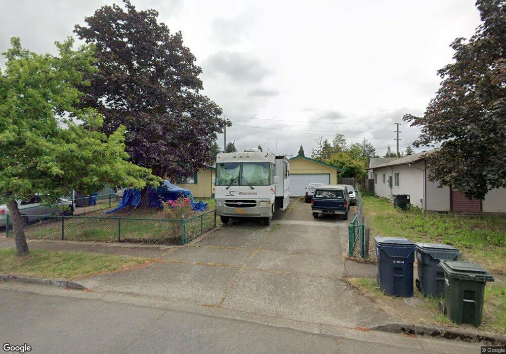
This home is located at 1201 Laurelhurst Dr, Eugene, OR 97402 and is currently estimated at $424,876, approximately $281 per square foot. 1201 Laurelhurst Dr is a home located in Lane County with nearby schools including Danebo Elementary School, Shasta Middle School, and Willamette High School.
Ownership History
Date
Name
Owned For
Owner Type
Purchase Details
Closed on
Mar 26, 2001
Sold by
Myhre Theodore A and Myhre Jeanie M
Bought by
Leet Kimberly A
Current Estimated Value
Home Financials for this Owner
Home Financials are based on the most recent Mortgage that was taken out on this home.
Original Mortgage
$114,171
Interest Rate
6.97%
Purchase Details
Closed on
Dec 21, 1998
Sold by
Myhre Theodore A and Myhre Jeanie M
Bought by
Myhre Theodore A and Myhre Jeanie M
Home Financials for this Owner
Home Financials are based on the most recent Mortgage that was taken out on this home.
Original Mortgage
$111,240
Interest Rate
6.91%
Mortgage Type
VA
Create a Home Valuation Report for This Property
The Home Valuation Report is an in-depth analysis detailing your home's value as well as a comparison with similar homes in the area
Home Values in the Area
Average Home Value in this Area
Purchase History
| Date | Buyer | Sale Price | Title Company |
|---|---|---|---|
| Leet Kimberly A | $129,000 | Cascade Title Co | |
| Myhre Theodore A | -- | Key Title Company |
Source: Public Records
Mortgage History
| Date | Status | Borrower | Loan Amount |
|---|---|---|---|
| Previous Owner | Leet Kimberly A | $114,171 | |
| Previous Owner | Myhre Theodore A | $111,240 |
Source: Public Records
Tax History
| Year | Tax Paid | Tax Assessment Tax Assessment Total Assessment is a certain percentage of the fair market value that is determined by local assessors to be the total taxable value of land and additions on the property. | Land | Improvement |
|---|---|---|---|---|
| 2025 | $3,898 | $224,113 | -- | -- |
| 2024 | $3,800 | $217,586 | -- | -- |
| 2023 | $3,800 | $211,249 | -- | -- |
| 2022 | $3,537 | $205,097 | $0 | $0 |
| 2021 | $3,463 | $199,124 | $0 | $0 |
| 2020 | $3,362 | $193,325 | $0 | $0 |
| 2019 | $3,196 | $187,695 | $0 | $0 |
| 2018 | $3,107 | $176,921 | $0 | $0 |
| 2017 | $2,969 | $176,921 | $0 | $0 |
| 2016 | $2,894 | $171,768 | $0 | $0 |
| 2015 | $2,837 | $166,765 | $0 | $0 |
| 2014 | $2,794 | $161,908 | $0 | $0 |
Source: Public Records
Map
Nearby Homes
- 4548 Cambon St
- 1153 Elizabeth St
- 870 Laurelhurst Dr
- 4554 Woodsboro St
- 1562 Philip St
- 4280 Avalon St
- 4749 Royal Ave
- 1145 Ludgate Dr
- 1159 Throne Dr
- 4941 Stagecoach Rd
- 4055 Royal Ave Unit 93
- 4055 Royal Ave Unit 22
- 4055 Royal Ave Unit 150
- 4055 Royal Ave Unit 69
- 4055 Royal Ave Unit 87
- 795 Red Cedar Ct
- 1400 Candlelight Dr Unit 162
- 1400 Candlelight Dr Unit 208
- 1400 Candlelight Dr
- 1400 Candlelight Dr Unit 226
- 1197 Laurelhurst Dr
- 1203 Laurelhurst Dr
- 1205 Laurelhurst Dr
- 1207 Laurelhurst Dr
- 1204 Laurelhurst Dr
- 4602 Marshall Ave
- 4604 Marshall Ave
- 1221 Laurelhurst Dr
- 4609 Marshall Ave
- 4606 Fuller Ave
- 1197 Elizabeth St
- 4614 Marshall Ave
- 1198 Elizabeth St
- 999 Laurelhurst Dr
- 4615 Marshall Ave
- 1233 Laurelhurst Dr
- 0 Fuller Ave Unit 20023274
- 0 Fuller Ave Unit 5300
- 4612 Fuller Ave
- 4580 Sean St
Your Personal Tour Guide
Ask me questions while you tour the home.