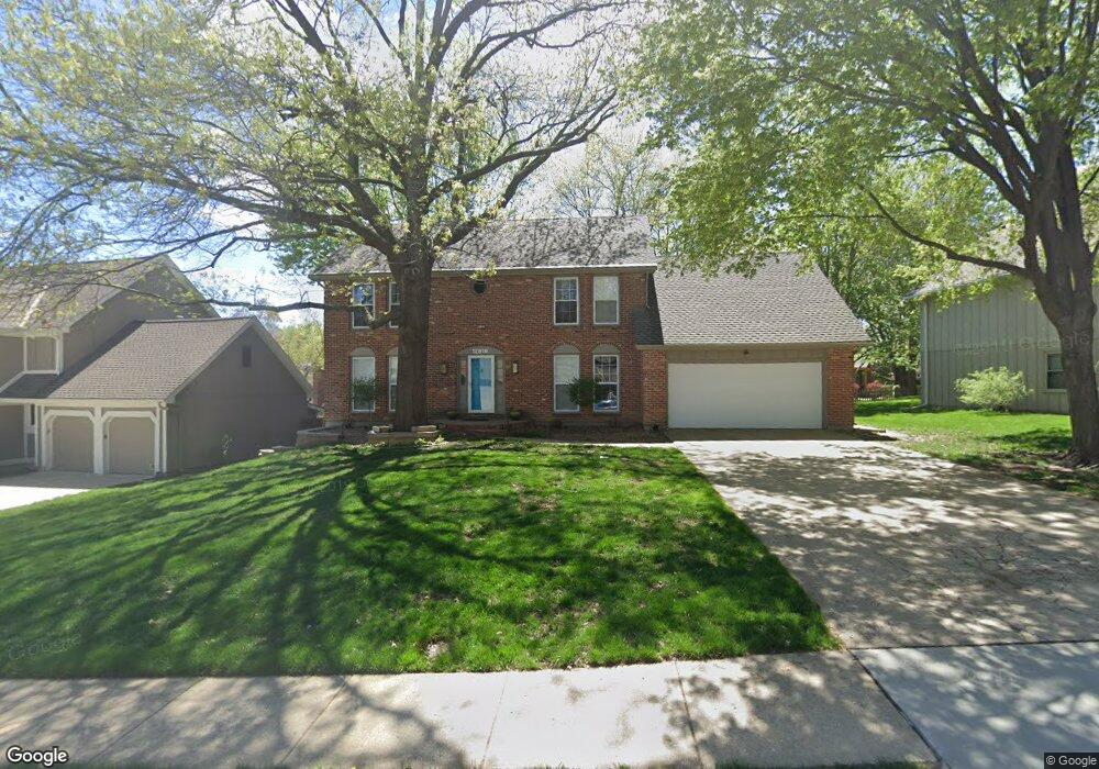
12819 W 82nd St Lenexa, KS 66215
Estimated Value: $491,000 - $554,000
5
Beds
3
Baths
3,148
Sq Ft
$163/Sq Ft
Est. Value
About This Home
This home is located at 12819 W 82nd St, Lenexa, KS 66215 and is currently estimated at $512,577, approximately $162 per square foot. 12819 W 82nd St is a home located in Johnson County with nearby schools including Mill Creek Elementary School, Trailridge Middle School, and Shawnee Mission Northwest High School.
Ownership History
Date
Name
Owned For
Owner Type
Purchase Details
Closed on
Dec 11, 2008
Sold by
Mccluskey Michael K and Mccluskey Kristi K
Bought by
Woolf David and Woolf Tracy
Current Estimated Value
Create a Home Valuation Report for This Property
The Home Valuation Report is an in-depth analysis detailing your home's value as well as a comparison with similar homes in the area
Home Values in the Area
Average Home Value in this Area
Purchase History
| Date | Buyer | Sale Price | Title Company |
|---|---|---|---|
| Woolf David | -- | Chicago Title Ins Co |
Source: Public Records
Tax History Compared to Growth
Tax History
| Year | Tax Paid | Tax Assessment Tax Assessment Total Assessment is a certain percentage of the fair market value that is determined by local assessors to be the total taxable value of land and additions on the property. | Land | Improvement |
|---|---|---|---|---|
| 2024 | $5,675 | $51,221 | $7,792 | $43,429 |
| 2023 | $4,914 | $43,654 | $7,422 | $36,232 |
| 2022 | $4,618 | $40,997 | $6,747 | $34,250 |
| 2021 | $4,126 | $34,741 | $6,135 | $28,606 |
| 2020 | $4,067 | $33,913 | $6,135 | $27,778 |
| 2019 | $3,779 | $31,464 | $5,116 | $26,348 |
| 2018 | $3,900 | $32,211 | $5,116 | $27,095 |
| 2017 | $3,646 | $29,164 | $4,647 | $24,517 |
| 2016 | $3,572 | $28,222 | $4,474 | $23,748 |
| 2015 | $3,437 | $27,336 | $4,474 | $22,862 |
| 2013 | -- | $24,082 | $4,474 | $19,608 |
Source: Public Records
Map
Nearby Homes
- 12808 W 82nd St
- 8215 Rosehill Rd
- 8011 Gillette St
- 13136 W 84th St
- 13212 W 84th St
- 7904 Rosehill Rd
- 7917 Westgate Dr
- 12557 W 82nd Terrace
- 8277 Monrovia St
- 12212 W 79th Terrace
- 7736 Westgate Dr
- 7805 Long Ave
- 7812 Caenen St
- 8545 Westgate St
- 7913 Colony Ln
- 11926 W 82nd Terrace
- 11924 W 82nd Terrace
- 8044 Halsey St
- 8528 Candlelight Ln
- 7514 Caenen Lake Rd
- 12817 W 82nd St
- 12823 W 82nd St
- 8210 Parkhill Cir
- 12815 W 82nd St
- 12831 W 82nd St
- 8212 Parkhill Cir
- 12820 W 82nd St
- 12818 W 82nd St
- 12816 W 82nd St
- 12841 W 82nd St
- 8216 Parkhill Cir
- 12824 W 82nd St
- 8121 Parkhill St
- 12812 W 82nd St
- 8201 Parkhill Cir
- 8138 Rosehill Rd
- 8226 Parkhill Cir
- 8222 Parkhill Cir
- 8117 Parkhill St
- 8209 Parkhill Cir