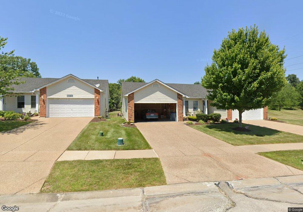
1646 Thurston Ct O Fallon, MO 63366
Estimated Value: $264,000 - $282,000
2
Beds
2
Baths
1,228
Sq Ft
$222/Sq Ft
Est. Value
About This Home
This home is located at 1646 Thurston Ct, O Fallon, MO 63366 and is currently estimated at $272,041, approximately $221 per square foot. 1646 Thurston Ct is a home located in St. Charles County with nearby schools including Westhoff Elementary School, Fort Zumwalt North Middle School, and Fort Zumwalt North High School.
Ownership History
Date
Name
Owned For
Owner Type
Purchase Details
Closed on
Sep 18, 2025
Sold by
Dressel Marcella A
Bought by
Marcella Dressel Living Trust and Dressel
Current Estimated Value
Purchase Details
Closed on
May 16, 2003
Sold by
Whittaker Builders Inc
Bought by
Dressel Marcella A
Home Financials for this Owner
Home Financials are based on the most recent Mortgage that was taken out on this home.
Original Mortgage
$115,000
Interest Rate
5.79%
Mortgage Type
Purchase Money Mortgage
Create a Home Valuation Report for This Property
The Home Valuation Report is an in-depth analysis detailing your home's value as well as a comparison with similar homes in the area
Home Values in the Area
Average Home Value in this Area
Purchase History
| Date | Buyer | Sale Price | Title Company |
|---|---|---|---|
| Marcella Dressel Living Trust | -- | None Listed On Document | |
| Dressel Marcella A | $143,772 | -- |
Source: Public Records
Mortgage History
| Date | Status | Borrower | Loan Amount |
|---|---|---|---|
| Previous Owner | Dressel Marcella A | $115,000 | |
| Closed | Dressel Marcella A | $14,000 |
Source: Public Records
Tax History
| Year | Tax Paid | Tax Assessment Tax Assessment Total Assessment is a certain percentage of the fair market value that is determined by local assessors to be the total taxable value of land and additions on the property. | Land | Improvement |
|---|---|---|---|---|
| 2025 | $2,917 | $47,036 | -- | -- |
| 2023 | $2,918 | $43,926 | $0 | $0 |
| 2022 | $2,520 | $35,239 | $0 | $0 |
| 2021 | $2,522 | $35,239 | $0 | $0 |
| 2020 | $2,325 | $31,491 | $0 | $0 |
| 2019 | $2,330 | $31,491 | $0 | $0 |
| 2018 | $2,212 | $28,537 | $0 | $0 |
| 2017 | $2,178 | $28,537 | $0 | $0 |
| 2016 | $1,884 | $24,574 | $0 | $0 |
| 2015 | $1,751 | $24,574 | $0 | $0 |
| 2014 | $1,893 | $26,136 | $0 | $0 |
Source: Public Records
Map
Nearby Homes
- 214 Maryland Dr Unit 26B
- 231 England Dr
- 34 Logan Crossing Cir
- 765 Koch Rd
- 487 Chatham Dr
- 3.59 Acres Matteson Blvd
- 7.19 Acres Matteson Blvd
- 3.6 Acres Matteson Blvd
- 1373 New Charter Ln
- 1358 Deerfield Estates Dr
- 1314 Woodgrove Park Dr
- 1110 Cypress Dr
- 730 Homerun Dr Unit 76N
- 1818 Sapling Dr
- 6 S Boxwood Ln
- 1102 Danielle Elizabeth Ct
- 634 Homerun Dr Unit 34N
- 632 Homerun Dr Unit 33N
- 2837 Grand Slam Dr
- 17 Homefield Gardens Dr
- 1644 Thurston Ct
- 1648 Thurston Ct
- 1650 Thurston Ct
- 1650 Thurston Ct Unit 42A
- 1652 Thurston Ct
- 1654 Thurston Ct
- 1638 Thurston Ct
- 1636 Thurston Ct
- 1656 Thurston Ct Unit 40B
- 1656 Thurston Ct
- 1658 Thurston Ct
- 1634 Thurston Ct
- 1660 Thurston Ct
- 1632 Thurston Ct
- 1662 Thurston Ct
- 229 Shinstock Ln
- 1630 Thurston Ct
- 1630 Thurston Ct Unit 46A
- 1628 Thurston Ct
- 1626 Thurston Ct
Your Personal Tour Guide
Ask me questions while you tour the home.