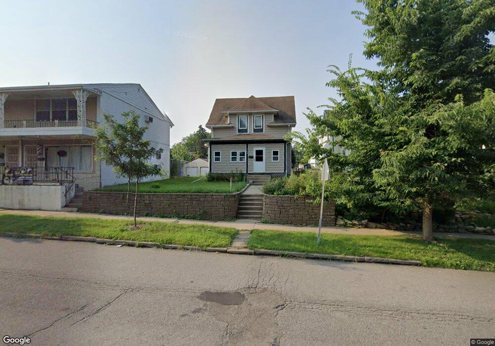
1704 7th St E Saint Paul, MN 55106
Hazel Park NeighborhoodEstimated Value: $246,000 - $279,000
3
Beds
2
Baths
1,248
Sq Ft
$208/Sq Ft
Est. Value
About This Home
This home is located at 1704 7th St E, Saint Paul, MN 55106 and is currently estimated at $259,648, approximately $208 per square foot. 1704 7th St E is a home located in Ramsey County with nearby schools including Hazel Park Preparatory Academy, Battle Creek Middle School, and Johnson Senior High School.
Ownership History
Date
Name
Owned For
Owner Type
Purchase Details
Closed on
Apr 24, 2020
Sold by
Yang Tong Pao and Yang Xo Lee
Bought by
Yang Tongson
Current Estimated Value
Purchase Details
Closed on
Mar 15, 2013
Sold by
Peters Sara Jean
Bought by
Yang Tongson
Home Financials for this Owner
Home Financials are based on the most recent Mortgage that was taken out on this home.
Original Mortgage
$5,000
Interest Rate
3.48%
Mortgage Type
Unknown
Purchase Details
Closed on
May 28, 1996
Sold by
Toye Jimmy L and Toye Arlie A
Bought by
Dixon Kenneth C and Dixon Renee L
Purchase Details
Closed on
Nov 3, 1994
Sold by
Toye Jimmy L and Toye A
Bought by
Dixon Kenneth C and Dixon Renee L
Create a Home Valuation Report for This Property
The Home Valuation Report is an in-depth analysis detailing your home's value as well as a comparison with similar homes in the area
Home Values in the Area
Average Home Value in this Area
Purchase History
| Date | Buyer | Sale Price | Title Company |
|---|---|---|---|
| Yang Tongson | -- | None Available | |
| Yang Tongson | $105,000 | Land Title Inc | |
| Dixon Kenneth C | $57,100 | -- | |
| Dixon Kenneth C | $57,170 | -- |
Source: Public Records
Mortgage History
| Date | Status | Borrower | Loan Amount |
|---|---|---|---|
| Closed | Yang Tongson | $5,000 | |
| Open | Yang Tongson | $103,098 | |
| Closed | Dixon Kenneth C | -- | |
| Closed | Dixon Kenneth C | $37,788 |
Source: Public Records
Tax History
| Year | Tax Paid | Tax Assessment Tax Assessment Total Assessment is a certain percentage of the fair market value that is determined by local assessors to be the total taxable value of land and additions on the property. | Land | Improvement |
|---|---|---|---|---|
| 2025 | $3,700 | $233,900 | $25,000 | $208,900 |
| 2023 | $3,700 | $240,800 | $20,000 | $220,800 |
| 2022 | $3,128 | $241,100 | $20,000 | $221,100 |
| 2021 | $2,656 | $196,400 | $20,000 | $176,400 |
| 2020 | $2,658 | $174,200 | $8,600 | $165,600 |
| 2019 | $2,434 | $174,200 | $8,600 | $165,600 |
| 2018 | $2,122 | $150,300 | $8,600 | $141,700 |
| 2017 | $1,874 | $143,800 | $8,600 | $135,200 |
| 2016 | $1,604 | $0 | $0 | $0 |
| 2015 | $1,358 | $117,400 | $8,600 | $108,800 |
| 2014 | $1,172 | $0 | $0 | $0 |
Source: Public Records
Map
Nearby Homes
- 1685 Bush Ave
- 1769 Ross Ave
- 1747 York Ave
- 935 Kennard St
- 1708 Minnehaha Ave E
- 1824 & 1822 Stillwater Ave E
- 1548 7th St E
- 1704 Beech St
- 1824 Sims Ave
- 1518 York Ave
- 597 Flandrau St
- 1862 Ames Ave
- 1836 Mechanic Ave
- 1497 Margaret St
- 1711 4th St E
- 1809 Mechanic Ave
- 1651 4th St E
- 861 Algonquin Ave
- 1093 Breen St
- 1879 Ames Ave
Your Personal Tour Guide
Ask me questions while you tour the home.