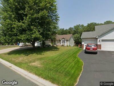
1847 Mooers Ave Shakopee, MN 55379
Estimated Value: $438,000 - $475,000
3
Beds
3
Baths
1,356
Sq Ft
$332/Sq Ft
Est. Value
About This Home
This home is located at 1847 Mooers Ave, Shakopee, MN 55379 and is currently estimated at $450,554, approximately $332 per square foot. 1847 Mooers Ave is a home located in Scott County with nearby schools including Sun Path Elementary School, Shakopee West Middle School, and Shakopee Senior High School.
Ownership History
Date
Name
Owned For
Owner Type
Purchase Details
Closed on
Jun 9, 2009
Sold by
Marin Cynthia A
Bought by
Bui Tri M
Current Estimated Value
Purchase Details
Closed on
Apr 2, 2007
Sold by
Oleson Brian L and Oleson Sarah H
Bought by
Marin Gary J and Marin Cynthia A
Home Financials for this Owner
Home Financials are based on the most recent Mortgage that was taken out on this home.
Original Mortgage
$250,000
Interest Rate
6.2%
Mortgage Type
New Conventional
Purchase Details
Closed on
May 18, 2001
Sold by
Us Home Corporation
Bought by
Oleson Brian L and Hagen Sarah L
Create a Home Valuation Report for This Property
The Home Valuation Report is an in-depth analysis detailing your home's value as well as a comparison with similar homes in the area
Home Values in the Area
Average Home Value in this Area
Purchase History
| Date | Buyer | Sale Price | Title Company |
|---|---|---|---|
| Bui Tri M | $243,000 | -- | |
| Marin Gary J | $315,000 | -- | |
| Oleson Brian L | $205,905 | -- |
Source: Public Records
Mortgage History
| Date | Status | Borrower | Loan Amount |
|---|---|---|---|
| Open | Bui Tri M | $214,000 | |
| Previous Owner | Marin Gary J | $250,000 | |
| Previous Owner | Hegen Sarah L | $75,000 |
Source: Public Records
Tax History Compared to Growth
Tax History
| Year | Tax Paid | Tax Assessment Tax Assessment Total Assessment is a certain percentage of the fair market value that is determined by local assessors to be the total taxable value of land and additions on the property. | Land | Improvement |
|---|---|---|---|---|
| 2025 | $4,166 | $409,300 | $156,600 | $252,700 |
| 2024 | $4,166 | $413,000 | $156,600 | $256,400 |
| 2023 | $4,434 | $390,200 | $143,300 | $246,900 |
| 2022 | $3,984 | $406,700 | $162,800 | $243,900 |
| 2021 | $3,344 | $319,100 | $128,100 | $191,000 |
| 2020 | $3,616 | $295,300 | $122,900 | $172,400 |
| 2019 | $3,544 | $281,600 | $109,200 | $172,400 |
| 2018 | $4,034 | $0 | $0 | $0 |
| 2016 | $3,666 | $0 | $0 | $0 |
| 2014 | -- | $0 | $0 | $0 |
Source: Public Records
Map
Nearby Homes
- 1815 Mooers Ave
- 1986 Mathias Rd
- 2179 Ponds Way
- 2052 Wilhelm Ct
- 1780 Quail Dr
- 2374 Thrush St
- 2330 Ponds Way
- 1874 Pintail Ave
- 1971 Evergreen Ln
- 2011 Downing Ave
- 2230 Downing Ave
- 1938 Ormond Dr
- 2550 Downing Ave
- 2127 Ormond Dr
- 2615 King Ave
- 1534 England Way
- 1542 England Way
- 2726 Green Ash Ave
- 2734 Green Ash Ave
- 2749 Green Ash Ave
- 1847 Mooers Ave
- 1831 Mooers Ave
- 1863 Mooers Ave
- 1879 Mooers Ave
- 1882 Groveland Way
- 1912 Groveland Way
- 1856 Mooers Ave
- 1924 Hazen St
- 1895 Mooers Ave
- 1862 Groveland Way
- 1872 Mooers Ave
- 1942 Groveland Way
- 1932 Hazen St
- 1842 Groveland Way
- 1911 Mooers Ave
- 1904 Mooers Ave
- 1935 Hazen St
- 1962 Groveland Way
- 1940 Hazen St
- 1901 Groveland Way