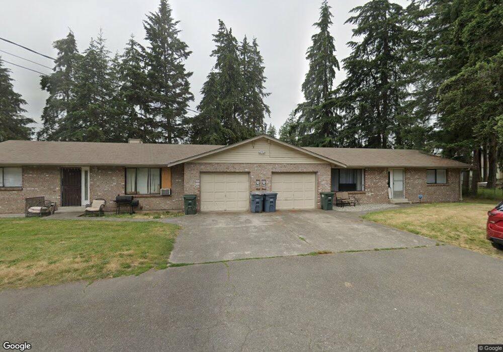
19108 5th Ave E Spanaway, WA 98387
Estimated Value: $572,000 - $663,000
4
Beds
3
Baths
2,266
Sq Ft
$265/Sq Ft
Est. Value
About This Home
This home is located at 19108 5th Ave E, Spanaway, WA 98387 and is currently estimated at $600,956, approximately $265 per square foot. 19108 5th Ave E is a home located in Pierce County with nearby schools including Camas Prairie Elementary School, Cedarcrest Junior High School, and Spanaway Lake High School.
Ownership History
Date
Name
Owned For
Owner Type
Purchase Details
Closed on
Jan 11, 1994
Sold by
Ching Raymond A and Ching Margaret S
Bought by
Lincoln Stephen Lee and Lincoln Ae Kyong
Current Estimated Value
Home Financials for this Owner
Home Financials are based on the most recent Mortgage that was taken out on this home.
Original Mortgage
$94,500
Interest Rate
7.21%
Create a Home Valuation Report for This Property
The Home Valuation Report is an in-depth analysis detailing your home's value as well as a comparison with similar homes in the area
Home Values in the Area
Average Home Value in this Area
Purchase History
| Date | Buyer | Sale Price | Title Company |
|---|---|---|---|
| Lincoln Stephen Lee | -- | -- |
Source: Public Records
Mortgage History
| Date | Status | Borrower | Loan Amount |
|---|---|---|---|
| Closed | Lincoln Stephen Lee | $94,500 |
Source: Public Records
Tax History
| Year | Tax Paid | Tax Assessment Tax Assessment Total Assessment is a certain percentage of the fair market value that is determined by local assessors to be the total taxable value of land and additions on the property. | Land | Improvement |
|---|---|---|---|---|
| 2025 | $6,236 | $584,000 | $202,600 | $381,400 |
| 2024 | $6,236 | $569,300 | $202,600 | $366,700 |
| 2023 | $6,236 | $536,600 | $208,400 | $328,200 |
| 2022 | $5,495 | $507,000 | $201,100 | $305,900 |
| 2021 | $5,368 | $381,300 | $125,600 | $255,700 |
| 2019 | $3,646 | $331,800 | $108,900 | $222,900 |
| 2018 | $4,058 | $297,100 | $98,000 | $199,100 |
| 2017 | $3,701 | $258,500 | $87,100 | $171,400 |
| 2016 | $3,505 | $218,900 | $74,300 | $144,600 |
| 2014 | $3,054 | $207,100 | $70,400 | $136,700 |
| 2013 | $3,054 | $187,100 | $60,800 | $126,300 |
Source: Public Records
Map
Nearby Homes
- 514 190th Street Ct E
- 511 190th St E
- 19215 6th Ave E
- 2 189th Street Ct E
- 140 191st Street Ct E
- 516 189th Street Ct E
- 1 8th Ave E
- 18618 8th Avenue Ct E
- Plan 2070 at Rolling Brook
- Plan 2330 Modeled at Rolling Brook
- Plan 1860 Modeled at Rolling Brook
- Plan 1630 at Rolling Brook
- Plan 1990 at Rolling Brook
- Plan 2755 at Rolling Brook
- Plan 2605 at Rolling Brook
- Plan 2230 at Rolling Brook
- Plan 1870 at Rolling Brook
- 458 185th Street Ct E Unit 24
- 604 185th Street Ct E Unit 28
- 18512 4th Avenue Ct E Unit 14
- 19116 5th Ave E
- 406 190th St E
- 19109 5th Ave E
- 204 191st Street Ct E
- 145 192nd Street Ct E
- 420 190th Street Ct E
- 145 192nd St E
- 502 190th Street Ct E
- 19117 5th Ave E
- 322 190th Street Ct E
- 510 190th Street Ct E
- 316 190th Street Ct E
- 19206 5th Ave E Unit A&B
- 19206 5th Ave E
- 19206 5th Ave E Unit s A & B
- 515 191st Street Ct E
- 507 190th Street Ct E
- 507 190th Street Ct E
- 316 190th Street Ct E
- 402A 192nd St E Unit 402B
Your Personal Tour Guide
Ask me questions while you tour the home.