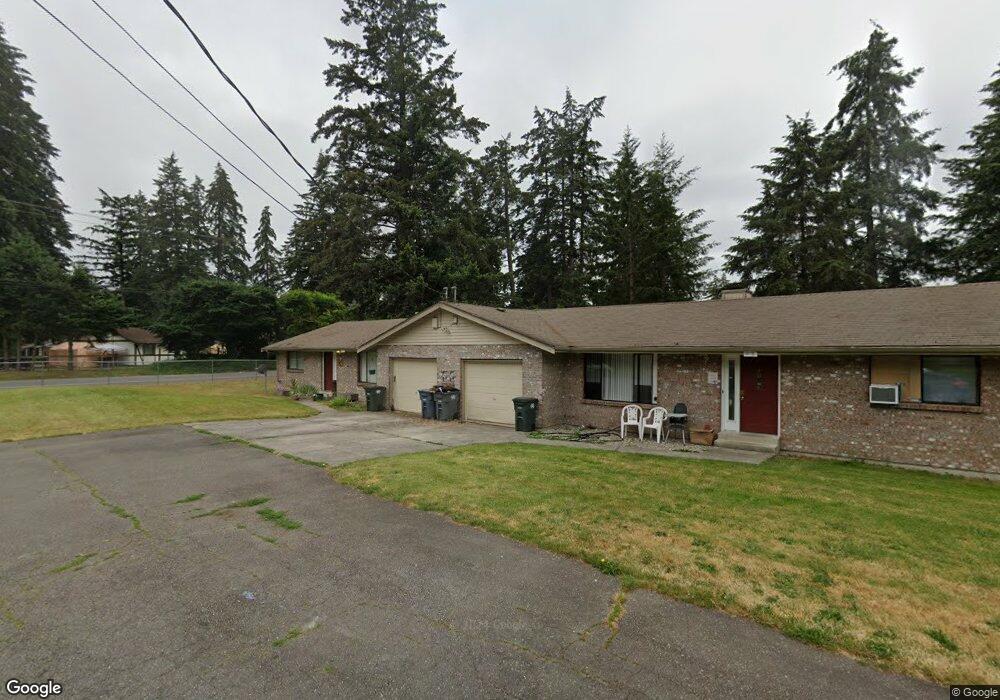
19116 5th Ave E Spanaway, WA 98387
Estimated Value: $556,000 - $636,000
4
Beds
3
Baths
2,266
Sq Ft
$260/Sq Ft
Est. Value
About This Home
This home is located at 19116 5th Ave E, Spanaway, WA 98387 and is currently estimated at $589,433, approximately $260 per square foot. 19116 5th Ave E is a home located in Pierce County with nearby schools including Camas Prairie Elementary School, Cedarcrest Junior High School, and Spanaway Lake High School.
Ownership History
Date
Name
Owned For
Owner Type
Purchase Details
Closed on
Jan 11, 1994
Sold by
Ching Raymond A and Ching Margaret S
Bought by
Lincoln Stephen Lee and Lincoln Ae Kyong
Current Estimated Value
Home Financials for this Owner
Home Financials are based on the most recent Mortgage that was taken out on this home.
Original Mortgage
$94,500
Interest Rate
7.21%
Create a Home Valuation Report for This Property
The Home Valuation Report is an in-depth analysis detailing your home's value as well as a comparison with similar homes in the area
Home Values in the Area
Average Home Value in this Area
Purchase History
| Date | Buyer | Sale Price | Title Company |
|---|---|---|---|
| Lincoln Stephen Lee | -- | -- |
Source: Public Records
Mortgage History
| Date | Status | Borrower | Loan Amount |
|---|---|---|---|
| Closed | Lincoln Stephen Lee | $94,500 |
Source: Public Records
Tax History
| Year | Tax Paid | Tax Assessment Tax Assessment Total Assessment is a certain percentage of the fair market value that is determined by local assessors to be the total taxable value of land and additions on the property. | Land | Improvement |
|---|---|---|---|---|
| 2025 | $6,266 | $586,700 | $205,300 | $381,400 |
| 2024 | $6,266 | $572,000 | $205,300 | $366,700 |
| 2023 | $6,266 | $539,400 | $211,200 | $328,200 |
| 2022 | $5,521 | $509,800 | $203,900 | $305,900 |
| 2021 | $5,392 | $383,200 | $127,500 | $255,700 |
| 2019 | $3,662 | $333,500 | $110,600 | $222,900 |
| 2018 | $4,078 | $298,600 | $99,500 | $199,100 |
| 2017 | $3,718 | $259,900 | $88,500 | $171,400 |
| 2016 | $3,524 | $220,100 | $75,500 | $144,600 |
| 2014 | $3,069 | $208,300 | $71,600 | $136,700 |
| 2013 | $3,069 | $188,100 | $61,800 | $126,300 |
Source: Public Records
Map
Nearby Homes
- 511 190th St E
- 2 189th Street Ct E
- 516 189th Street Ct E
- 1 8th Ave E
- 604 185th Street Ct E Unit 28
- 608 185th Street Ct E Unit 29
- 18512 4th Avenue Ct E Unit 14
- 612 185th Street Ct E Unit 30
- 18508 4th Avenue Ct E Unit 15
- 501 185th Street Ct E Unit 19
- 454 184th Street Ct E Unit 64
- 604 184th Street Ct E Unit 50
- 461 184th Street Ct E Unit 54
- 449 184th Street Ct E Unit 57
- 505 184th Street Ct E Unit 53
- 18439 7th Avenue Ct E Unit 37
- 509 184th Street Ct E Unit 52
- 605 184th Street Ct E Unit 49
- 611 184th Street Ct E Unit 48
- 703 184th Street Ct E Unit 47
- 19108 5th Ave E
- 204 191st Street Ct E
- 145 192nd St E
- 145 192nd Street Ct E
- 19206 5th Ave E Unit A&B
- 19206 5th Ave E
- 19206 5th Ave E Unit s A & B
- 19117 5th Ave E
- 19109 5th Ave E
- 402A 192nd St E Unit 402B
- 402 192nd St E
- 402 192nd St E Unit A & B
- 19201 5th Ave E
- 406 190th St E
- 502 190th Street Ct E
- 19220 5th Ave E Unit F&E
- 19220 5th Ave E Unit E&F
- 19220 5th Ave E
- 19220 5th Ave E Unit 1922
- 19220 5th Ave E Unit E & F
Your Personal Tour Guide
Ask me questions while you tour the home.