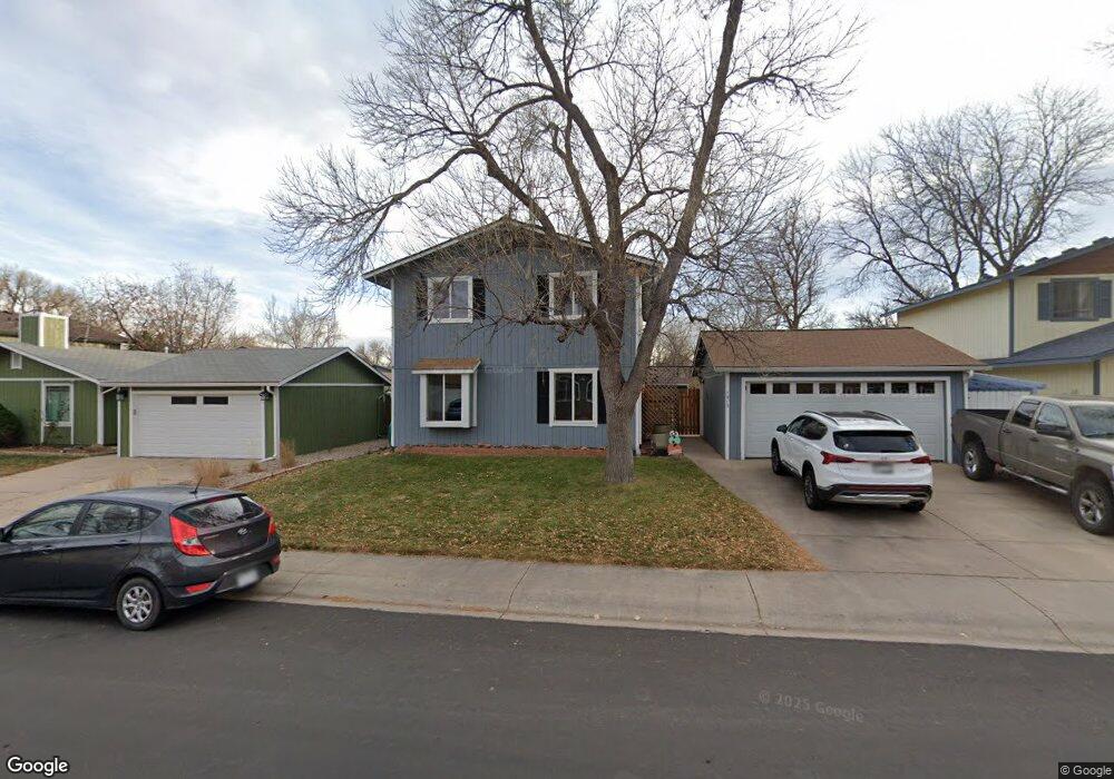
1913 Devonshire Dr Fort Collins, CO 80526
Estimated Value: $513,938 - $626,000
4
Beds
4
Baths
1,920
Sq Ft
$285/Sq Ft
Est. Value
About This Home
This home is located at 1913 Devonshire Dr, Fort Collins, CO 80526 and is currently estimated at $546,735, approximately $284 per square foot. 1913 Devonshire Dr is a home located in Larimer County with nearby schools including Johnson Elementary School, Webber Middle School, and Rocky Mountain High School.
Ownership History
Date
Name
Owned For
Owner Type
Purchase Details
Closed on
Jun 23, 2021
Sold by
Curtis Douglas G and Curtis Kathleen T
Bought by
Brooks Daniel P and Brooks Stephanie R
Current Estimated Value
Home Financials for this Owner
Home Financials are based on the most recent Mortgage that was taken out on this home.
Original Mortgage
$398,610
Outstanding Balance
$360,892
Interest Rate
2.9%
Mortgage Type
New Conventional
Estimated Equity
$185,843
Purchase Details
Closed on
Mar 11, 2002
Sold by
Curtis Byrd C
Bought by
Curtis Douglas G and Curtis Kathleen T
Home Financials for this Owner
Home Financials are based on the most recent Mortgage that was taken out on this home.
Original Mortgage
$130,000
Interest Rate
7.01%
Purchase Details
Closed on
Jul 1, 1995
Sold by
Orlowski Rhonda K
Bought by
Curtis Douglas G
Create a Home Valuation Report for This Property
The Home Valuation Report is an in-depth analysis detailing your home's value as well as a comparison with similar homes in the area
Purchase History
| Date | Buyer | Sale Price | Title Company |
|---|---|---|---|
| Brooks Daniel P | $442,900 | Fidelity National Title | |
| Curtis Douglas G | -- | -- | |
| Curtis Douglas G | $119,800 | -- |
Source: Public Records
Mortgage History
| Date | Status | Borrower | Loan Amount |
|---|---|---|---|
| Open | Brooks Daniel P | $398,610 | |
| Previous Owner | Curtis Douglas G | $130,000 |
Source: Public Records
Tax History
| Year | Tax Paid | Tax Assessment Tax Assessment Total Assessment is a certain percentage of the fair market value that is determined by local assessors to be the total taxable value of land and additions on the property. | Land | Improvement |
|---|---|---|---|---|
| 2025 | $3,006 | $33,019 | $2,500 | $30,519 |
| 2024 | $2,860 | $35,014 | $2,680 | $32,334 |
| 2022 | $2,438 | $25,819 | $2,780 | $23,039 |
| 2021 | $2,438 | $26,283 | $2,860 | $23,423 |
| 2020 | $2,681 | $28,657 | $2,860 | $25,797 |
| 2019 | $2,693 | $28,657 | $2,860 | $25,797 |
| 2018 | $2,002 | $21,967 | $2,880 | $19,087 |
| 2017 | $1,995 | $21,967 | $2,880 | $19,087 |
| 2016 | $1,711 | $18,746 | $3,184 | $15,562 |
| 2015 | $1,699 | $18,740 | $3,180 | $15,560 |
| 2014 | $1,464 | $16,050 | $3,180 | $12,870 |
Source: Public Records
Map
Nearby Homes
- 2260 Silver Oaks Dr
- 1927 Churchill Ct
- 1827 Churchill Ct
- 1618 Enfield St
- 1512 Casa Grande Blvd
- 3527 Big Ben Dr Unit F
- 1601 W Swallow Rd Unit 7B
- 1601 W Swallow Rd Unit 9B
- 3605 Royal Dr
- 3622 Capitol Dr
- 3525 Auntie Stone St Unit 16
- 3525 Auntie Stone St Unit 8
- 3717 S Taft Hill Rd Unit 279
- 3717 S Taft Hill Rd Unit 27
- 3717 S Taft Hill Rd Unit 119
- 3717 S Taft Hill Rd Unit 285
- 1514 Carmela Ct
- 1539 Ambrosia Ct
- 2114 Water Blossom Ln
- 2156 Water Blossom Ln
- 1907 Devonshire Dr
- 1919 Devonshire Dr
- 1918 Cheshire St
- 1924 Cheshire St
- 2001 Devonshire Dr
- 1912 Cheshire St
- 1901 Devonshire Dr
- 2000 Cheshire St
- 1912 Devonshire Dr
- 1918 Devonshire Dr
- 1900 Cheshire St
- 2007 Devonshire Dr
- 2006 Cheshire St
- 2000 Devonshire Dr
- 1900 Devonshire Dr
- 2006 Devonshire Dr
- 2013 Devonshire Dr
- 2012 Cheshire St
- 1919 Cheshire St
- 1925 Cheshire St
Your Personal Tour Guide
Ask me questions while you tour the home.