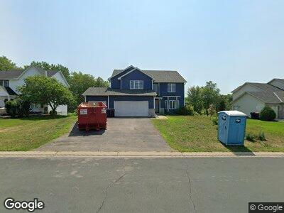
1942 Mathias Rd Shakopee, MN 55379
Estimated Value: $513,000 - $616,000
6
Beds
4
Baths
3,775
Sq Ft
$151/Sq Ft
Est. Value
About This Home
This home is located at 1942 Mathias Rd, Shakopee, MN 55379 and is currently estimated at $571,551, approximately $151 per square foot. 1942 Mathias Rd is a home located in Scott County with nearby schools including Sun Path Elementary School, Shakopee West Middle School, and Shakopee Senior High School.
Ownership History
Date
Name
Owned For
Owner Type
Purchase Details
Closed on
Sep 28, 2020
Sold by
Tan Xieu T and Tan Linh Le
Bought by
Ahmed Farid and Bhuiyan Rekha
Current Estimated Value
Home Financials for this Owner
Home Financials are based on the most recent Mortgage that was taken out on this home.
Original Mortgage
$312,000
Outstanding Balance
$279,529
Interest Rate
2.8%
Mortgage Type
New Conventional
Estimated Equity
$292,022
Purchase Details
Closed on
Jun 21, 2001
Sold by
Us Home Corp
Bought by
Tan Xieu T and Tan Linh Le
Create a Home Valuation Report for This Property
The Home Valuation Report is an in-depth analysis detailing your home's value as well as a comparison with similar homes in the area
Home Values in the Area
Average Home Value in this Area
Purchase History
| Date | Buyer | Sale Price | Title Company |
|---|---|---|---|
| Ahmed Farid | $390,000 | Edina Realty Title Inc | |
| Tan Xieu T | $279,070 | -- |
Source: Public Records
Mortgage History
| Date | Status | Borrower | Loan Amount |
|---|---|---|---|
| Open | Ahmed Farid | $312,000 |
Source: Public Records
Tax History Compared to Growth
Tax History
| Year | Tax Paid | Tax Assessment Tax Assessment Total Assessment is a certain percentage of the fair market value that is determined by local assessors to be the total taxable value of land and additions on the property. | Land | Improvement |
|---|---|---|---|---|
| 2025 | $5,458 | $614,600 | $149,600 | $465,000 |
| 2024 | $5,458 | $621,000 | $149,600 | $471,400 |
| 2023 | $5,778 | $508,100 | $152,800 | $355,300 |
| 2022 | $5,290 | $524,700 | $173,600 | $351,100 |
| 2021 | $4,478 | $415,100 | $134,500 | $280,600 |
| 2020 | $4,904 | $385,100 | $129,000 | $256,100 |
| 2019 | $4,892 | $370,900 | $114,700 | $256,200 |
| 2018 | $5,286 | $0 | $0 | $0 |
| 2016 | $2,578 | $0 | $0 | $0 |
| 2014 | -- | $0 | $0 | $0 |
Source: Public Records
Map
Nearby Homes
- 1986 Mathias Rd
- 1815 Mooers Ave
- 2179 Ponds Way
- 1780 Quail Dr
- 2052 Wilhelm Ct
- 2374 Thrush St
- 2330 Ponds Way
- 1874 Pintail Ave
- 1938 Ormond Dr
- 2011 Downing Ave
- 2230 Downing Ave
- 1971 Evergreen Ln
- 2550 Downing Ave
- 2615 King Ave
- 2127 Ormond Dr
- 1534 England Way
- 1542 England Way
- 2940 Tiflawn Ct
- 2726 Green Ash Ave
- 2734 Green Ash Ave
- 1942 Mathias Rd
- 1964 Mathias Rd
- 1920 Mathias Rd
- 1898 Mathias Rd
- 2035 Ponds Way
- 2051 Ponds Way
- 1933 Mathias Rd
- 1876 Mathias Rd
- 2019 Ponds Way
- 2008 Mathias Rd
- 1918 Mooers Ave
- 1955 Mathias Rd
- 2067 Ponds Way
- 1977 Mathias Rd
- 1854 Mathias Rd
- 2030 Mathias Rd
- 1911 Mooers Ave
- 1904 Mooers Ave
- 1889 Mathias Rd
- 2003 Ponds Way