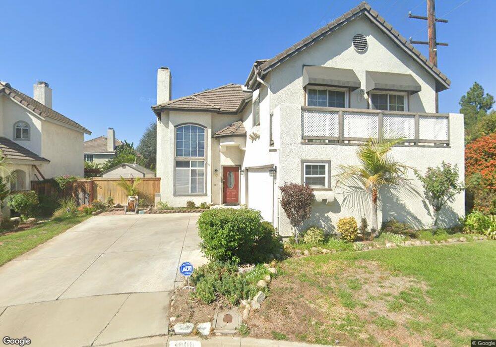
1999 Briar Path Trail Upland, CA 91784
Estimated Value: $786,752 - $940,000
4
Beds
3
Baths
1,951
Sq Ft
$450/Sq Ft
Est. Value
About This Home
This home is located at 1999 Briar Path Trail, Upland, CA 91784 and is currently estimated at $877,438, approximately $449 per square foot. 1999 Briar Path Trail is a home located in San Bernardino County with nearby schools including Pepper Tree Elementary, Pioneer Junior High School, and Upland High School.
Ownership History
Date
Name
Owned For
Owner Type
Purchase Details
Closed on
Jan 11, 2013
Sold by
Hong Ngai
Bought by
Zhou Guang Neng
Current Estimated Value
Purchase Details
Closed on
Jan 9, 2013
Sold by
Reza Melissa and Reza Anna Marie
Bought by
Zhou Guang Neng
Purchase Details
Closed on
Aug 9, 2006
Sold by
Marchese Joseph L and Marchese Barbara W
Bought by
Reza Melissa and Reza Javier
Home Financials for this Owner
Home Financials are based on the most recent Mortgage that was taken out on this home.
Original Mortgage
$436,000
Interest Rate
6.25%
Mortgage Type
Purchase Money Mortgage
Create a Home Valuation Report for This Property
The Home Valuation Report is an in-depth analysis detailing your home's value as well as a comparison with similar homes in the area
Home Values in the Area
Average Home Value in this Area
Purchase History
| Date | Buyer | Sale Price | Title Company |
|---|---|---|---|
| Zhou Guang Neng | -- | First American Title Co | |
| Zhou Guang Neng | $350,000 | First American Title Co | |
| Reza Melissa | $545,000 | Fidelity National Title Co |
Source: Public Records
Mortgage History
| Date | Status | Borrower | Loan Amount |
|---|---|---|---|
| Previous Owner | Reza Melissa | $436,000 |
Source: Public Records
Tax History
| Year | Tax Paid | Tax Assessment Tax Assessment Total Assessment is a certain percentage of the fair market value that is determined by local assessors to be the total taxable value of land and additions on the property. | Land | Improvement |
|---|---|---|---|---|
| 2025 | $4,756 | $430,937 | $150,828 | $280,109 |
| 2024 | $4,604 | $422,488 | $147,871 | $274,617 |
| 2023 | $4,533 | $414,204 | $144,972 | $269,232 |
| 2022 | $4,433 | $406,082 | $142,129 | $263,953 |
| 2021 | $4,426 | $398,119 | $139,342 | $258,777 |
| 2020 | $4,305 | $394,037 | $137,913 | $256,124 |
| 2019 | $4,290 | $386,311 | $135,209 | $251,102 |
| 2018 | $4,184 | $378,736 | $132,558 | $246,178 |
| 2017 | $4,063 | $371,310 | $129,959 | $241,351 |
| 2016 | $3,854 | $364,030 | $127,411 | $236,619 |
| 2015 | $3,765 | $358,562 | $125,497 | $233,065 |
| 2014 | $3,667 | $351,539 | $123,039 | $228,500 |
Source: Public Records
Map
Nearby Homes
- 2048 Birkdale Ave
- 1214 Miller Ct
- 1830 Wilson Ave
- 2166 Malati Cir
- 1063 W 19th St
- 1798 Wilson Ave
- 2193 Lorraine Dr
- 959 Kenwood St
- 1140 W 22nd St
- 1224 Fairway Cir
- 907 Pineridge St
- 1254 Tamarisk Cir
- 2257 Poppy Ave
- 1904 Belmar Way
- 2061 N Albright Ave
- 1279 Moss St
- 1693 N Mountain Ave Unit D
- 1691 N Mountain Ave
- 1672 Carmel Cir W
- 1239 Mallorca St
- 1999 Briar Trail
- 1995 Briar Trail
- 1995 Briar Path Trail
- 1998 Shady Brook Way
- 1991 Briar Path Trail
- 1994 Shady Brook Way
- 1372 Willowbrook Ln
- 1366 Willowbrook Ln
- 1378 Willowbrook Ln
- 1358 Willowbrook Ln
- 1990 Shady Brook Way
- 1998 Briar Path Trail
- 1985 Briar Trail
- 1985 Briar Path Trail
- 1994 Briar Path Trail
- 1386 Willowbrook Ln
- 1990 Briar Path Trail
- 1984 Shady Brook Way
- 1350 Willowbrook Ln
- 1394 Willowbrook Ln
Your Personal Tour Guide
Ask me questions while you tour the home.