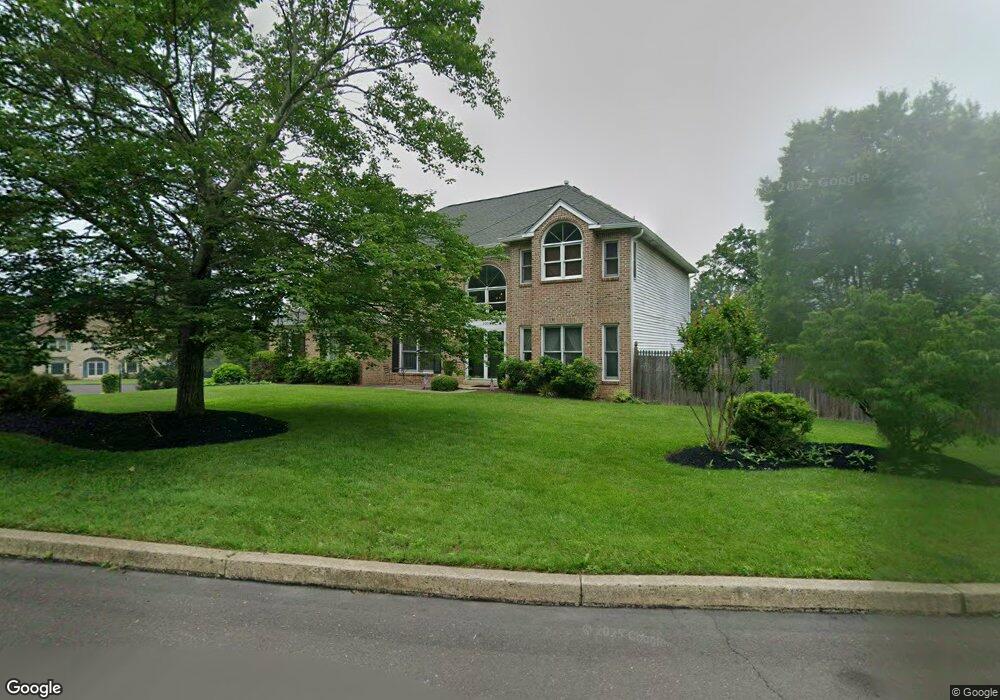
2001 Par Dr Doylestown, PA 18901
Estimated Value: $817,487 - $872,000
4
Beds
3
Baths
3,150
Sq Ft
$267/Sq Ft
Est. Value
About This Home
This home is located at 2001 Par Dr, Doylestown, PA 18901 and is currently estimated at $841,372, approximately $267 per square foot. 2001 Par Dr is a home located in Bucks County with nearby schools including Jamison Elementary School, Tamanend Middle School, and Central Bucks High School - South.
Ownership History
Date
Name
Owned For
Owner Type
Purchase Details
Closed on
Apr 22, 2004
Sold by
Cendant Mobility Financial Corp
Bought by
Rumsey William J and Rumsey Venetia
Current Estimated Value
Home Financials for this Owner
Home Financials are based on the most recent Mortgage that was taken out on this home.
Original Mortgage
$333,700
Outstanding Balance
$154,072
Interest Rate
5.39%
Mortgage Type
Purchase Money Mortgage
Estimated Equity
$687,300
Purchase Details
Closed on
Jan 12, 2004
Sold by
Christman Mark R and Christman Kristin L
Bought by
Cendant Mobility Financial Corp
Purchase Details
Closed on
Oct 30, 1997
Sold by
Fox Tony and Fox Margaret
Bought by
Christman Mark R and Christman Kristin L
Home Financials for this Owner
Home Financials are based on the most recent Mortgage that was taken out on this home.
Original Mortgage
$180,000
Interest Rate
7.28%
Create a Home Valuation Report for This Property
The Home Valuation Report is an in-depth analysis detailing your home's value as well as a comparison with similar homes in the area
Home Values in the Area
Average Home Value in this Area
Purchase History
| Date | Buyer | Sale Price | Title Company |
|---|---|---|---|
| Rumsey William J | $445,000 | -- | |
| Cendant Mobility Financial Corp | $445,000 | -- | |
| Christman Mark R | $243,500 | First American Title Ins Co |
Source: Public Records
Mortgage History
| Date | Status | Borrower | Loan Amount |
|---|---|---|---|
| Open | Rumsey William J | $333,700 | |
| Previous Owner | Christman Mark R | $180,000 | |
| Closed | Rumsey William J | $60,000 |
Source: Public Records
Tax History Compared to Growth
Tax History
| Year | Tax Paid | Tax Assessment Tax Assessment Total Assessment is a certain percentage of the fair market value that is determined by local assessors to be the total taxable value of land and additions on the property. | Land | Improvement |
|---|---|---|---|---|
| 2025 | $8,593 | $48,560 | $11,240 | $37,320 |
| 2024 | $8,593 | $48,560 | $11,240 | $37,320 |
| 2023 | $8,194 | $48,560 | $11,240 | $37,320 |
| 2022 | $8,103 | $48,560 | $11,240 | $37,320 |
| 2021 | $7,936 | $48,560 | $11,240 | $37,320 |
| 2020 | $7,900 | $48,560 | $11,240 | $37,320 |
| 2019 | $7,815 | $48,560 | $11,240 | $37,320 |
| 2018 | $7,790 | $48,560 | $11,240 | $37,320 |
| 2017 | $7,730 | $48,560 | $11,240 | $37,320 |
| 2016 | $7,681 | $48,560 | $11,240 | $37,320 |
| 2015 | -- | $48,560 | $11,240 | $37,320 |
| 2014 | -- | $48,560 | $11,240 | $37,320 |
Source: Public Records
Map
Nearby Homes
- 2018 Buckingham Dr
- 2158 Green Ridge Dr
- 125 Edison Furlong Rd
- 45 Bedford Ave
- 1 Squirrel Rd
- 150 Edison Furlong Rd
- 1249 Pebble Hill Rd
- 1917 Brook Ln
- 100 Ginko St Unit 303
- 1877 Brook Ln
- 2226 Orchard Hill Cir
- 100 Fiddleleaf Ln Unit 104
- 1834 Augusta Dr
- 100 Claret Ct Unit 102
- 9 Cornerstone Ct Unit 4105
- 200 Beech Blvd Unit 301
- 2807 Mountain Laurel Dr
- 2046 Elm Ave
- 110 Zircon Ct Unit 14
- 137 Pebble Woods Dri Pebble Woods Dr