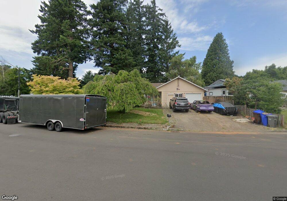
2015 NE Roberts Ave Gresham, OR 97030
North Central NeighborhoodEstimated Value: $419,000 - $442,000
3
Beds
2
Baths
1,296
Sq Ft
$334/Sq Ft
Est. Value
About This Home
This home is located at 2015 NE Roberts Ave, Gresham, OR 97030 and is currently estimated at $432,528, approximately $333 per square foot. 2015 NE Roberts Ave is a home located in Multnomah County with nearby schools including Highland Elementary School, Clear Creek Middle School, and Gresham High School.
Ownership History
Date
Name
Owned For
Owner Type
Purchase Details
Closed on
Oct 12, 2006
Sold by
Knight Roberta J
Bought by
Not Provided
Current Estimated Value
Home Financials for this Owner
Home Financials are based on the most recent Mortgage that was taken out on this home.
Original Mortgage
$231,500
Outstanding Balance
$143,364
Interest Rate
7.25%
Mortgage Type
Adjustable Rate Mortgage/ARM
Estimated Equity
$289,164
Purchase Details
Closed on
Apr 30, 2001
Sold by
Knight William W
Bought by
Knight Roberta Joan
Create a Home Valuation Report for This Property
The Home Valuation Report is an in-depth analysis detailing your home's value as well as a comparison with similar homes in the area
Home Values in the Area
Average Home Value in this Area
Purchase History
We collect this data history from publicly available records. To have your information removed, we recommend requesting removal directly through your county’s website.
| Date | Buyer | Sale Price | Title Company |
|---|---|---|---|
| Not Provided | $231,500 | Multiple | |
| Knight Roberta Joan | -- | -- |
Source: Public Records
Mortgage History
We collect this data history from publicly available records. To have your information removed, we recommend requesting removal directly through your county’s website.
| Date | Status | Borrower | Loan Amount |
|---|---|---|---|
| Open | Not Provided | $231,500 |
Source: Public Records
Tax History
| Year | Tax Paid | Tax Assessment Tax Assessment Total Assessment is a certain percentage of the fair market value that is determined by local assessors to be the total taxable value of land and additions on the property. | Land | Improvement |
|---|---|---|---|---|
| 2025 | $4,299 | $211,240 | -- | -- |
| 2024 | $4,115 | $205,090 | -- | -- |
| 2023 | $3,749 | $199,120 | $0 | $0 |
| 2022 | $3,644 | $193,330 | $0 | $0 |
| 2021 | $3,553 | $187,700 | $0 | $0 |
| 2020 | $3,343 | $182,240 | $0 | $0 |
| 2019 | $3,255 | $176,940 | $0 | $0 |
| 2018 | $3,104 | $171,790 | $0 | $0 |
| 2017 | $2,978 | $166,790 | $0 | $0 |
| 2016 | $2,626 | $161,940 | $0 | $0 |
| 2015 | $2,569 | $157,230 | $0 | $0 |
| 2014 | $2,507 | $152,660 | $0 | $0 |
Source: Public Records
Map
Nearby Homes
- 450 NE 22nd St
- 1783 1791 NE Beech Place
- 535 NE 24th St
- 1035 SE 225th Ave
- 1675 NE Juniper Ave
- 105 NW 13th St
- 1304 NW Victoria Ave
- 815 NE 25th St
- 2750 NE Elliott Ave
- 1546 NE Cleveland Ave Unit 1568
- 812 NE 28th St
- 892 NE 28th St
- 835 N Main Ave
- 824 NW Mignonette Ave
- 1926 NE Vista Ave
- 830 NW Council Dr
- 1773 NE 19th St
- 1830 NE Hogan Dr Unit 83
- 22043 SE Oak St
- 0 NE 5th St
- 1960 NE Roberts Ave
- 1940 NE Roberts Ave
- 2000 NE Roberts Ave
- 1915 NE Hood Ct
- 2005 NE Hood Ct
- 235 NE 19th St
- 1920 NE Roberts Ave
- 215 NE 19th St
- 1905 NE Hood Ct
- 2015 NE Hood Ct
- 135 NE 19th St
- 2025 NE Roberts Ave
- 1910 NE Roberts Ave
- 1910 NE Hood Ct
- 2013 NE Roberts Ct
- 115 NE 19th St
- 2060 NE Roberts Ave
- 2045 NE Roberts Av-Not Busy
- 840 NW Relisted With Nwre
- 1547 NE Palomatriple Garage
Your Personal Tour Guide
Ask me questions while you tour the home.