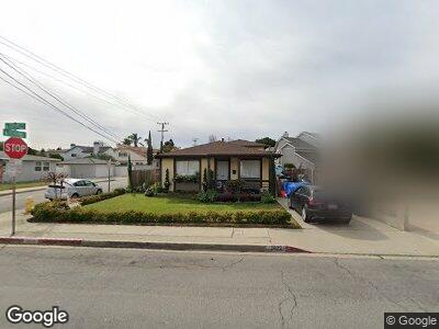
2022 Dufour Ave Redondo Beach, CA 90278
North Redondo Beach NeighborhoodEstimated Value: $1,514,000 - $2,200,529
5
Beds
4
Baths
2,376
Sq Ft
$792/Sq Ft
Est. Value
About This Home
This home is located at 2022 Dufour Ave, Redondo Beach, CA 90278 and is currently estimated at $1,881,632, approximately $791 per square foot. 2022 Dufour Ave is a home located in Los Angeles County with nearby schools including Lincoln Elementary School, Adams Middle School, and Redondo Union High School.
Ownership History
Date
Name
Owned For
Owner Type
Purchase Details
Closed on
Mar 26, 2012
Sold by
Ehrlich Scott G
Bought by
Ehrlich Scott G
Current Estimated Value
Home Financials for this Owner
Home Financials are based on the most recent Mortgage that was taken out on this home.
Original Mortgage
$507,400
Interest Rate
3.91%
Mortgage Type
New Conventional
Purchase Details
Closed on
Feb 20, 2003
Sold by
Mickaelian Steven G
Bought by
Ehrlich Scott G
Home Financials for this Owner
Home Financials are based on the most recent Mortgage that was taken out on this home.
Original Mortgage
$548,000
Interest Rate
5.82%
Create a Home Valuation Report for This Property
The Home Valuation Report is an in-depth analysis detailing your home's value as well as a comparison with similar homes in the area
Home Values in the Area
Average Home Value in this Area
Purchase History
| Date | Buyer | Sale Price | Title Company |
|---|---|---|---|
| Ehrlich Scott G | -- | Lsi | |
| Ehrlich Scott G | $685,000 | Landamerica Lawyers Title |
Source: Public Records
Mortgage History
| Date | Status | Borrower | Loan Amount |
|---|---|---|---|
| Open | Ehrlich Scott G | $506,500 | |
| Closed | Ehrlich Scott G | $507,400 | |
| Closed | Ehrlich Scott G | $548,000 | |
| Previous Owner | Mickaelian Steven G | $115,000 | |
| Previous Owner | Mickaelian Steven G | $103,000 |
Source: Public Records
Tax History Compared to Growth
Tax History
| Year | Tax Paid | Tax Assessment Tax Assessment Total Assessment is a certain percentage of the fair market value that is determined by local assessors to be the total taxable value of land and additions on the property. | Land | Improvement |
|---|---|---|---|---|
| 2024 | $12,386 | $972,640 | $441,591 | $531,049 |
| 2023 | $12,170 | $953,570 | $432,933 | $520,637 |
| 2022 | $11,926 | $934,874 | $424,445 | $510,429 |
| 2021 | $11,591 | $916,544 | $416,123 | $500,421 |
| 2020 | $11,558 | $907,147 | $411,857 | $495,290 |
| 2019 | $11,289 | $889,361 | $403,782 | $485,579 |
| 2018 | $10,895 | $871,923 | $395,865 | $476,058 |
| 2016 | $10,541 | $838,067 | $380,494 | $457,573 |
| 2015 | $10,357 | $825,479 | $374,779 | $450,700 |
| 2014 | $10,209 | $809,310 | $367,438 | $441,872 |
Source: Public Records
Map
Nearby Homes
- 2018 Bataan Rd Unit A
- 2109 Warfield Ave
- 3202 Green Ln
- 1907 Ernest Ave Unit B
- 2221 Dufour Ave Unit B
- 1827 9th St
- 1820 9th St
- 1852 6th St
- 2929 Green Ln
- 1818 12th St
- 1304 Harkness St
- 2409 Spurgeon Ave
- 2020 Graham Ave
- 1707 10th St
- 2700 Aviation Blvd
- 2205 Gates Ave Unit A
- 2021 Curtis Ave
- 1922 Gates Ave Unit A
- 1643 3rd St
- 2100 Wendy Way
- 2022 Dufour Ave
- 2020 Dufour Ave Unit 2
- 2020 Dufour Ave Unit 1
- 2100 Dufour Ave
- 2018 Dufour Ave
- 3305 Blossom Ln
- 2102 Dufour Ave
- 2016 Dufour Ave Unit B
- 2016 Dufour Ave Unit A
- 3304 Blossom Ln Unit 2
- 2101 Bataan Rd
- 2025 Bataan Rd
- 2023 Bataan Rd
- 2104 Dufour Ave
- 2023 Dufour Ave
- 2019 Dufour Ave
- 2014 Dufour Ave
- 2014 Dufour Ave Unit B
- 2021 Dufour Ave Unit B
- 2021 Dufour Ave Unit E