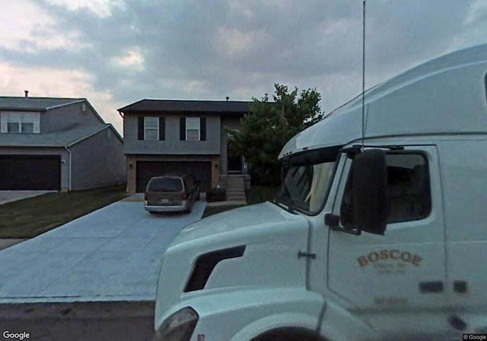
2959 Hinsel Dr Columbus, OH 43232
Walnut Heights NeighborhoodEstimated Value: $253,774 - $290,000
3
Beds
3
Baths
1,616
Sq Ft
$167/Sq Ft
Est. Value
About This Home
This home is located at 2959 Hinsel Dr, Columbus, OH 43232 and is currently estimated at $269,944, approximately $167 per square foot. 2959 Hinsel Dr is a home located in Franklin County with nearby schools including Liberty Elementary School, Yorktown Middle School, and Independence High School.
Ownership History
Date
Name
Owned For
Owner Type
Purchase Details
Closed on
Nov 16, 2005
Sold by
Moorehead Debra J
Bought by
Harris Anthony
Current Estimated Value
Home Financials for this Owner
Home Financials are based on the most recent Mortgage that was taken out on this home.
Original Mortgage
$107,573
Outstanding Balance
$58,671
Interest Rate
6.36%
Mortgage Type
Fannie Mae Freddie Mac
Estimated Equity
$211,273
Purchase Details
Closed on
May 21, 1996
Sold by
Crossmann Communities Of
Bought by
Debra J Moorehead
Home Financials for this Owner
Home Financials are based on the most recent Mortgage that was taken out on this home.
Original Mortgage
$102,546
Interest Rate
7.86%
Mortgage Type
FHA
Create a Home Valuation Report for This Property
The Home Valuation Report is an in-depth analysis detailing your home's value as well as a comparison with similar homes in the area
Home Values in the Area
Average Home Value in this Area
Purchase History
| Date | Buyer | Sale Price | Title Company |
|---|---|---|---|
| Harris Anthony | $110,900 | Supreme Ti | |
| Debra J Moorehead | $103,680 | -- |
Source: Public Records
Mortgage History
| Date | Status | Borrower | Loan Amount |
|---|---|---|---|
| Open | Harris Anthony | $107,573 | |
| Previous Owner | Debra J Moorehead | $102,546 |
Source: Public Records
Tax History
| Year | Tax Paid | Tax Assessment Tax Assessment Total Assessment is a certain percentage of the fair market value that is determined by local assessors to be the total taxable value of land and additions on the property. | Land | Improvement |
|---|---|---|---|---|
| 2025 | $3,230 | $71,970 | $16,980 | $54,990 |
| 2024 | $3,230 | $71,970 | $16,980 | $54,990 |
| 2023 | $3,189 | $71,960 | $16,975 | $54,985 |
| 2022 | $2,140 | $41,270 | $5,250 | $36,020 |
| 2021 | $2,144 | $41,270 | $5,250 | $36,020 |
| 2020 | $2,147 | $41,270 | $5,250 | $36,020 |
| 2019 | $2,092 | $34,480 | $4,380 | $30,100 |
| 2018 | $1,932 | $34,480 | $4,380 | $30,100 |
| 2017 | $2,090 | $34,480 | $4,380 | $30,100 |
| 2016 | $1,957 | $29,540 | $5,740 | $23,800 |
| 2015 | $1,776 | $29,540 | $5,740 | $23,800 |
| 2014 | $1,781 | $29,540 | $5,740 | $23,800 |
| 2013 | $975 | $32,795 | $6,370 | $26,425 |
Source: Public Records
Map
Nearby Homes
- 3057 Lamptonridge Dr
- 5946 Abernathy Ln
- 5944 Abernathy Ln
- 5962 Abernathy Ln
- 5960 Abernathy Ln
- 5970 Abernathy Ln
- 5976 Abernathy Ln
- 5968 Abernathy Ln
- 5882 Abernathy Ln Unit 5882F
- 2744 Barrows Rd
- 2736 Barrows Rd
- 3304 Joshstock Dr
- 2730 Raphael Dr
- 2700 Raphael Dr
- 6518 Centennial Dr
- 5326 Adderley Ave
- 5691 Matuka Dr
- 6288 Fence Row Ln
- 5414 Paladim Rd
- 2832 Liberty Bell Ln
- 2951 Hinsel Dr
- 2967 Hinsel Dr
- 2975 Hinsel Dr
- 2954 Sand Dollar Dr
- 2962 Sand Dollar Dr
- 6077 Leafridge Ln
- 2946 Sand Dollar Dr
- 2970 Sand Dollar Dr
- 2983 Hinsel Dr
- 2964 Hinsel Dr
- 2938 Sand Dollar Dr
- 2956 Hinsel Dr
- 2978 Sand Dollar Dr
- 2972 Hinsel Dr
- 2948 Hinsel Dr
- 2991 Hinsel Dr
- 2980 Hinsel Dr
- 2986 Sand Dollar Dr
- 2930 Sand Dollar Dr
- 2940 Hinsel Dr
Your Personal Tour Guide
Ask me questions while you tour the home.