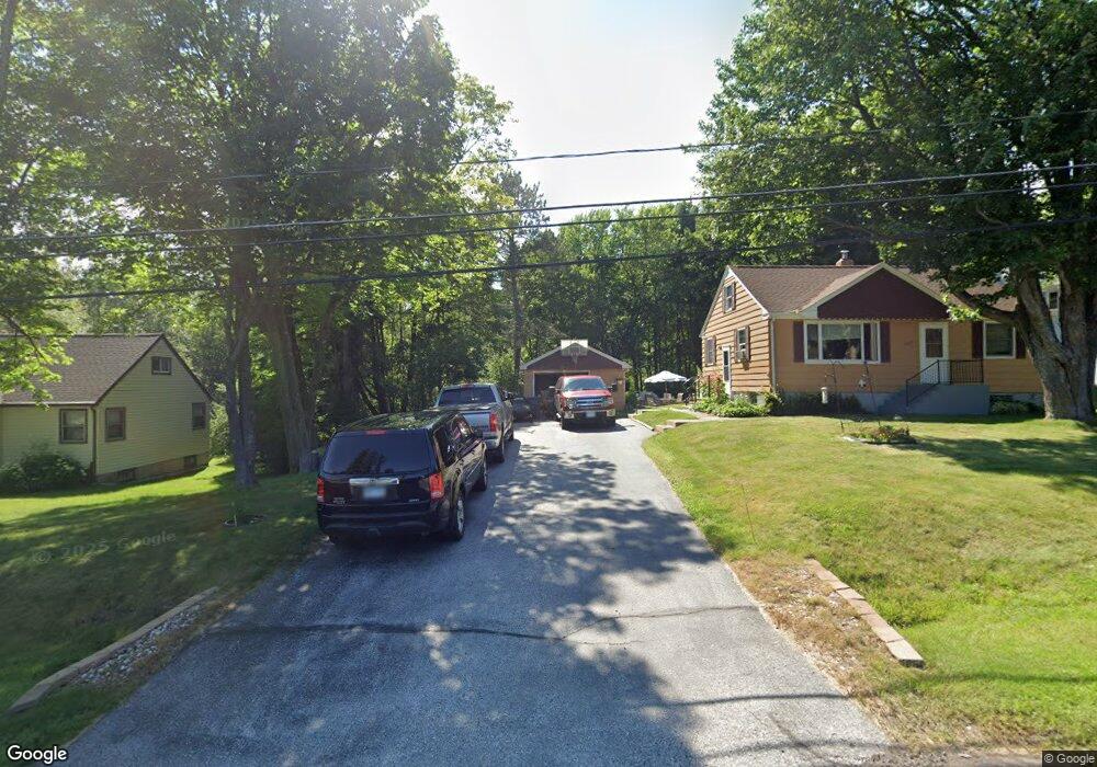
3027 N Blackman Ave Duluth, MN 55811
Kenwood NeighborhoodEstimated Value: $271,796 - $320,000
4
Beds
2
Baths
1,040
Sq Ft
$283/Sq Ft
Est. Value
About This Home
This home is located at 3027 N Blackman Ave, Duluth, MN 55811 and is currently estimated at $293,949, approximately $282 per square foot. 3027 N Blackman Ave is a home located in St. Louis County with nearby schools including Lowell Elementary School, Lincoln Park Middle School, and Denfeld High School.
Ownership History
Date
Name
Owned For
Owner Type
Purchase Details
Closed on
Oct 1, 2015
Sold by
Bolf Frederick A and Bolf Wanda L
Bought by
Roragen Brian R and Roragen Karen D
Current Estimated Value
Home Financials for this Owner
Home Financials are based on the most recent Mortgage that was taken out on this home.
Original Mortgage
$165,000
Outstanding Balance
$129,644
Interest Rate
3.84%
Mortgage Type
VA
Estimated Equity
$164,305
Purchase Details
Closed on
Sep 11, 2012
Sold by
Berg Mark R and Berg Annette L
Bought by
Berg Mark R and Berg Annette L
Create a Home Valuation Report for This Property
The Home Valuation Report is an in-depth analysis detailing your home's value as well as a comparison with similar homes in the area
Home Values in the Area
Average Home Value in this Area
Purchase History
| Date | Buyer | Sale Price | Title Company |
|---|---|---|---|
| Roragen Brian R | $165,000 | Stewart Title Company | |
| Berg Mark R | -- | None Available |
Source: Public Records
Mortgage History
| Date | Status | Borrower | Loan Amount |
|---|---|---|---|
| Open | Roragen Brian R | $165,000 |
Source: Public Records
Tax History Compared to Growth
Tax History
| Year | Tax Paid | Tax Assessment Tax Assessment Total Assessment is a certain percentage of the fair market value that is determined by local assessors to be the total taxable value of land and additions on the property. | Land | Improvement |
|---|---|---|---|---|
| 2023 | $2,128 | $207,800 | $67,000 | $140,800 |
| 2022 | $1,884 | $193,400 | $62,800 | $130,600 |
| 2021 | $2,292 | $159,800 | $51,800 | $108,000 |
| 2020 | $2,520 | $159,800 | $51,800 | $108,000 |
| 2019 | $2,260 | $169,000 | $51,800 | $117,200 |
| 2018 | $2,104 | $155,200 | $51,800 | $103,400 |
| 2017 | $1,842 | $155,200 | $51,800 | $103,400 |
| 2016 | $1,802 | $139,500 | $47,600 | $91,900 |
| 2015 | $1,368 | $85,000 | $30,200 | $54,800 |
| 2014 | $1,359 | $85,000 | $30,200 | $54,800 |
Source: Public Records
Map
Nearby Homes
- 341 Madison Ave Unit 12B
- 802 Hamilton Dr Unit 34D
- 1001 Bong Blvd Unit 24A
- 1919 Middle Ln
- 1950 Middle Ln
- 110 W Toledo St
- 1802 Rice Lake Rd
- 1804 Rice Lake Rd
- 2020 Stanford Ave
- 1106 Butternut Ave
- 311 W Rainbow St
- 309 Hickory St
- 332 Hickory St
- 1229 W Arrowhead Rd
- 48 E Buffalo St
- 205 Bluff's Ridge Ct
- xxx Catherine St
- 924 N Blackman Ave
- 911 N Blackman Ave
- XXX N Basswood Ave
- 3021 N Blackman Ave
- 3037 N Blackman Ave
- 3011 N Blackman Ave
- 2621 Englewood Dr
- 3043 N Blackman Ave
- 3044 N Blackman Ave
- 2611 Englewood Dr
- 3101 N Blackman Ave
- 3102 N Blackman Ave
- 2612 Englewood Dr
- 2605 Englewood Dr
- 2602 Englewood Dr
- 3108 N Blackman Ave
- 2520 Englewood Dr
- 3124 N Blackman Ave
- 2933 N Blackman Ave
- 2511 Englewood Dr
- 2925 N Blackman Ave
- 3202 N Blackman Ave
- 3201 N Blackman Ave