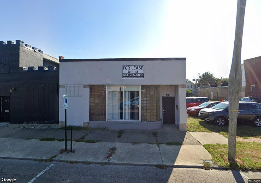
310 N Columbus St Lancaster, OH 43130
Estimated Value: $115,000 - $469,000
Studio
--
Bath
2,858
Sq Ft
$93/Sq Ft
Est. Value
About This Home
This home is located at 310 N Columbus St, Lancaster, OH 43130 and is currently estimated at $266,333, approximately $93 per square foot. 310 N Columbus St is a home located in Fairfield County with nearby schools including Thomas Ewing Junior High School, Lancaster High School, and St Mary Elementary School.
Ownership History
Date
Name
Owned For
Owner Type
Purchase Details
Closed on
Feb 16, 2022
Sold by
Cruit David E
Bought by
314 Columbus Street Llc
Current Estimated Value
Purchase Details
Closed on
Feb 2, 2022
Sold by
Cruit David E
Bought by
314 Columbus Street Llc
Purchase Details
Closed on
Feb 29, 2012
Sold by
Lancaster Port Authority
Bought by
Cruit David L and Cruit Nancy M
Purchase Details
Closed on
Jan 31, 2012
Sold by
The City Of Lancaster
Bought by
Lancaster Port Authority
Purchase Details
Closed on
May 29, 2009
Sold by
Voris Clyde Andrew
Bought by
City Of Lancaster
Purchase Details
Closed on
Dec 6, 2006
Sold by
Voris Michael J and Voris Melinda C
Bought by
Voris Clyde Andrew
Purchase Details
Closed on
Oct 4, 2005
Sold by
Estate Of Grace E Aneshansley
Bought by
Voris Clyde Andrew and Voris Michael J
Create a Home Valuation Report for This Property
The Home Valuation Report is an in-depth analysis detailing your home's value as well as a comparison with similar homes in the area
Home Values in the Area
Average Home Value in this Area
Purchase History
| Date | Buyer | Sale Price | Title Company |
|---|---|---|---|
| 314 Columbus Street Llc | -- | Valmer Land Title | |
| 314 Columbus Street Llc | -- | Valmer Land Title | |
| Cruit David L | -- | Attorney | |
| Lancaster Port Authority | -- | Attorney | |
| City Of Lancaster | -- | None Available | |
| Voris Clyde Andrew | -- | Attorney | |
| Voris Clyde Andrew | -- | -- |
Source: Public Records
Tax History
| Year | Tax Paid | Tax Assessment Tax Assessment Total Assessment is a certain percentage of the fair market value that is determined by local assessors to be the total taxable value of land and additions on the property. | Land | Improvement |
|---|---|---|---|---|
| 2025 | $371 | $8,230 | $8,230 | -- |
| 2024 | $371 | $4,130 | $4,130 | -- |
| 2023 | $154 | $4,130 | $4,130 | -- |
| 2022 | $154 | $4,130 | $4,130 | $0 |
| 2021 | $165 | $4,130 | $4,130 | $0 |
| 2020 | $158 | $4,130 | $4,130 | $0 |
| 2019 | $150 | $4,130 | $4,130 | $0 |
| 2018 | $137 | $4,130 | $4,130 | $0 |
| 2017 | $137 | $3,570 | $3,570 | $0 |
| 2016 | $134 | $3,570 | $3,570 | $0 |
| 2015 | $138 | $3,570 | $3,570 | $0 |
| 2014 | $131 | $3,570 | $3,570 | $0 |
| 2013 | $131 | $3,570 | $3,570 | $0 |
Source: Public Records
Map
Nearby Homes
- 233 Union St
- 515 N Columbus St
- 526 N Columbus St
- 0 Slocum Ave
- 0 N Columbus St
- 154 E Main St
- 249 N Pearl Ave
- 600 N High St
- 123 Arnold Ave
- 233 E 6th Ave
- 820 N Broad St
- 830 N Broad St
- 130 W Fair Ave
- 113 N George St
- 165 Lake St
- 520 W Wheeling St
- 311 E Allen St
- 342 E Chestnut St
- 517 N Maple St
- 336 Reber Ave
- 314 N Columbus St
- 322 N Columbus St
- 328 N Columbus St
- 315 N Columbus St
- 336 N Columbus St
- 143 W Mulberry St
- 338 N Columbus St
- 338 N Columbus St Unit 2
- 150 Union St
- 141 W Mulberry St
- 230 N Columbus St
- 230 N Columbus St Unit A
- 148 Union St
- 138 Union St
- 219 N Columbus St
- 136 Union St
- 142 Union St
- 220 Union St
- 400 N Columbus St
- 144 W Mulberry St
Your Personal Tour Guide
Ask me questions while you tour the home.