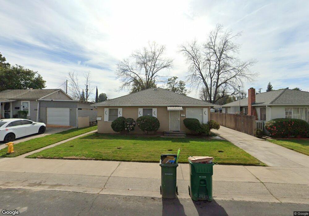
320 Forrest Ave Lodi, CA 95240
North Lodi NeighborhoodEstimated Value: $387,342 - $720,000
8
Beds
4
Baths
1,716
Sq Ft
$310/Sq Ft
Est. Value
About This Home
This home is located at 320 Forrest Ave, Lodi, CA 95240 and is currently estimated at $531,836, approximately $309 per square foot. 320 Forrest Ave is a home located in San Joaquin County with nearby schools including Lakewood Elementary School, Millswood Middle School, and Lodi High School.
Ownership History
Date
Name
Owned For
Owner Type
Purchase Details
Closed on
Dec 7, 2009
Sold by
Weisz Bonnie J and Robertson Judith A
Bought by
Weisz Bonnie J
Current Estimated Value
Home Financials for this Owner
Home Financials are based on the most recent Mortgage that was taken out on this home.
Original Mortgage
$85,000
Outstanding Balance
$55,470
Interest Rate
4.91%
Mortgage Type
New Conventional
Estimated Equity
$476,366
Purchase Details
Closed on
Sep 28, 2009
Sold by
Robertson Thomas S
Bought by
Robertson Judith A
Create a Home Valuation Report for This Property
The Home Valuation Report is an in-depth analysis detailing your home's value as well as a comparison with similar homes in the area
Home Values in the Area
Average Home Value in this Area
Purchase History
| Date | Buyer | Sale Price | Title Company |
|---|---|---|---|
| Weisz Bonnie J | $85,000 | Old Republic Title Company | |
| Robertson Judith A | -- | Old Republic Title Company |
Source: Public Records
Mortgage History
| Date | Status | Borrower | Loan Amount |
|---|---|---|---|
| Open | Weisz Bonnie J | $85,000 |
Source: Public Records
Tax History
| Year | Tax Paid | Tax Assessment Tax Assessment Total Assessment is a certain percentage of the fair market value that is determined by local assessors to be the total taxable value of land and additions on the property. | Land | Improvement |
|---|---|---|---|---|
| 2025 | $1,610 | $145,929 | $34,821 | $111,108 |
| 2024 | $1,567 | $143,069 | $34,139 | $108,930 |
| 2023 | $1,541 | $140,265 | $33,470 | $106,795 |
| 2022 | $1,507 | $137,515 | $32,814 | $104,701 |
| 2021 | $1,534 | $134,820 | $32,171 | $102,649 |
| 2020 | $1,494 | $133,439 | $31,842 | $101,597 |
| 2019 | $1,465 | $130,823 | $31,218 | $99,605 |
| 2018 | $1,444 | $128,258 | $30,606 | $97,652 |
| 2017 | $1,413 | $125,744 | $30,006 | $95,738 |
| 2016 | $1,325 | $123,279 | $29,418 | $93,861 |
| 2014 | $1,291 | $119,050 | $28,409 | $90,641 |
Source: Public Records
Map
Nearby Homes
- 518 N Church St
- 705 N School St
- 625 N Sacramento St
- 525 Eureka Ave
- 101 W Lockeford St
- 333 W Locust St
- 0 W Turner Rd Unit 226006338
- 606 W Turner Rd
- 1258 Rivergate Dr
- 507 N Sunset Dr
- 1180 Northwood Dr
- 427 E Locust St
- 1416 Reiman St
- 736 Golden Ave
- 909 Greenwood Dr
- 1427 Reiman St
- 1413 Mariposa Way
- 1424 Graffigna Ave
- 1729 Le Bec Ct
- 1507 Holly Dr
- 324 Forrest Ave
- 324 Forrest Ave
- 316 Forrest Ave
- 330 Forrest Ave
- 330 Forrest Ave
- 312 Forrest Ave
- 334 Forrest Ave
- 308 Forrest Ave
- 620 Lincoln Ave
- 618 Lincoln Ave
- 626 Lincoln Ave
- 337 Forrest Ave
- 325 Forrest Ave
- 321 Daisy Ave
- 627 N Pleasant Ave
- 325 Daisy Ave
- 317 Daisy Ave
- 629 N Pleasant Ave
- 313 Forrest Ave
- 331 Forrest Ave
Your Personal Tour Guide
Ask me questions while you tour the home.