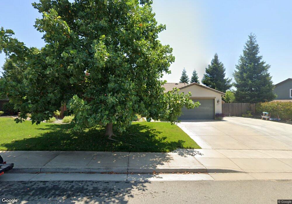
3431 Carlsbad Ln Redding, CA 96002
Forest Hills NeighborhoodEstimated Value: $538,112 - $631,000
4
Beds
3
Baths
2,351
Sq Ft
$248/Sq Ft
Est. Value
About This Home
This home is located at 3431 Carlsbad Ln, Redding, CA 96002 and is currently estimated at $583,278, approximately $248 per square foot. 3431 Carlsbad Ln is a home located in Shasta County with nearby schools including Alta Mesa Elementary School, Parsons Junior High School, and Enterprise High School.
Ownership History
Date
Name
Owned For
Owner Type
Purchase Details
Closed on
Jan 11, 2011
Sold by
D R Horton Inc Sacramento
Bought by
Brooks James W
Current Estimated Value
Home Financials for this Owner
Home Financials are based on the most recent Mortgage that was taken out on this home.
Original Mortgage
$100,000
Outstanding Balance
$67,653
Interest Rate
4.62%
Mortgage Type
New Conventional
Estimated Equity
$515,625
Purchase Details
Closed on
Jan 15, 2010
Sold by
Clover Creek Development Company Llc
Bought by
D R Horton Inc Sacramento
Home Financials for this Owner
Home Financials are based on the most recent Mortgage that was taken out on this home.
Original Mortgage
$319,500
Interest Rate
4.78%
Mortgage Type
Seller Take Back
Create a Home Valuation Report for This Property
The Home Valuation Report is an in-depth analysis detailing your home's value as well as a comparison with similar homes in the area
Home Values in the Area
Average Home Value in this Area
Purchase History
| Date | Buyer | Sale Price | Title Company |
|---|---|---|---|
| Brooks James W | $280,000 | Fidelity National Title Co | |
| D R Horton Inc Sacramento | $639,000 | Fidelity Natl Title Co Of Ca |
Source: Public Records
Mortgage History
| Date | Status | Borrower | Loan Amount |
|---|---|---|---|
| Open | Brooks James W | $100,000 | |
| Previous Owner | D R Horton Inc Sacramento | $319,500 |
Source: Public Records
Tax History Compared to Growth
Tax History
| Year | Tax Paid | Tax Assessment Tax Assessment Total Assessment is a certain percentage of the fair market value that is determined by local assessors to be the total taxable value of land and additions on the property. | Land | Improvement |
|---|---|---|---|---|
| 2025 | $4,181 | $358,716 | $90,956 | $267,760 |
| 2024 | $4,123 | $351,683 | $89,173 | $262,510 |
| 2023 | $4,123 | $344,788 | $87,425 | $257,363 |
| 2022 | $3,984 | $338,028 | $85,711 | $252,317 |
| 2021 | $3,843 | $331,401 | $84,031 | $247,370 |
| 2020 | $3,796 | $328,004 | $83,170 | $244,834 |
| 2019 | $3,745 | $321,574 | $81,540 | $240,034 |
| 2018 | $3,662 | $315,270 | $79,942 | $235,328 |
| 2017 | $3,628 | $309,089 | $78,375 | $230,714 |
| 2016 | $3,538 | $303,030 | $76,839 | $226,191 |
| 2015 | $3,389 | $298,479 | $75,685 | $222,794 |
| 2014 | $3,372 | $292,633 | $74,203 | $218,430 |
Source: Public Records
Map
Nearby Homes
- 3863 Indian Wells Ln
- 3685 Wimbledon Dr
- 3792 Thomason Trail
- 3385 Wimbledon Dr
- 3035 Argyle Rd
- 3156 Niklaus Path
- 2903 Newbury Ln
- 9105 Madrone Way
- 3512 Capricorn Way
- 0 Shasta View Unit 25-1945
- 2681 Hartnell Ave
- 2912 Squire Ave
- 2850 Oakview Dr
- 4655 Goodwater Ave
- 2877 Green Riffle Rd
- 3361 Alta Mesa Dr
- 2795 Carolee Ct
- 20766 Cattle Dr
- 0 Lot12 Unit 2 Ph 2 Stillwater Unit 25-4954
- 2068 Solar Way
- 3461 Carlsbad Ln
- 3825 Palm Springs Dr
- 3401 Carlsbad Ln
- 3849 Palm Springs Dr
- 3491 Carlsbad Ln
- 3424 Carlsbad Ln
- 3442 Carlsbad Ln
- 3824 Indian Wells Ln
- 3406 Carlsbad Ln
- 3460 Carlsbad Ln
- 3397 Carlsbad Ct
- 3848 Indian Wells Ln
- 3820 Palm Springs Dr
- 3478 Carlsbad Ln
- 3838 Palm Springs Dr
- 3533 Laver St
- 3555 Laver St
- 3856 Palm Springs Dr
- 3513 Laver St
- 3394 Carlsbad Ct