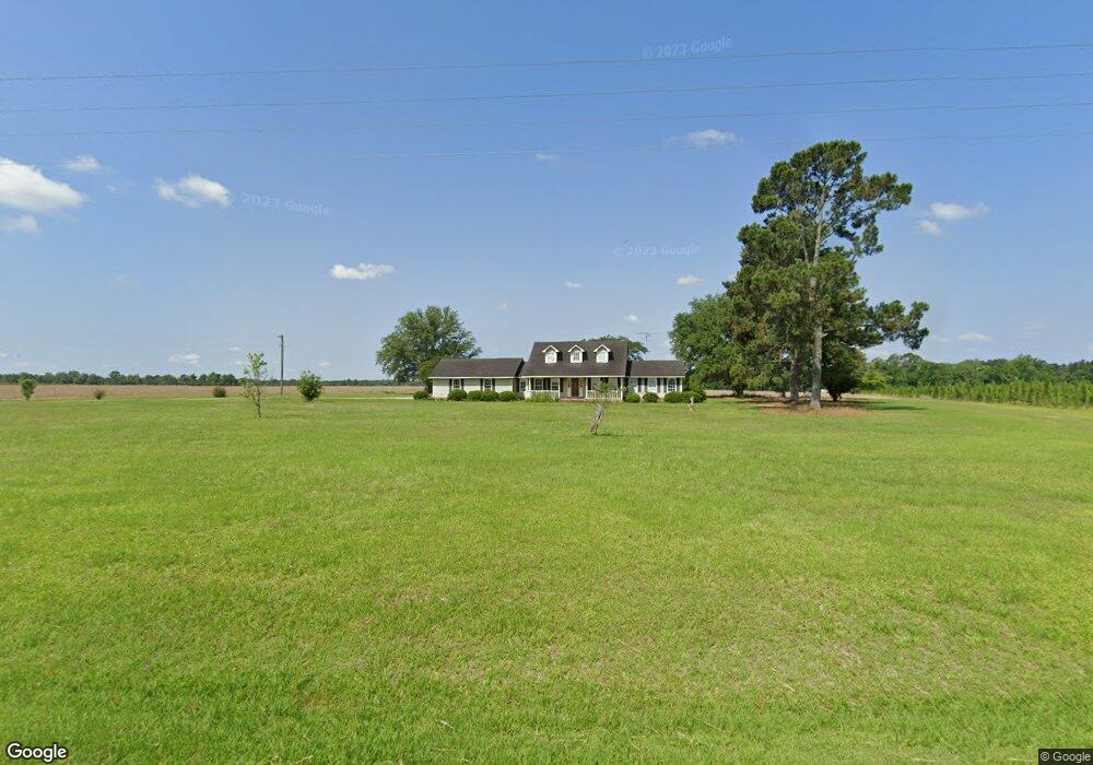
3695 Barwick Rd Quitman, GA 31643
Estimated Value: $149,000 - $1,492,852
Studio
2
Baths
1,128
Sq Ft
$561/Sq Ft
Est. Value
About This Home
This home is located at 3695 Barwick Rd, Quitman, GA 31643 and is currently estimated at $633,284, approximately $561 per square foot. 3695 Barwick Rd is a home located in Brooks County with nearby schools including Quitman Elementary School and First Baptist Church Preschool & Kindergarten.
Ownership History
Date
Name
Owned For
Owner Type
Purchase Details
Closed on
Apr 30, 2025
Sold by
Red Iron Farms Llc
Bought by
Jones Robbie Laurie
Current Estimated Value
Purchase Details
Closed on
Mar 18, 2010
Sold by
Red Iron Farms Llc
Bought by
Conservation Use Covenant Recording
Purchase Details
Closed on
Sep 21, 2009
Sold by
Jones Southern Land Company Inc
Bought by
Red Iron Farms Llc
Purchase Details
Closed on
Jun 5, 2009
Sold by
Jones Southern Land Company Inc
Bought by
Conservation Use Covenant Recording
Purchase Details
Closed on
Sep 15, 2000
Sold by
C/O Link Enterprises Inc S/C
Bought by
Jones Southern Land Company Inc
Purchase Details
Closed on
Jul 6, 1998
Sold by
Mitchell Henry F
Bought by
C/O Link Enterprises Inc S/C
Purchase Details
Closed on
Dec 19, 1991
Bought by
Mitchell Henry F
Create a Home Valuation Report for This Property
The Home Valuation Report is an in-depth analysis detailing your home's value as well as a comparison with similar homes in the area
Purchase History
| Date | Buyer | Sale Price | Title Company |
|---|---|---|---|
| Jones Robbie Laurie | -- | -- | |
| Conservation Use Covenant Recording | -- | -- | |
| Red Iron Farms Llc | -- | -- | |
| Conservation Use Covenant Recording | -- | -- | |
| Jones Southern Land Company Inc | $310,000 | -- | |
| C/O Link Enterprises Inc S/C | -- | -- | |
| Mitchell Henry F | $292,800 | -- |
Source: Public Records
Tax History
| Year | Tax Paid | Tax Assessment Tax Assessment Total Assessment is a certain percentage of the fair market value that is determined by local assessors to be the total taxable value of land and additions on the property. | Land | Improvement |
|---|---|---|---|---|
| 2025 | $3,053 | $316,040 | $269,920 | $46,120 |
| 2024 | $3,011 | $316,040 | $269,920 | $46,120 |
| 2023 | $2,819 | $282,240 | $241,920 | $40,320 |
| 2022 | $2,736 | $260,920 | $230,440 | $30,480 |
| 2021 | $2,568 | $214,640 | $187,400 | $27,240 |
| 2020 | $5,964 | $214,760 | $187,400 | $27,360 |
| 2019 | $2,413 | $194,200 | $167,680 | $26,520 |
| 2018 | $5,730 | $196,200 | $169,320 | $26,880 |
| 2017 | $2,164 | $194,800 | $169,320 | $25,480 |
| 2016 | $2,165 | $195,160 | $169,320 | $25,840 |
| 2015 | -- | $194,920 | $169,320 | $25,600 |
| 2014 | -- | $195,240 | $169,320 | $25,920 |
| 2013 | -- | $195,240 | $169,320 | $25,920 |
Source: Public Records
Map
Nearby Homes
- 2661 Dewberry Rd
- 103 Victorian Way
- 1501 W Screven St
- Dixie Rd
- 103 Magnolia Dr
- 1001 W Bartow St
- 807 N Court St
- 714 Morris Ave
- 606 N Court St
- 506 Oglesby St
- 5199 U S 84
- 203 W Gordon St
- 804 Westlake Dr
- 1521 Mount Carmel Chuch Rx
- Lot 14 Dawn Ln
- 0 E Gordon St
- 0 W Swamp St
- 237 Turkey Ridge Ln
- 1306 E Screven St
- 0 Madison Hwy Unit 26460639
Your Personal Tour Guide
Ask me questions while you tour the home.