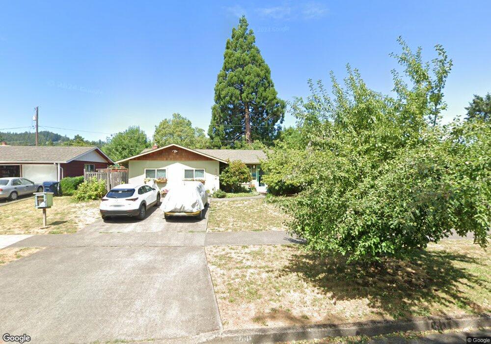
4410 Donald St Eugene, OR 97405
Southeast Eugene NeighborhoodEstimated Value: $483,000 - $555,000
3
Beds
1
Bath
1,560
Sq Ft
$332/Sq Ft
Est. Value
About This Home
This home is located at 4410 Donald St, Eugene, OR 97405 and is currently estimated at $517,629, approximately $331 per square foot. 4410 Donald St is a home located in Lane County with nearby schools including Edgewood Community Elementary School, Spencer Butte Middle School, and South Eugene High School.
Ownership History
Date
Name
Owned For
Owner Type
Purchase Details
Closed on
Jul 25, 2013
Sold by
Geary Reathel E and Geary Debbie L
Bought by
Hurbis Charles G and Wightman Jillian
Current Estimated Value
Home Financials for this Owner
Home Financials are based on the most recent Mortgage that was taken out on this home.
Original Mortgage
$199,800
Outstanding Balance
$145,183
Interest Rate
3.98%
Mortgage Type
New Conventional
Estimated Equity
$372,446
Purchase Details
Closed on
Mar 4, 2009
Sold by
Larsen Mary Evelyn
Bought by
Geary Reathel E and Geary Debbie L
Home Financials for this Owner
Home Financials are based on the most recent Mortgage that was taken out on this home.
Original Mortgage
$172,000
Interest Rate
5.08%
Mortgage Type
Purchase Money Mortgage
Create a Home Valuation Report for This Property
The Home Valuation Report is an in-depth analysis detailing your home's value as well as a comparison with similar homes in the area
Home Values in the Area
Average Home Value in this Area
Purchase History
| Date | Buyer | Sale Price | Title Company |
|---|---|---|---|
| Hurbis Charles G | $222,000 | Cascade Title Company | |
| Geary Reathel E | $215,000 | Evergreen Land Title Co |
Source: Public Records
Mortgage History
| Date | Status | Borrower | Loan Amount |
|---|---|---|---|
| Open | Hurbis Charles G | $199,800 | |
| Previous Owner | Geary Reathel E | $172,000 |
Source: Public Records
Tax History
| Year | Tax Paid | Tax Assessment Tax Assessment Total Assessment is a certain percentage of the fair market value that is determined by local assessors to be the total taxable value of land and additions on the property. | Land | Improvement |
|---|---|---|---|---|
| 2025 | $4,528 | $232,401 | -- | -- |
| 2024 | $4,472 | $225,633 | -- | -- |
| 2023 | $4,472 | $219,062 | $0 | $0 |
| 2022 | $4,189 | $212,682 | $0 | $0 |
| 2021 | $3,935 | $206,488 | $0 | $0 |
| 2020 | $3,949 | $200,474 | $0 | $0 |
| 2019 | $3,814 | $194,635 | $0 | $0 |
| 2018 | $3,067 | $156,744 | $0 | $0 |
| 2017 | $2,930 | $156,744 | $0 | $0 |
| 2016 | $2,857 | $152,179 | $0 | $0 |
| 2015 | $2,775 | $147,747 | $0 | $0 |
| 2014 | $2,719 | $143,444 | $0 | $0 |
Source: Public Records
Map
Nearby Homes
- 4295 Ferry St
- 4083 Donald St Unit A
- 4023 Donald St Unit K
- 4734 Brookwood St
- 170 E 40th Ave
- 4845 Brookwood St
- 17 Westbrook Way
- 21 Westbrook Way
- 36 Westbrook Way
- 434 E 39th Ave
- 275 E 39th Ave
- 0 E 39th Ave
- 4364 Fox Hollow Rd
- 4320 Fox Hollow Rd
- 910 E 43rd Ave
- 4429 Fox Hollow Rd Unit 3
- 278 Rockridge Ct
- 765 Sprague St
- 365 Brae Burn Dr
- 126 Treehill Loop Unit 126
- 4430 Donald St
- 4390 Donald St
- 4395 Mill St
- 4355 Mill St
- 4460 Donald St
- 4350 Donald St
- 4415 Mill St
- 350 E 43rd Ave
- 4315 Mill St
- 390 E 43rd Ave
- 4490 Donald St
- 4455 Mill St
- 4360 Mill St
- 4390 Mill St
- 4510 Donald St
- 4320 Mill St
- 4495 Mill St
- 4420 Mill St
- 0 Donald St Unit 1505957
- 0 Donald St Unit 15144108
Your Personal Tour Guide
Ask me questions while you tour the home.