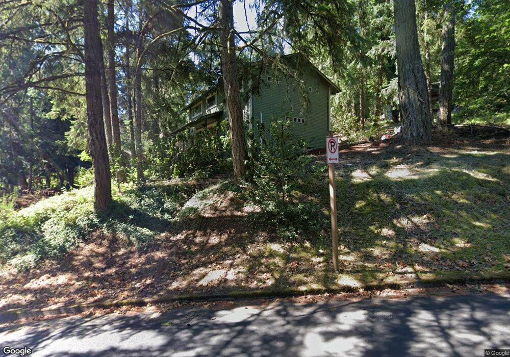
488 Brookside Dr Eugene, OR 97405
Crest Drive NeighborhoodEstimated Value: $557,000 - $585,000
4
Beds
3
Baths
1,976
Sq Ft
$288/Sq Ft
Est. Value
About This Home
This home is located at 488 Brookside Dr, Eugene, OR 97405 and is currently estimated at $569,479, approximately $288 per square foot. 488 Brookside Dr is a home located in Lane County with nearby schools including Edgewood Community Elementary School, Spencer Butte Middle School, and South Eugene High School.
Ownership History
Date
Name
Owned For
Owner Type
Purchase Details
Closed on
Sep 29, 2023
Sold by
Manheim Joseph Matthew and Manheim Lori Ann
Bought by
Manheim Joint Trust and Manheim
Current Estimated Value
Purchase Details
Closed on
Jun 25, 2015
Sold by
Faunce Ronald A and Faunce Barbara B
Bought by
Manheim Joseph Matthew and Manheim Lori Ann
Home Financials for this Owner
Home Financials are based on the most recent Mortgage that was taken out on this home.
Original Mortgage
$186,300
Interest Rate
3.03%
Mortgage Type
New Conventional
Create a Home Valuation Report for This Property
The Home Valuation Report is an in-depth analysis detailing your home's value as well as a comparison with similar homes in the area
Home Values in the Area
Average Home Value in this Area
Purchase History
| Date | Buyer | Sale Price | Title Company |
|---|---|---|---|
| Manheim Joint Trust | -- | None Listed On Document | |
| Manheim Joseph Matthew | $310,500 | Cascade Title Company |
Source: Public Records
Mortgage History
| Date | Status | Borrower | Loan Amount |
|---|---|---|---|
| Previous Owner | Manheim Joseph Matthew | $186,300 |
Source: Public Records
Tax History
| Year | Tax Paid | Tax Assessment Tax Assessment Total Assessment is a certain percentage of the fair market value that is determined by local assessors to be the total taxable value of land and additions on the property. | Land | Improvement |
|---|---|---|---|---|
| 2025 | $5,753 | $295,256 | -- | -- |
| 2024 | $5,681 | $286,657 | -- | -- |
| 2023 | $5,681 | $278,308 | $0 | $0 |
| 2022 | $5,322 | $270,202 | $0 | $0 |
| 2021 | $4,999 | $262,333 | $0 | $0 |
| 2020 | $5,017 | $254,693 | $0 | $0 |
| 2019 | $4,845 | $247,275 | $0 | $0 |
| 2018 | $4,561 | $233,081 | $0 | $0 |
| 2017 | $4,356 | $233,081 | $0 | $0 |
| 2016 | $4,205 | $226,292 | $0 | $0 |
| 2015 | $4,083 | $219,701 | $0 | $0 |
| 2014 | -- | $213,302 | $0 | $0 |
Source: Public Records
Map
Nearby Homes
- 278 Rockridge Ct
- 422 Stonewood Dr Unit 422
- 418 Stonewood Dr Unit 418
- 653 Brookside Dr
- 151 Treehill Loop Unit 151
- 152 Treehill Loop Unit 152
- 143 Treehill Loop Unit 143
- 223 Trailside Loop Unit 223
- 126 Treehill Loop Unit 126
- 784 Brookside Dr
- 0 Pine View Ct Unit 758820410
- 36 Westbrook Way
- 21 Westbrook Way
- 17 Westbrook Way
- 4040 Southpointe Dr
- 4734 Brookwood St
- 395 E 46th Ave
- 806 Sundance St
- 3872 Monroe St
- 3854 Monroe St
- 482 Brookside Dr
- 542 Brookside Dr
- 544 Brookside Dr
- 474 Brookside Dr
- 470 Brookside Dr
- 453 Brookside Dr
- 451 Brookside Dr
- 478 Brookside Dr
- 556 Brookside Dr
- 540 Brookside Dr
- 546 Brookside Dr
- 550 Brookside Dr
- 449 Brookside Dr
- 235 Rockridge Loop
- 566 Brookside Dr
- 457 Brookside Dr
- 231 Rockridge Loop
- 445 Brookside Dr
- 443 Brookside Dr
- 507 Brookside Dr
Your Personal Tour Guide
Ask me questions while you tour the home.