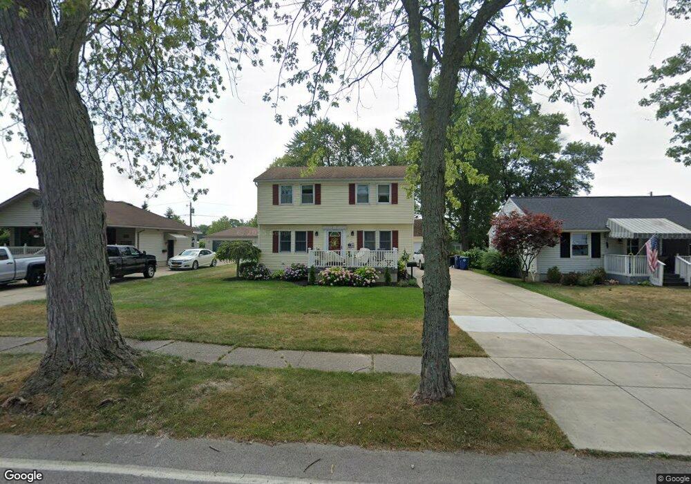
54 Pierpont Ave Buffalo, NY 14221
South Amherst NeighborhoodEstimated Value: $336,000 - $367,000
3
Beds
2
Baths
1,764
Sq Ft
$198/Sq Ft
Est. Value
About This Home
This home is located at 54 Pierpont Ave, Buffalo, NY 14221 and is currently estimated at $348,820, approximately $197 per square foot. 54 Pierpont Ave is a home located in Erie County with nearby schools including Forest Elementary School, Mill Middle School, and Williamsville South High School.
Ownership History
Date
Name
Owned For
Owner Type
Purchase Details
Closed on
Jun 8, 2010
Sold by
Kaiser Bonnie J and Hill Bonnie Jean
Bought by
Kaiser Bonnie J
Current Estimated Value
Home Financials for this Owner
Home Financials are based on the most recent Mortgage that was taken out on this home.
Original Mortgage
$153,084
Interest Rate
5.12%
Mortgage Type
FHA
Create a Home Valuation Report for This Property
The Home Valuation Report is an in-depth analysis detailing your home's value as well as a comparison with similar homes in the area
Home Values in the Area
Average Home Value in this Area
Purchase History
| Date | Buyer | Sale Price | Title Company |
|---|---|---|---|
| Kaiser Bonnie J | -- | None Available |
Source: Public Records
Mortgage History
| Date | Status | Borrower | Loan Amount |
|---|---|---|---|
| Closed | Kaiser Bonnie J | $153,084 |
Source: Public Records
Tax History Compared to Growth
Tax History
| Year | Tax Paid | Tax Assessment Tax Assessment Total Assessment is a certain percentage of the fair market value that is determined by local assessors to be the total taxable value of land and additions on the property. | Land | Improvement |
|---|---|---|---|---|
| 2024 | $5,987 | $291,000 | $58,000 | $233,000 |
| 2023 | $5,922 | $178,000 | $27,300 | $150,700 |
| 2022 | $5,581 | $178,000 | $27,300 | $150,700 |
| 2021 | $5,471 | $178,000 | $27,300 | $150,700 |
| 2020 | $4,325 | $178,000 | $27,300 | $150,700 |
| 2019 | $4,789 | $178,000 | $27,300 | $150,700 |
| 2018 | $4,695 | $178,000 | $27,300 | $150,700 |
| 2017 | $1,807 | $178,000 | $27,300 | $150,700 |
| 2016 | $3,978 | $133,900 | $25,600 | $108,300 |
| 2015 | -- | $133,900 | $25,600 | $108,300 |
| 2014 | -- | $133,900 | $25,600 | $108,300 |
Source: Public Records
Map
Nearby Homes
- 302 S Forest Rd
- 230 S Forest Rd
- 228 S Forest Rd
- 144 Lafayette Blvd
- 132 Royal Pkwy E
- 495 Wehrle Dr Unit 455,465,475,485
- 306 Ridgewood Dr
- 7 Matthew Ln
- 439 Wehrle Dr
- 109 Avalon Dr
- 129 Bennington Rd
- 33 Virginia Rd
- 176 Bennington Rd
- 150 S Union Rd Unit 125
- 1120 Cleveland Dr
- 870 Beach Rd
- 246 Lorfield Dr
- 43 Linwood Ave
- 83 S Union Rd
- 183 N Harvest St
- 46 Pierpont Ave
- 60 Pierpont Ave
- 40 Pierpont Ave
- 66 Pierpont Ave
- 34 Pierpont Ave
- 72 Pierpont Ave
- 45 Pierpont Ave
- 59 Pierpont Ave
- 69 Pierpont Ave
- 39 Pierpont Ave
- 28 Pierpont Ave
- 80 Pierpont Ave
- 33 Pierpont Ave
- 22 Pierpont Ave
- 268 Royal Pkwy E
- 88 Pierpont Ave
- 27 Pierpont Ave
- 260 Royal Pkwy E
- 21 Pierpont Ave
- 16 Pierpont Ave