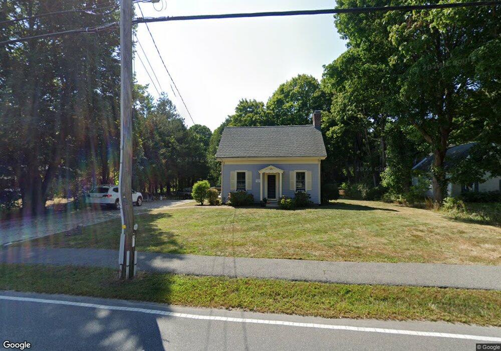
545 Main St Cotuit, MA 02635
Cotuit NeighborhoodEstimated Value: $522,000 - $639,000
2
Beds
1
Bath
750
Sq Ft
$746/Sq Ft
Est. Value
About This Home
This home is located at 545 Main St, Cotuit, MA 02635 and is currently estimated at $559,619, approximately $746 per square foot. 545 Main St is a home located in Barnstable County with nearby schools including West Villages Elementary School, Barnstable United Elementary School, and Barnstable Intermediate School.
Ownership History
Date
Name
Owned For
Owner Type
Purchase Details
Closed on
Aug 7, 2025
Sold by
Christian Kim D and Christian Mary K
Bought by
Christian Ft and Christian
Current Estimated Value
Purchase Details
Closed on
Aug 19, 2024
Sold by
Macdowell Earlene
Bought by
Christian Kim D and Christian Mary K
Purchase Details
Closed on
Jun 27, 1995
Sold by
Macdowell Earlene and Hoxie Bernice L
Bought by
Macdowell Earlene
Create a Home Valuation Report for This Property
The Home Valuation Report is an in-depth analysis detailing your home's value as well as a comparison with similar homes in the area
Home Values in the Area
Average Home Value in this Area
Purchase History
| Date | Buyer | Sale Price | Title Company |
|---|---|---|---|
| Christian Ft | -- | -- | |
| Christian Ft | -- | -- | |
| Christian Kim D | $425,000 | None Available | |
| Christian Kim D | $425,000 | None Available | |
| Christian Kim D | $425,000 | None Available | |
| Macdowell Earlene | $55,000 | -- | |
| Macdowell Earlene | $55,000 | -- |
Source: Public Records
Tax History Compared to Growth
Tax History
| Year | Tax Paid | Tax Assessment Tax Assessment Total Assessment is a certain percentage of the fair market value that is determined by local assessors to be the total taxable value of land and additions on the property. | Land | Improvement |
|---|---|---|---|---|
| 2025 | $4,441 | $531,900 | $328,500 | $203,400 |
| 2024 | $4,087 | $518,700 | $328,500 | $190,200 |
| 2023 | $3,967 | $473,900 | $305,400 | $168,500 |
| 2022 | $3,644 | $352,400 | $211,100 | $141,300 |
| 2021 | $3,882 | $351,600 | $231,200 | $120,400 |
| 2020 | $3,897 | $332,800 | $231,200 | $101,600 |
| 2019 | $3,938 | $331,500 | $241,300 | $90,200 |
| 2018 | $3,815 | $321,100 | $243,400 | $77,700 |
| 2017 | $3,747 | $317,500 | $243,400 | $74,100 |
| 2016 | $3,672 | $319,000 | $244,900 | $74,100 |
| 2015 | $3,613 | $313,600 | $235,600 | $78,000 |
Source: Public Records
Map
Nearby Homes
- 804 Main St
- 135 Putnam Ave
- 426 Old Post Rd
- 916 Main St
- 33 Oyster Place Rd
- 43 Poponessett Rd
- 602 Putnam Ave
- 30 Wings Ln
- 1081 Main St
- 220 Dunrobin Rd
- 226 Dunrobin Rd
- 70 Cape Dr Unit 14D
- 70 Cape Dr Unit 11D
- 70 Cape Dr Unit 11D
- 70 Simons Rd Unit E
- 70 Simons Rd
- 75 Bob White Run
- 6 Cedar St
- 6 Cedar St
- 188 Ocean View Ave