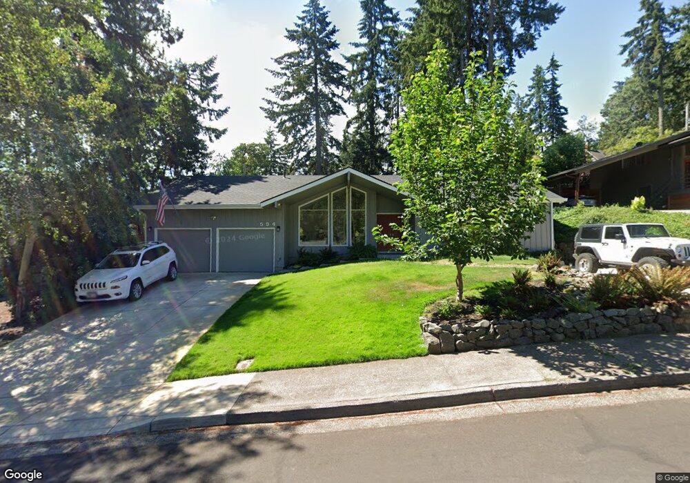
594 Empress Ave Eugene, OR 97405
Southeast Eugene NeighborhoodEstimated Value: $461,000 - $555,000
3
Beds
2
Baths
1,564
Sq Ft
$323/Sq Ft
Est. Value
About This Home
This home is located at 594 Empress Ave, Eugene, OR 97405 and is currently estimated at $504,890, approximately $322 per square foot. 594 Empress Ave is a home located in Lane County with nearby schools including Edgewood Community Elementary School, Spencer Butte Middle School, and South Eugene High School.
Ownership History
Date
Name
Owned For
Owner Type
Purchase Details
Closed on
Jul 23, 2024
Sold by
Baker Marvin G and Baker Karen
Bought by
Marvin And Karen Baker Joint Revocable Trust and Baker
Current Estimated Value
Purchase Details
Closed on
May 6, 2008
Sold by
Horyna Karen and Baker Karen
Bought by
Baker Marvin G and Baker Karen
Purchase Details
Closed on
Sep 3, 2003
Sold by
Horyna Karen and Beisse Karen
Bought by
Horyna Richard L and Horyna Karen
Create a Home Valuation Report for This Property
The Home Valuation Report is an in-depth analysis detailing your home's value as well as a comparison with similar homes in the area
Home Values in the Area
Average Home Value in this Area
Purchase History
| Date | Buyer | Sale Price | Title Company |
|---|---|---|---|
| Marvin And Karen Baker Joint Revocable Trust | -- | None Listed On Document | |
| Baker Marvin G | -- | None Available | |
| Horyna Richard L | -- | -- |
Source: Public Records
Tax History
| Year | Tax Paid | Tax Assessment Tax Assessment Total Assessment is a certain percentage of the fair market value that is determined by local assessors to be the total taxable value of land and additions on the property. | Land | Improvement |
|---|---|---|---|---|
| 2025 | $5,579 | $286,362 | -- | -- |
| 2024 | $5,510 | $278,022 | -- | -- |
| 2023 | $5,510 | $269,925 | $0 | $0 |
| 2022 | $5,162 | $262,064 | $0 | $0 |
| 2021 | $4,848 | $254,432 | $0 | $0 |
| 2020 | $4,865 | $247,022 | $0 | $0 |
| 2019 | $4,699 | $239,828 | $0 | $0 |
| 2018 | $4,404 | $226,061 | $0 | $0 |
| 2017 | $4,154 | $226,061 | $0 | $0 |
| 2016 | $3,976 | $219,477 | $0 | $0 |
| 2015 | $3,860 | $213,084 | $0 | $0 |
| 2014 | $3,811 | $206,878 | $0 | $0 |
Source: Public Records
Map
Nearby Homes
- 4845 Brookwood St
- 4734 Brookwood St
- 4680 W Hillside Dr
- 395 E 46th Ave
- 892 Sprague St
- 4425 Hilyard St
- 4429 Fox Hollow Rd Unit 3
- 296 Woodridge Dr
- 4733 E Amazon Dr
- 4295 Ferry St
- 36 Westbrook Way
- 202 Foxtail Dr
- 21 Westbrook Way
- 17 Westbrook Way
- 4364 Fox Hollow Rd
- 126 Treehill Loop Unit 126
- 4320 Fox Hollow Rd
- 910 E 43rd Ave
- 143 Treehill Loop Unit 143
- 278 Rockridge Ct
- 610 Empress Ave
- 570 Empress Ave
- 5180 Miramar St
- 5190 Miramar St
- 5170 Miramar St
- 599 Empress Ave
- 585 Empress Ave
- 530 Empress Ave
- 628 Empress Ave
- 5210 Miramar St
- 5150 Miramar St
- 567 Empress Ave
- 5195 Miramar St
- 536 Empress Ave
- 5220 Miramar St
- 642 Empress Ave
- 681 Empress Ave
- 586 Princess Ave
- 558 Princess Ave
- 5125 Miramar St
Your Personal Tour Guide
Ask me questions while you tour the home.