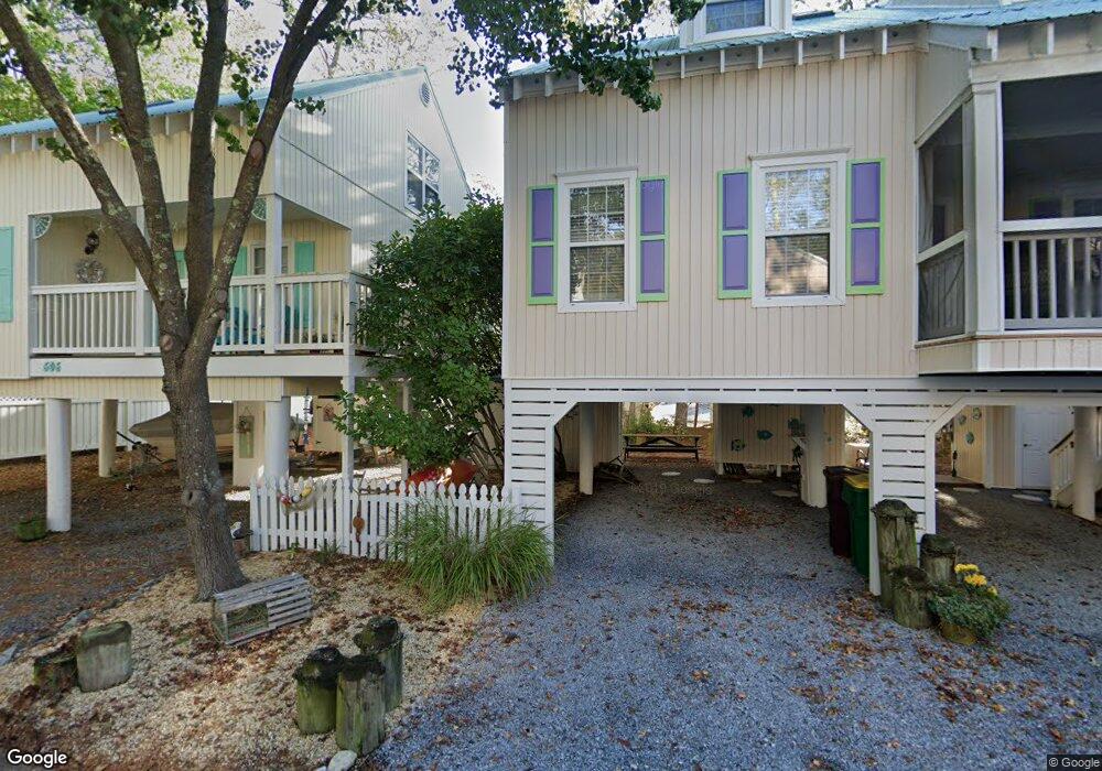
604 Arthurstown Rd Unit 58 Bethany Beach, DE 19930
Estimated Value: $559,052 - $725,000
3
Beds
2
Baths
1,215
Sq Ft
$510/Sq Ft
Est. Value
About This Home
This home is located at 604 Arthurstown Rd Unit 58, Bethany Beach, DE 19930 and is currently estimated at $619,263, approximately $509 per square foot. 604 Arthurstown Rd Unit 58 is a home located in Sussex County with nearby schools including Lord Baltimore Elementary School, Selbyville Middle School, and Indian River High School.
Ownership History
Date
Name
Owned For
Owner Type
Purchase Details
Closed on
Nov 9, 2020
Sold by
Platt Andrew G and Platt Dianne
Bought by
Brody Steven and Brody Laurie
Current Estimated Value
Home Financials for this Owner
Home Financials are based on the most recent Mortgage that was taken out on this home.
Original Mortgage
$344,624
Outstanding Balance
$306,666
Interest Rate
2.8%
Mortgage Type
New Conventional
Estimated Equity
$312,597
Purchase Details
Closed on
Jul 1, 2011
Bought by
Platt Andrew G and Platt Dianne Platt
Create a Home Valuation Report for This Property
The Home Valuation Report is an in-depth analysis detailing your home's value as well as a comparison with similar homes in the area
Home Values in the Area
Average Home Value in this Area
Purchase History
| Date | Buyer | Sale Price | Title Company |
|---|---|---|---|
| Brody Steven | $425,000 | None Available | |
| Platt Andrew G | $300,000 | -- |
Source: Public Records
Mortgage History
| Date | Status | Borrower | Loan Amount |
|---|---|---|---|
| Open | Brody Steven | $344,624 |
Source: Public Records
Tax History Compared to Growth
Tax History
| Year | Tax Paid | Tax Assessment Tax Assessment Total Assessment is a certain percentage of the fair market value that is determined by local assessors to be the total taxable value of land and additions on the property. | Land | Improvement |
|---|---|---|---|---|
| 2025 | $899 | $22,700 | $0 | $22,700 |
| 2024 | $953 | $22,700 | $0 | $22,700 |
| 2023 | $952 | $22,700 | $0 | $22,700 |
| 2022 | $937 | $22,700 | $0 | $22,700 |
| 2021 | $909 | $22,700 | $0 | $22,700 |
| 2020 | $867 | $22,700 | $0 | $22,700 |
| 2019 | $863 | $22,700 | $0 | $22,700 |
| 2018 | $872 | $23,050 | $0 | $0 |
| 2017 | $879 | $23,050 | $0 | $0 |
| 2016 | $774 | $23,050 | $0 | $0 |
| 2015 | $798 | $23,050 | $0 | $0 |
| 2014 | $786 | $23,050 | $0 | $0 |
Source: Public Records
Map
Nearby Homes
- 39259 Bayberry Ct Unit 16005
- 2 Bridge Rd
- 39362 Racquet Ln Unit 8603
- 39346 Racquet Ln Unit 8502
- 39346 Racquet Ln Unit 8504
- 39617 Round Robin Way Unit 2502
- 33795 N Hampton Cir
- 311 W 9th St
- 39685 Round Robin Way Unit 3505
- 39655 Tie Breaker Ct Unit 4801
- 34055 Monterray Ave Unit 173
- 207 W 11th St
- 39743 Forest Hills Ct Unit 1508
- 33553 Long Boat Dr Unit 131
- 33597 Center Ct Unit 1206
- 33232 Walston Walk Ct
- 39634 Jefferson Bridge Rd Unit 104
- 8 Old Orchard Ave
- 140 Ocean Farm Dr
- 33997 N Hampton Cir
- 604 Arthurstown Rd
- 606 Arthurstown Rd
- 625 Freeport Blvd Unit 53
- 605 Arthurstown Rd Unit 61
- 627 Freeport Blvd Unit 52
- 623 Freeport Blvd Unit 54
- 600 Arthurstown Rd
- 624 New Providence Rd Unit 51
- 602 Cape Eleuthra Rd Unit 65
- 602 Cape Eleuthra Rd
- 600 Cape Eleuthra Rd Unit 66
- 622 New Providence Rd
- 622 New Providence Rd Unit 50
- 645 Sandy Point Rd Unit 36
- 645 Sandy Point Rd
- 613 Sandy Point Rd Unit 67
- 643 Sandy Point Rd
- 615 Sandy Point Rd Unit 68
- 641 Sandy Point Rd Unit 34