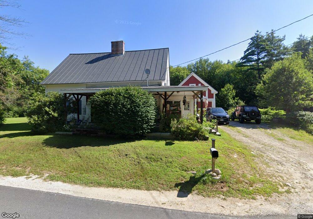
62 Whittemore Rd Salisbury, NH 03268
Estimated Value: $362,000 - $391,000
3
Beds
1
Bath
2,077
Sq Ft
$181/Sq Ft
Est. Value
About This Home
This home is located at 62 Whittemore Rd, Salisbury, NH 03268 and is currently estimated at $376,403, approximately $181 per square foot. 62 Whittemore Rd is a home located in Merrimack County with nearby schools including Salisbury Elementary School, Merrimack Valley Middle School, and Merrimack Valley High School.
Ownership History
Date
Name
Owned For
Owner Type
Purchase Details
Closed on
May 4, 2020
Sold by
Swenson Dorothy J
Bought by
Swenson Dorothy J and Walker Steven F
Current Estimated Value
Home Financials for this Owner
Home Financials are based on the most recent Mortgage that was taken out on this home.
Original Mortgage
$60,000
Outstanding Balance
$41,969
Interest Rate
3.3%
Mortgage Type
New Conventional
Estimated Equity
$334,434
Create a Home Valuation Report for This Property
The Home Valuation Report is an in-depth analysis detailing your home's value as well as a comparison with similar homes in the area
Home Values in the Area
Average Home Value in this Area
Purchase History
| Date | Buyer | Sale Price | Title Company |
|---|---|---|---|
| Swenson Dorothy J | -- | None Available |
Source: Public Records
Mortgage History
| Date | Status | Borrower | Loan Amount |
|---|---|---|---|
| Open | Swenson Dorothy J | $60,000 |
Source: Public Records
Tax History Compared to Growth
Tax History
| Year | Tax Paid | Tax Assessment Tax Assessment Total Assessment is a certain percentage of the fair market value that is determined by local assessors to be the total taxable value of land and additions on the property. | Land | Improvement |
|---|---|---|---|---|
| 2024 | $4,728 | $291,700 | $99,000 | $192,700 |
| 2023 | $4,726 | $291,700 | $99,000 | $192,700 |
| 2022 | $4,656 | $291,700 | $99,000 | $192,700 |
| 2021 | $4,465 | $188,000 | $54,700 | $133,300 |
| 2020 | $3,631 | $147,600 | $54,700 | $92,900 |
| 2019 | $4,003 | $173,000 | $54,700 | $118,300 |
| 2018 | $4,024 | $173,000 | $54,700 | $118,300 |
| 2017 | $4,152 | $173,000 | $54,700 | $118,300 |
| 2016 | $4,094 | $166,700 | $47,900 | $118,800 |
| 2015 | $4,352 | $179,600 | $47,900 | $131,700 |
| 2014 | $4,185 | $179,600 | $47,900 | $131,700 |
| 2012 | $4,337 | $179,600 | $47,900 | $131,700 |
Source: Public Records
Map
Nearby Homes
- 54 Franklin Rd
- 233 Hensmith Rd
- 375 Franklin Rd
- 231 Mutton Rd
- 526 Salisbury Rd
- 428 North Rd
- 428 N Rd
- 437 High St
- 00 Smith Hill Rd Unit 401
- 27 A St
- 516 W Salisbury Rd
- 0 Putney Rd Unit 433
- 131 Flaghole Rd
- 0 Beech Hill Rd Unit 370 5046361
- 110 Pearson Hill Rd
- 10 Upland Dr
- 593 Prospect St
- 603 Prospect St
- Lot 02 Franklin Hwy
- 97 Salisbury Hwy
- 47 Whittemore Rd
- 44 Whittemore Rd
- 392 Old Turnpike Rd
- 380 Old Turnpike Rd
- 77 Whittemore Rd
- 68 Whittemore Rd
- 400 Old Turnpike Rd
- 31 Whittemore Rd
- 86 Whittemore Rd
- 24 Whittemore Rd
- 387 Old Turnpike Rd
- 416 Old Turnpike Rd
- 360 Old Turnpike Rd
- 102 Whittemore Rd
- 383 Old Turnpike Rd
- 407 Old Turnpike Rd
- 93 Whittemore Rd
- 0 Whittemore Rd
- 108 Whittemore Rd
- 420 Old Turnpike Rd