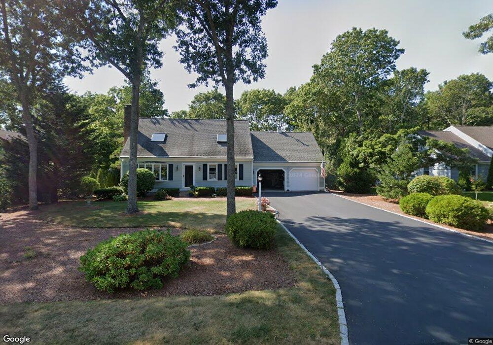
69 Yardarm Dr Mashpee, MA 02649
Mashpee Neck NeighborhoodEstimated Value: $649,000 - $688,000
3
Beds
2
Baths
1,443
Sq Ft
$464/Sq Ft
Est. Value
About This Home
This home is located at 69 Yardarm Dr, Mashpee, MA 02649 and is currently estimated at $668,858, approximately $463 per square foot. 69 Yardarm Dr is a home located in Barnstable County with nearby schools including Kenneth C. Coombs School, Quashnet School, and Mashpee Middle School.
Ownership History
Date
Name
Owned For
Owner Type
Purchase Details
Closed on
Jul 5, 2018
Sold by
Schmit Lisa A and Schmit Mark R
Bought by
Schmit Ret
Current Estimated Value
Purchase Details
Closed on
Sep 14, 1994
Sold by
Arsht Adrienne
Bought by
Schmit Mark R and Schmit Brenda M
Purchase Details
Closed on
Jul 26, 1990
Sold by
Basile Jacqueline
Bought by
Siuta Richard W
Create a Home Valuation Report for This Property
The Home Valuation Report is an in-depth analysis detailing your home's value as well as a comparison with similar homes in the area
Home Values in the Area
Average Home Value in this Area
Purchase History
| Date | Buyer | Sale Price | Title Company |
|---|---|---|---|
| Schmit Ret | -- | -- | |
| Schmit Mark R | $95,250 | -- | |
| Siuta Richard W | $152,000 | -- |
Source: Public Records
Mortgage History
| Date | Status | Borrower | Loan Amount |
|---|---|---|---|
| Previous Owner | Siuta Richard W | $133,252 | |
| Previous Owner | Siuta Richard W | $125,000 | |
| Previous Owner | Siuta Richard W | $114,000 |
Source: Public Records
Tax History
| Year | Tax Paid | Tax Assessment Tax Assessment Total Assessment is a certain percentage of the fair market value that is determined by local assessors to be the total taxable value of land and additions on the property. | Land | Improvement |
|---|---|---|---|---|
| 2025 | $4,086 | $617,200 | $243,300 | $373,900 |
| 2024 | $3,713 | $577,400 | $221,200 | $356,200 |
| 2023 | $3,499 | $499,100 | $210,600 | $288,500 |
| 2022 | $3,351 | $410,200 | $171,300 | $238,900 |
| 2021 | $3,270 | $360,500 | $154,300 | $206,200 |
| 2020 | $3,153 | $346,900 | $148,400 | $198,500 |
| 2019 | $3,032 | $335,000 | $148,400 | $186,600 |
| 2018 | $2,841 | $318,500 | $148,400 | $170,100 |
| 2017 | $2,763 | $300,700 | $148,400 | $152,300 |
| 2016 | $2,696 | $291,800 | $148,400 | $143,400 |
| 2015 | $2,379 | $261,100 | $125,500 | $135,600 |
| 2014 | $2,431 | $258,900 | $125,200 | $133,700 |
Source: Public Records
Map
Nearby Homes
- 11 Teal Cir
- 61 Shoestring Bay Rd
- 35 Spinnaker Dr W
- 640 Poponessett Rd
- 640 Poponessett Rd
- 85 Clamshell Cove Rd
- 34 Rainbow Ln
- 16 Cedar St
- 25 Rainbow Ln
- 14 Rainbow Ln
- 311 Waquoit Rd
- 6 Willow Cir
- 239 Clamshell Cove Rd
- 20 Mutiny Way
- 114 Orchard Rd
- 12 Tracey Rd
- 70 Simons Rd Unit E
- 70 Simons Rd
- 239 Oxford Dr
- 6 Cedar St
- 52 Spinnaker Dr
- 65 Yardarm Dr
- 42 Spinnaker Dr
- 74 Yardarm Dr
- 70 Yardarm Dr
- 61 Yardarm Dr
- 62 Spinnaker Dr
- 66 Yardarm Dr
- 53 Spinnaker Dr
- 47 Spinnaker Dr
- 36 Spinnaker Dr
- 57 Spinnaker Dr
- 53 Yardarm Dr
- 39 Spinnaker Dr
- 62 Yardarm Dr
- 63 Spinnaker Dr
- 45 Yardarm Dr
- 54 Shoestring Bay Rd
- 32 Spinnaker Dr
- 48 Shoestring Bay Rd
Your Personal Tour Guide
Ask me questions while you tour the home.