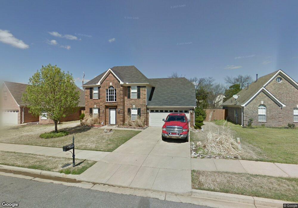
7222 Crape Myrtle Dr Olive Branch, MS 38654
Estimated Value: $276,000 - $305,000
3
Beds
3
Baths
1,968
Sq Ft
$150/Sq Ft
Est. Value
About This Home
This home is located at 7222 Crape Myrtle Dr, Olive Branch, MS 38654 and is currently estimated at $295,019, approximately $149 per square foot. 7222 Crape Myrtle Dr is a home located in DeSoto County with nearby schools including Olive Branch Elementary School, Chickasaw Elementary School, and Olive Branch Middle School.
Ownership History
Date
Name
Owned For
Owner Type
Purchase Details
Closed on
Aug 27, 2019
Sold by
Norys Edward Robert
Bought by
Walker Christopher K
Current Estimated Value
Home Financials for this Owner
Home Financials are based on the most recent Mortgage that was taken out on this home.
Original Mortgage
$198,341
Outstanding Balance
$173,319
Interest Rate
3.8%
Mortgage Type
FHA
Estimated Equity
$121,700
Purchase Details
Closed on
Jan 16, 2019
Sold by
Norys Heather Michelle
Bought by
Norys Edward Robert
Create a Home Valuation Report for This Property
The Home Valuation Report is an in-depth analysis detailing your home's value as well as a comparison with similar homes in the area
Home Values in the Area
Average Home Value in this Area
Purchase History
| Date | Buyer | Sale Price | Title Company |
|---|---|---|---|
| Walker Christopher K | -- | Guardian Title Llc | |
| Norys Edward Robert | -- | None Available |
Source: Public Records
Mortgage History
| Date | Status | Borrower | Loan Amount |
|---|---|---|---|
| Open | Walker Christopher K | $198,341 | |
| Closed | Walker Christopher K | $7,070 |
Source: Public Records
Tax History
| Year | Tax Paid | Tax Assessment Tax Assessment Total Assessment is a certain percentage of the fair market value that is determined by local assessors to be the total taxable value of land and additions on the property. | Land | Improvement |
|---|---|---|---|---|
| 2025 | $1,949 | $19,422 | $2,500 | $16,922 |
| 2024 | $1,625 | $14,103 | $2,500 | $11,603 |
| 2023 | $1,625 | $14,103 | $0 | $0 |
| 2022 | $1,625 | $14,103 | $2,500 | $11,603 |
| 2021 | $1,625 | $14,103 | $2,500 | $11,603 |
| 2020 | $1,498 | $13,175 | $2,500 | $10,675 |
| 2019 | $1,494 | $13,142 | $2,500 | $10,642 |
| 2017 | $1,484 | $23,510 | $13,005 | $10,505 |
| 2016 | $1,484 | $13,005 | $2,500 | $10,505 |
| 2015 | $1,784 | $23,510 | $13,005 | $10,505 |
| 2014 | $557 | $13,337 | $0 | $0 |
| 2013 | $1,591 | $13,337 | $0 | $0 |
Source: Public Records
Map
Nearby Homes
- 7338 Alexander Rd
- 7182 Archer Ln
- 7276 Edgewater Dr
- 6931 Maury Dr
- 6915 Maury Dr
- 9861 Alexanders Ridge Dr
- 9472 Village Pointe
- 10185 Goodman Rd
- 10141 Fox Chase Dr
- 6849 Dogwood Manor W
- 10238 Cheryl Cove
- 7741 Meadow Ridge Ln
- 9737 Dogwood Ct W
- 10153 Stephenson Ln
- 9678 Stuart Cove
- 8031 Alexander Rd
- 9919 Adina Cove
- 8049 Montrose Dr
- 10395 Catalpa Cove
- 10550 Rose Ln
- 7230 Crape Myrtle Dr
- 7214 Crape Myrtle Dr
- 7238 Crape Myrtle Dr
- 7225 Crape Myrtle Dr
- 7246 Crape Myrtle Dr
- 7217 Crape Myrtle Dr
- 7233 Crape Myrtle Dr
- 7209 Crape Myrtle Dr
- 7285 Green Ash Dr
- 7281 Green Ash Dr
- 7289 Green Ash Dr
- 7241 Crape Myrtle Dr
- 7277 Green Ash Dr
- 7293 Green Ash Dr
- 7269 Green Ash Dr
- 9866 Fox Run Dr
- 7297 Green Ash Dr
- 7257 Crape Myrtle Dr
- 7254 Crape Myrtle Dr
- 7198 Crape Myrtle Dr
Your Personal Tour Guide
Ask me questions while you tour the home.