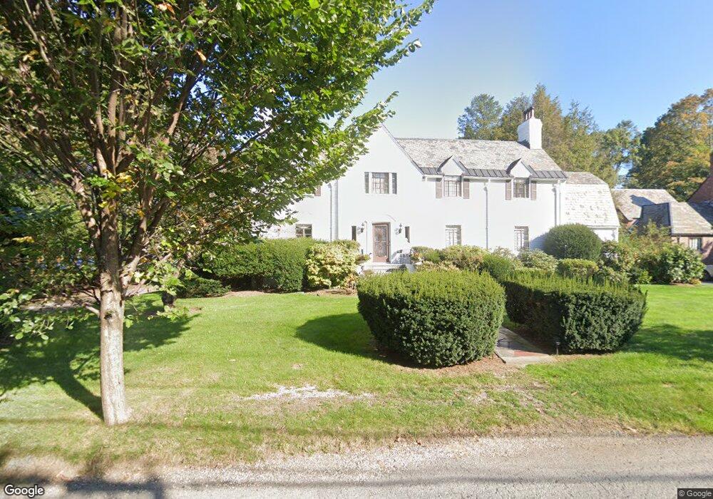
76 Gordon Rd Waban, MA 02468
Waban NeighborhoodEstimated Value: $2,694,981 - $3,104,000
6
Beds
6
Baths
4,097
Sq Ft
$712/Sq Ft
Est. Value
About This Home
This home is located at 76 Gordon Rd, Waban, MA 02468 and is currently estimated at $2,918,495, approximately $712 per square foot. 76 Gordon Rd is a home located in Middlesex County with nearby schools including Zervas Elementary School, Oak Hill Middle School, and Newton South High School.
Ownership History
Date
Name
Owned For
Owner Type
Purchase Details
Closed on
Apr 23, 2025
Sold by
Ross Daniel
Bought by
Ross Ft and Ross
Current Estimated Value
Purchase Details
Closed on
Oct 9, 1996
Sold by
Woolf Sheldon M and Woolf Elisabeth A
Bought by
Ross Daniel
Home Financials for this Owner
Home Financials are based on the most recent Mortgage that was taken out on this home.
Original Mortgage
$500,000
Interest Rate
8.06%
Mortgage Type
Purchase Money Mortgage
Create a Home Valuation Report for This Property
The Home Valuation Report is an in-depth analysis detailing your home's value as well as a comparison with similar homes in the area
Home Values in the Area
Average Home Value in this Area
Purchase History
We collect this data history from publicly available records. To have your information removed, we recommend requesting removal directly through your county’s website.
| Date | Buyer | Sale Price | Title Company |
|---|---|---|---|
| Ross Ft | -- | None Available | |
| Ross Ft | -- | None Available | |
| Ross Daniel | $840,000 | -- | |
| Ross Daniel | $840,000 | -- |
Source: Public Records
Mortgage History
We collect this data history from publicly available records. To have your information removed, we recommend requesting removal directly through your county’s website.
| Date | Status | Borrower | Loan Amount |
|---|---|---|---|
| Previous Owner | Ross Daniel | $500,000 | |
| Previous Owner | Ross Daniel | $205,500 | |
| Previous Owner | Ross Daniel | $80,000 |
Source: Public Records
Tax History
| Year | Tax Paid | Tax Assessment Tax Assessment Total Assessment is a certain percentage of the fair market value that is determined by local assessors to be the total taxable value of land and additions on the property. | Land | Improvement |
|---|---|---|---|---|
| 2025 | $25,338 | $2,585,500 | $1,408,700 | $1,176,800 |
| 2024 | $24,500 | $2,510,200 | $1,367,700 | $1,142,500 |
| 2023 | $23,753 | $2,333,300 | $1,079,900 | $1,253,400 |
| 2022 | $22,728 | $2,160,500 | $999,900 | $1,160,600 |
| 2021 | $6,861 | $2,038,200 | $943,300 | $1,094,900 |
| 2020 | $21,279 | $2,038,200 | $943,300 | $1,094,900 |
| 2019 | $20,678 | $1,978,800 | $915,800 | $1,063,000 |
| 2018 | $20,369 | $1,882,500 | $822,100 | $1,060,400 |
| 2017 | $19,748 | $1,775,900 | $775,600 | $1,000,300 |
| 2016 | $18,887 | $1,659,700 | $724,900 | $934,800 |
| 2015 | $18,008 | $1,551,100 | $677,500 | $873,600 |
Source: Public Records
Map
Nearby Homes
- 29 Gammons Rd
- 443 Chestnut St
- 19 Bonnybrook Rd
- 210 Evelyn Rd
- 575 Chestnut St
- 17 Woodhaven Rd
- 91 Mary Ellen Rd
- 11 Woodhaven Rd
- 308 Prince St
- 82 Allen Ave
- 148 Dartmouth St
- 151 Pine Ridge Rd
- 1580 Beacon St
- 97 Valentine St
- 458 Woodward St
- 400 Homer St
- 11 Hargrave Cir Unit B
- 20 Kinmonth Rd Unit 4
- 28 Wilson Cir Unit 28
- 514 Lowell Ave Unit 514
Your Personal Tour Guide
Ask me questions while you tour the home.