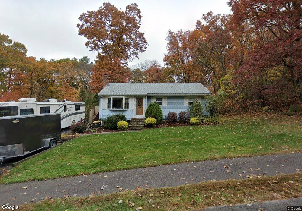
8 Hilltop Rd Franklin, MA 02038
Estimated Value: $528,000 - $818,000
3
Beds
1
Bath
942
Sq Ft
$707/Sq Ft
Est. Value
About This Home
This home is located at 8 Hilltop Rd, Franklin, MA 02038 and is currently estimated at $665,758, approximately $706 per square foot. 8 Hilltop Rd is a home located in Norfolk County with nearby schools including Oak Street Elementary School, Horace Mann Middle School, and Franklin High School.
Ownership History
Date
Name
Owned For
Owner Type
Purchase Details
Closed on
Sep 14, 2024
Sold by
Durkee Cynthia M
Bought by
Cm Durkee Rt and Durkee
Current Estimated Value
Purchase Details
Closed on
Apr 25, 2000
Sold by
Clearwater Dev Corp
Bought by
Hunt Paul F and Hunt Jennifer L
Home Financials for this Owner
Home Financials are based on the most recent Mortgage that was taken out on this home.
Original Mortgage
$251,900
Interest Rate
8.21%
Mortgage Type
Purchase Money Mortgage
Create a Home Valuation Report for This Property
The Home Valuation Report is an in-depth analysis detailing your home's value as well as a comparison with similar homes in the area
Purchase History
| Date | Buyer | Sale Price | Title Company |
|---|---|---|---|
| Cm Durkee Rt | -- | None Available | |
| Cm Durkee Rt | -- | None Available | |
| Hunt Paul F | $279,900 | -- |
Source: Public Records
Mortgage History
| Date | Status | Borrower | Loan Amount |
|---|---|---|---|
| Previous Owner | Hunt Paul F | $251,900 |
Source: Public Records
Tax History
| Year | Tax Paid | Tax Assessment Tax Assessment Total Assessment is a certain percentage of the fair market value that is determined by local assessors to be the total taxable value of land and additions on the property. | Land | Improvement |
|---|---|---|---|---|
| 2025 | $5,399 | $464,600 | $242,600 | $222,000 |
| 2024 | $5,215 | $442,300 | $242,600 | $199,700 |
| 2023 | $5,194 | $412,900 | $253,000 | $159,900 |
| 2022 | $4,919 | $350,100 | $209,100 | $141,000 |
| 2021 | $4,657 | $317,900 | $205,000 | $112,900 |
| 2020 | $4,756 | $327,800 | $220,400 | $107,400 |
| 2019 | $4,495 | $306,600 | $199,300 | $107,300 |
| 2018 | $4,470 | $305,100 | $208,900 | $96,200 |
| 2017 | $4,196 | $287,800 | $191,600 | $96,200 |
| 2016 | $4,185 | $288,600 | $204,500 | $84,100 |
| 2015 | $3,930 | $264,800 | $180,700 | $84,100 |
| 2014 | $3,678 | $254,500 | $170,400 | $84,100 |
Source: Public Records
Map
Nearby Homes
- 25 Brookview Rd
- 8 Riverstone Way
- 1801 Franklin Crossing Rd Unit 1801
- 276 Pond St
- 602 Franklin Crossing Rd Unit 602
- 834-836 W Central St
- 78 Highwood Dr
- 214 Conlyn Ave
- 34 Schofield Dr
- 6 Lydia Ln
- 6 Pine Knoll Rd
- 70 Oak St
- 41 Kimberlee Ave
- 14 Pleasant St Unit B
- 163 W Central St
- 120 Union St Unit 1
- 88 Crescent St
- 17 Longhill Rd
- 204 Lincoln St
- 27 Dover Cir
- 0 Lot 10_hill Top Rd Unit 50489596
- 0 Lot 8 Hill Top Rd Unit 50489595
- 0 Lot 9 Hill Top Rd Unit 50489597
- 6 Hilltop Rd
- 20 Hilltop Rd
- 21 Rolling Ridge Rd
- 4 Hilltop Rd
- 3 Hilltop Rd
- 23 Hilltop Rd
- 24 Hilltop Rd
- 19 Rolling Ridge Rd
- 145 Pond St
- 197 Pond St
- 24 Rolling Ridge Rd
- 137 Pond St
- 29 Hilltop Rd
- 129 Pond St
- 17 Rolling Ridge Rd
- 22 Rolling Ridge Rd
- 121 Pond St
Your Personal Tour Guide
Ask me questions while you tour the home.