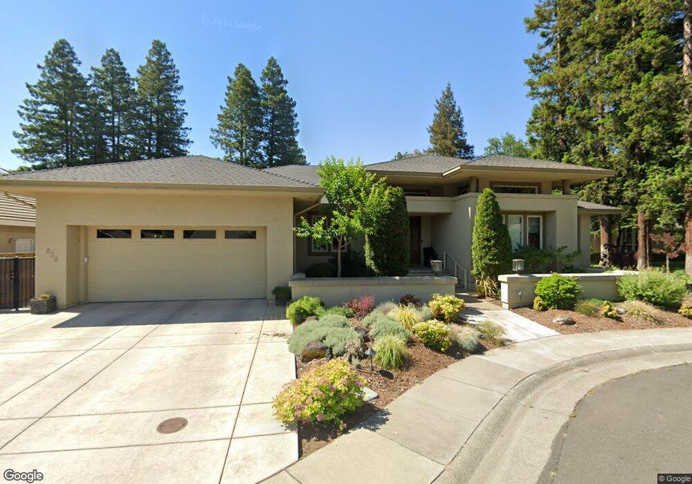
830 Falcon Ave Davis, CA 95616
North Davis NeighborhoodEstimated Value: $1,016,000 - $1,259,000
3
Beds
3
Baths
2,967
Sq Ft
$387/Sq Ft
Est. Value
About This Home
This home is located at 830 Falcon Ave, Davis, CA 95616 and is currently estimated at $1,147,357, approximately $386 per square foot. 830 Falcon Ave is a home located in Yolo County with nearby schools including North Davis Elementary School, Oliver Wendell Holmes Junior High School, and Davis Senior High School.
Ownership History
Date
Name
Owned For
Owner Type
Purchase Details
Closed on
Nov 18, 2015
Sold by
Swanson Linda V and Swanson Roderick J
Bought by
Rod & Linda Swanson Joint Trust
Current Estimated Value
Purchase Details
Closed on
Oct 3, 2002
Sold by
Swanson Linda and Swanson Linda V
Bought by
Swanson Linda V and Swanson Roderick J
Purchase Details
Closed on
May 26, 1999
Sold by
Barber Bonita J
Bought by
Swanson Linda
Purchase Details
Closed on
Mar 30, 1998
Sold by
Derock Harry B and Derock Elfriede W
Bought by
Barber Bonita J
Create a Home Valuation Report for This Property
The Home Valuation Report is an in-depth analysis detailing your home's value as well as a comparison with similar homes in the area
Home Values in the Area
Average Home Value in this Area
Purchase History
| Date | Buyer | Sale Price | Title Company |
|---|---|---|---|
| Rod & Linda Swanson Joint Trust | -- | None Available | |
| Swanson Linda V | -- | -- | |
| Swanson Linda | $160,000 | First American Title Co | |
| Barber Bonita J | $139,000 | North American Title Co |
Source: Public Records
Tax History
| Year | Tax Paid | Tax Assessment Tax Assessment Total Assessment is a certain percentage of the fair market value that is determined by local assessors to be the total taxable value of land and additions on the property. | Land | Improvement |
|---|---|---|---|---|
| 2025 | $9,022 | $819,534 | $250,823 | $568,711 |
| 2023 | $9,022 | $787,712 | $241,084 | $546,628 |
| 2022 | $9,759 | $772,267 | $236,357 | $535,910 |
| 2021 | $9,541 | $757,125 | $231,723 | $525,402 |
| 2020 | $9,394 | $749,362 | $229,347 | $520,015 |
| 2019 | $9,035 | $734,669 | $224,850 | $509,819 |
| 2018 | $8,398 | $720,265 | $220,442 | $499,823 |
| 2017 | $8,227 | $706,143 | $216,120 | $490,023 |
| 2016 | $8,006 | $692,298 | $211,883 | $480,415 |
| 2015 | $7,858 | $681,900 | $208,701 | $473,199 |
| 2014 | $7,724 | $668,543 | $204,613 | $463,930 |
Source: Public Records
Map
Nearby Homes
- 2818 Anza Ave
- 416 Merganser Place
- 1577 Drake Dr
- Greenway - Residence 1 Plan at Bretton Woods - Greenway
- Bungalows - Residence 2 Plan at Bretton Woods - Bungalows
- Greenway - Residence 2 Plan at Bretton Woods - Greenway
- Greenway - Residence 3 Plan at Bretton Woods - Greenway
- Bungalows - Residence 1 Plan at Bretton Woods - Bungalows
- 247 El Cajon Ave
- 2007 Alta Loma St
- 114 Guaymas Place
- 1838 Foster Ln
- 1815 Foster Ln
- 1814 Foster Ln
- 5542 Thomson Loop
- 3303 Houser Ct
- 3360 Houser Ct
- 3368 Houser Ct
- 2128 Bueno Dr Unit 5
- 2248 Cannery Loop
- 824 Falcon Ave
- 836 Falcon Ave
- 861 Malaga Ave
- 818 Falcon Ave
- 2817 Almeria St
- 825 Falcon Ave
- 831 Falcon Ave
- 855 Malaga Ave
- 819 Falcon Ave
- 849 Malaga Ave
- 812 Falcon Ave
- 1003 Eagle Place
- 813 Falcon Ave
- 843 Malaga Ave
- 826 Kestrel Place
- 1009 Eagle Place
- 820 Kestrel Place
- 806 Falcon Ave
- 837 Malaga Ave
- 807 Falcon Ave