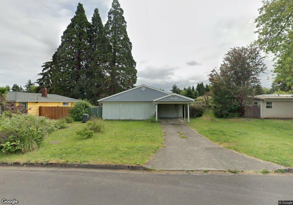
939 Laurelhurst Dr Eugene, OR 97402
Bethel NeighborhoodEstimated Value: $320,569 - $380,000
3
Beds
2
Baths
1,302
Sq Ft
$261/Sq Ft
Est. Value
About This Home
This home is located at 939 Laurelhurst Dr, Eugene, OR 97402 and is currently estimated at $340,392, approximately $261 per square foot. 939 Laurelhurst Dr is a home located in Lane County with nearby schools including Danebo Elementary School, Shasta Middle School, and Willamette High School.
Ownership History
Date
Name
Owned For
Owner Type
Purchase Details
Closed on
Aug 29, 2001
Sold by
Morrison Clifford E
Bought by
Northrup William J and Northrup Linda M
Current Estimated Value
Home Financials for this Owner
Home Financials are based on the most recent Mortgage that was taken out on this home.
Original Mortgage
$97,595
Outstanding Balance
$37,474
Interest Rate
7.09%
Mortgage Type
Construction
Estimated Equity
$302,918
Create a Home Valuation Report for This Property
The Home Valuation Report is an in-depth analysis detailing your home's value as well as a comparison with similar homes in the area
Home Values in the Area
Average Home Value in this Area
Purchase History
| Date | Buyer | Sale Price | Title Company |
|---|---|---|---|
| Northrup William J | $85,000 | Western Title & Escrow Compa |
Source: Public Records
Mortgage History
| Date | Status | Borrower | Loan Amount |
|---|---|---|---|
| Open | Northrup William J | $97,595 |
Source: Public Records
Tax History
| Year | Tax Paid | Tax Assessment Tax Assessment Total Assessment is a certain percentage of the fair market value that is determined by local assessors to be the total taxable value of land and additions on the property. | Land | Improvement |
|---|---|---|---|---|
| 2025 | $2,208 | $126,921 | -- | -- |
| 2024 | $2,152 | $123,225 | -- | -- |
| 2023 | $2,152 | $119,636 | $0 | $0 |
| 2022 | $2,003 | $116,152 | $0 | $0 |
| 2021 | $1,961 | $112,769 | $0 | $0 |
| 2020 | $1,904 | $109,485 | $0 | $0 |
| 2019 | $1,810 | $106,297 | $0 | $0 |
| 2018 | $1,760 | $100,195 | $0 | $0 |
| 2017 | $1,682 | $100,195 | $0 | $0 |
| 2016 | $1,639 | $97,277 | $0 | $0 |
| 2015 | $1,607 | $94,444 | $0 | $0 |
| 2014 | $1,582 | $91,693 | $0 | $0 |
Source: Public Records
Map
Nearby Homes
- 870 Laurelhurst Dr
- 4749 Royal Ave
- 1153 Elizabeth St
- 4548 Cambon St
- 1145 Ludgate Dr
- 4554 Woodsboro St
- 1562 Philip St
- 4280 Avalon St
- 4941 Stagecoach Rd
- 1159 Throne Dr
- 4467 Fergus Ave
- 4055 Royal Ave Unit 93
- 4055 Royal Ave Unit 22
- 4055 Royal Ave Unit 150
- 4055 Royal Ave Unit 69
- 4055 Royal Ave Unit 87
- 4165 Wood Ave
- 795 Red Cedar Ct
- 4462 Fergus Ave
- 4900 Royal Ave Unit 105
- 929 Laurelhurst Dr
- 959 Laurelhurst Dr
- 919 Laurelhurst Dr
- 969 Laurelhurst Dr
- 920 Laurelhurst Dr
- 930 Laurelhurst Dr
- 30 Sheffield Ct
- 940 Laurelhurst Dr
- 909 Laurelhurst Dr
- 979 Laurelhurst Dr
- 910 Laurelhurst Dr
- 932 Laurelhurst Dr
- 950 Laurelhurst Dr
- 880 Laurelhurst Dr
- 989 Laurelhurst Dr
- 934 Laurelhurst Dr
- 878 Laurelhurst Dr
- 970 Laurelhurst Dr
- 960 Laurelhurst Dr
- 876 Laurelhurst Dr
Your Personal Tour Guide
Ask me questions while you tour the home.